TLDR
Cambodia’s natural resources are mostly living ones. Forests, fresh water, fish and farmland carry the economy and feed the population. Minerals (gold, iron ore, bauxite, gemstones, phosphate), offshore oil and gas, and construction sand exist, but none has yet matched the value of the Mekong and Tonle Sap system. The biggest threats are deforestation, sand dredging, dams and falling fish catches.
Table of Contents
- The short version: a country rich in biology, thin in minerals
- Water: the Mekong and the Tonle Sap
- Fisheries
- Forests and timber
- Farmland and soils
- Minerals and gemstones
- Oil, gas and sand
- Energy: hydropower and firewood
- Resource summary table
- Environmental pressures
The short version: a country rich in biology, thin in minerals
Ask what the natural resources of Cambodia are and the honest answer is: water, forest, fish and soil. Mineral wealth is modest, and the big-ticket extractive projects that define neighbors like Myanmar or Indonesia never arrived at scale.
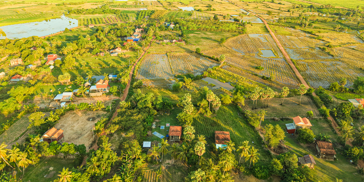
What Cambodia has instead is geography. The country sits in the lower Mekong basin, built around a flat central plain that floods every year. That flood pulse feeds one of the most productive inland fisheries on Earth, waters rice fields, and recharges the soil. Around the plain, hills and uplands in the north, east and southwest hold the remaining forest and most of the known minerals.
Water: the Mekong and the Tonle Sap
The Mekong enters Cambodia from Laos and runs south through Stung Treng, Kratie and Kampong Cham before reaching Phnom Penh. There it meets the Tonle Sap River, and the two behave in a way that surprises most people.
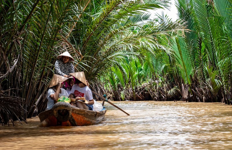
During the monsoon, the Mekong swells so much that the Tonle Sap River reverses direction and flows northwest, back into the Tonle Sap Lake. The lake grows from roughly 2,600 km² in the dry season to about 10,500 km² at the wet-season peak, flooding forest and scrubland around its edges. In November, when the Mekong drops, the river turns around and drains the lake back out. UNESCO designated the lake a biosphere reserve largely because of this cycle.
The numbers are what make it a resource rather than a curiosity. Millions of people live within reach of the lake, and the flooded forest works as a nursery for fish that later spread across the whole system.
Fisheries
Cambodia’s inland fishery is the quiet giant of its natural resource base. Fish, mostly caught in the Tonle Sap system and the Mekong, supply the bulk of animal protein for most Cambodians. Fermented fish paste (prahok) is a staple, not a garnish.
The fishery has three layers: large commercial lots, middle-scale operations, and a huge number of household fishers. The household layer matters most for nutrition, because it needs no license and feeds people directly.
Catches are under pressure. Dams upstream trap sediment and block migratory species, since many Mekong fish travel long distances between feeding and spawning grounds. The Mekong River Commission has tracked how changes in flow timing and dam operations affect fish migration across the basin. Overfishing and illegal gear add to the problem, and fishers report smaller fish and longer trips for the same catch.
Forests and timber
Forest once covered around 70% of the country. That share has fallen hard since the 1970s, driven by logging concessions, agricultural clearing and land grants for plantations. Large blocks survive in the Cardamom Mountains, the Eastern Plains (Mondulkiri), the Northern Plains and around the Tonle Sap’s flooded forest.

Timber was once Cambodia’s most valuable export after the civil war, and it left lasting damage. Today logging for export is officially restricted, but illegal logging of valuable hardwoods such as rosewood continues, and the larger driver is conversion to rubber, cassava, cashew and sugar plantations.
Forests do more than supply wood. The Cardamom range and Prey Lang, one of the largest remaining lowland evergreen forests in mainland Southeast Asia, protect watersheds and shelter elephants, tigers’ last records, and dozens of species on the IUCN Red List. Their loss shows up downstream as faster runoff and silted rivers.
Farmland and soils
Roughly a fifth to a quarter of Cambodia’s land is cultivated, and rice dominates. The best soils lie on the floodplain around the Tonle Sap and along the Mekong, where annual flooding deposits fresh silt. Battambang, Kampong Thom, Takeo and Prey Veng are the main rice provinces.
Red basalt soils in Ratanakiri and Mondulkiri in the northeast support rubber, coffee and pepper. Kampot, on the southern coast, is known for pepper that carries a protected geographical indication in the EU. Cassava, maize, cashew and mango fill out the upland crop list.
Agriculture works as a resource base because water and soil are reliable, but it depends on the flood pulse, which loops back to the dams.
Minerals and gemstones
Cambodia’s mineral record is thinner than you’d expect from a country this size, partly because the geology is poorly mapped and decades of conflict stopped exploration. Known deposits include:
- Gold: artisanal and exploration activity in Mondulkiri, Ratanakiri and Kampong Thom.
- Iron ore: the Phnom Deck area in Preah Vihear is the most discussed deposit.
- Bauxite: found in the basalt plateaus of the east, notably Mondulkiri.
- Copper: exploration prospects in the north and northeast.
- Gemstones: the Pailin area in the west is the classic source of sapphires and rubies.
- Phosphate: in Kampot province, used locally as fertilizer.
- Manganese: small deposits in the northwest.
Most of these remain in exploration or small-scale extraction. Limestone is the exception: quarried widely in Kampot and Battambang for the cement industry, it’s the mineral actually driving construction.
Oil, gas and sand
Offshore Block A in the Gulf of Thailand holds Cambodia’s best-known petroleum discovery. Drilling there has gone on since the 2000s, but commercial production has repeatedly been delayed by financing problems, operator changes and low oil prices. Further offshore blocks overlap with a boundary dispute with Thailand, which has slowed their development.
Sand is the resource nobody planned for. The Mekong carries huge volumes of sediment, and dredging for construction fill, mainly for projects in Phnom Penh and for export, has exploded. Cambodia banned sand exports to Singapore in 2017, but dredging for domestic use continues along the Mekong and Tonle Sap and in the Koh Kong coast.
Energy: hydropower and firewood
Hydropower supplies around 45% of Cambodia’s electricity mix, following dams such as Kamchay (2011) in Kampot and Lower Sesan 2 (2018) in Stung Treng. Coal, imported power and a growing share of solar make up the rest.
At the household level, the picture looks very different. Wood and charcoal remain the main cooking fuel for most rural families, which puts steady pressure on nearby forests and is one reason deforestation continues even without large-scale logging.
Resource summary table
| Resource | Main location | Main use | Status |
|---|---|---|---|
| Fresh water | Mekong, Tonle Sap, Bassac | Irrigation, fisheries, hydropower | Heavily used, altered by dams |
| Fish | Tonle Sap and Mekong | Food, income, exports | Declining catches |
| Forest | Cardamoms, Prey Lang, Eastern Plains | Timber, fuel, watersheds | Shrinking |
| Farmland | Central plain, Battambang, Takeo | Rice, rubber, cassava, pepper | Expanding |
| Gold | Mondulkiri, Ratanakiri | Jewelry, trade | Small-scale and exploration |
| Iron ore | Preah Vihear | Steel feedstock | Largely undeveloped |
| Bauxite | Eastern basalt plateau | Aluminum feedstock | Exploration |
| Gemstones | Pailin | Jewelry | Small-scale mining |
| Phosphate | Kampot | Fertilizer | Limited |
| Limestone | Kampot, Battambang | Cement | Active |
| Oil and gas | Gulf of Thailand (Block A) | Energy | Not in full production |
| Sand | Mekong, Tonle Sap | Construction | Heavily dredged |
Environmental pressures
Four pressures matter most.
Deforestation. Forest cover keeps falling as land is cleared for plantations and fuel. Loss also shrinks habitat for wildlife.
Sand dredging. Removing sediment from the river changes its bed, accelerates bank erosion and strips material that downstream deltas depend on.
Dams. Dams on the Mekong and its tributaries alter the flood pulse, block fish migration and reduce the sediment that fertilizes floodplains. Cambodia’s own dams add to this, as does hydropower upstream in Laos and China.
Fishery decline. The signs are smaller fish and lower catch per effort, with consequences for the diets of the poorest households.
None of these four problems stands alone. Cutting the flooded forest reduces fish nursery habitat, dams change the flood that grows the fish, and dredging reshapes the channels they travel. The resources that make Cambodia rich are the same ones that depend on each other, which is why losing one tends to damage the rest.