
TLDR
- Djibouti is one of the most resource-poor countries in Africa. Its real assets are its location on the Bab-el-Mandeb strait, salt, geothermal heat, and the sea.
- Minerals are mostly low-value industrial materials: salt, gypsum, perlite, pumice, diatomite, limestone, clay, and construction aggregate. Gold is minor.
- Energy potential is large on paper: geothermal near Lake Assal, plus solar and wind.
- Arable land is a tiny fraction of the territory. Water comes mostly from groundwater, and most food is imported.
- That scarcity is why the economy runs on ports, logistics, and foreign military bases rather than extraction.
Contents
- The short version
- Minerals
- Energy
- Marine resources and fisheries
- Water and arable land
- Forests and wildlife
- Summary table
- Why scarcity built a port economy
The short version
The natural resources of Djibouti are thin on the ground and rich in a few odd places. The country covers about 23,000 square kilometers of volcanic desert at the mouth of the Red Sea. No oil, no major metal deposits, no rivers that run all year. What it has is a salt lake sitting 155 meters below sea level, a rift valley full of heat, steady wind, strong sun, and a strategic coastline.
Here’s each category, with what’s actually used and what’s still on the drawing board.
Minerals
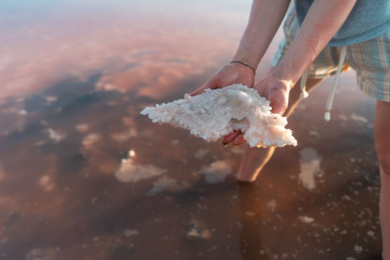
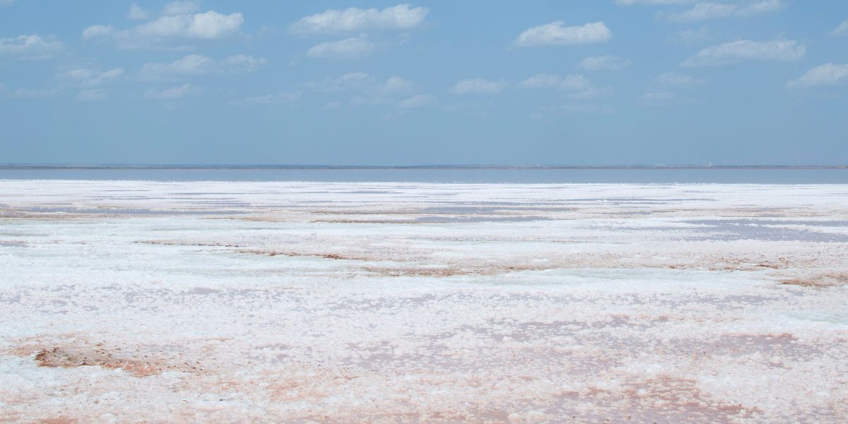
Salt is the headline. Lake Assal, in the Afar Depression, is the lowest point in Africa and one of the saltiest bodies of water on Earth, roughly ten times saltier than the ocean. Its shore is a white crust of evaporite that is harvested, sacked, and trucked out, much of it toward Ethiopia. The lake is a reservoir that never runs out on any human timescale, which is the only reason salt works as an export for a country this small.
The rest of the mineral list is industrial and mostly modest:
- Gypsum: found in the same evaporite basins.
- Perlite and pumice: products of volcanic rock, used in construction and insulation.
- Diatomite: a lightweight silica rock from ancient lake deposits.
- Limestone and clay: feedstock for local building materials.
- Gold: small, mostly artisanal, never a significant export.
The USGS minerals profile for Djibouti shows how small the numbers are. Recent output includes roughly 3.6 million tonnes of sand and gravel and about 600,000 tonnes of cement. Those are construction inputs feeding port expansion and housing, not export commodities. Djibouti doesn’t mine its way to prosperity. It mines enough to build.
Energy
Djibouti sits on the Afar Triple Junction, where three tectonic plates are pulling apart. That’s bad for stability and good for geothermal. Hot rock sits close to the surface near Lake Assal, and the Fiale caldera area has been the focus of exploration drilling for years. Resource estimates have long put the potential in the hundreds of megawatts, more than the country’s domestic demand.
The catch is converting estimates into turbines. Geothermal drilling is expensive, early wells have hit problems with high salinity, and projects have moved slowly. Meanwhile Djibouti has imported a large share of its electricity from Ethiopia through a transmission line.
Solar and wind fill in the picture:
- Solar: Djibouti gets abundant sunshine nearly year-round. A 30 MW solar project is planned, with more capacity discussed.
- Wind: The Ghoubet area near Lake Assal has strong, steady winds funneled by the geography, and it’s the site of the country’s flagship wind development.
The government has set targets for a fully renewable grid. The resource is there. Financing and delivery are the bottleneck.
Marine resources and fisheries
Djibouti has about 314 kilometers of coastline on the Red Sea and the Gulf of Aden. The Gulf of Tadjoura cuts deep into the country and holds its best fishing and diving.
Artisanal fishing is the main activity: small boats, hand lines, and nets, landing tuna, grouper, snapper, and other reef and pelagic fish. The catch is small and mostly serves local markets. Fish isn’t a traditional staple for much of the population, and the fishing sector has stayed minor, though development projects have tried to grow cold storage and landing infrastructure.
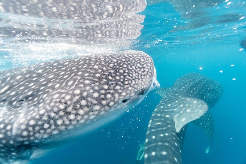
The more distinctive marine asset is whale sharks. They gather in the Gulf of Tadjoura roughly from October to February, drawing snorkelers and a small but growing ecotourism trade. Add coral reefs, and the sea is worth more as scenery than as seafood.
Water and arable land
Water is the tightest constraint. Rainfall is low and erratic, there are no permanent rivers, and most supply comes from groundwater in aquifers and wadi beds. Coastal aquifers are prone to saltwater intrusion when overpumped. The capital, home to most of the population, relies on boreholes, and the country has turned to desalination and to a pipeline project to bring in water from Ethiopia.
Farmland is nearly absent. The FAO’s country water profile documents how little land is irrigable and cultivated, and the figure is a fraction of one percent of the territory in most accounts. The data is old, but the picture hasn’t changed. Livestock is the bigger agricultural story: pastoralists in the interior herd goats, sheep, camels, and cattle on sparse rangeland. Djibouti imports the vast majority of its food.
That’s why water appears in so many development plans. Every sector, from ports to housing to tourism, ends up asking where the water will come from.
Forests and wildlife
Forest cover is under one percent, but the remnants matter. The Day Forest, in the Goda Mountains in the north, is the main one. At elevations around 1,500 meters and higher, juniper and boxwood hold on in cooler, wetter air, and the forest shelters species found nowhere else in the country. Mount Goda, near 1,780 meters, rises above it.
The forest is under pressure from drought, grazing, and wood cutting. It’s also the closest thing Djibouti has to a watershed: it catches mist and rain that feed the lowlands. Protecting it is as much about water as it is about wildlife.
Elsewhere, the dry plains and coastal wetlands support birds, gazelles, and a handful of larger mammals, though numbers are low.
Summary table
| Resource | Where | Main use |
|---|---|---|
| Salt | Lake Assal, Afar Depression | Export, mainly to Ethiopia; local use |
| Gypsum, perlite, pumice, diatomite | Volcanic and evaporite zones | Construction and industrial materials |
| Sand, gravel, limestone, clay | Across the country | Cement and building (about 3.6 Mt sand and gravel and 600,000 t cement in recent USGS data) |
| Gold | Scattered small occurrences | Artisanal, minor |
| Geothermal | Lake Assal, Fiale caldera area | Planned power generation |
| Solar and wind | Nationwide; Ghoubet for wind | Planned and early-stage grid power |
| Fish and marine life | Gulf of Tadjoura, Red Sea coast | Local fishing, whale shark tourism |
| Groundwater | Aquifers and wadi beds | Drinking water, limited irrigation |
| Juniper-boxwood forest | Day Forest, Goda Mountains | Watershed, wildlife habitat |
Why scarcity built a port economy
A country with no oil and almost no farmland has to sell something else. Djibouti sells position.
The Bab-el-Mandeb strait, 30 kilometers across at its narrowest, links the Red Sea to the Gulf of Aden and funnels shipping between Europe and Asia via the Suez Canal. Yemen, on the opposite shore, has its own natural wealth in oil, gas, and minerals, though war keeps much of it buried. Ethiopia, a landlocked country of well over 100 million people, moves the bulk of its trade through Djiboutian ports. Container terminals, a free zone, and rail and road links to Addis Ababa turned a coastline into a business. Foreign military bases add rent. According to the World Bank’s country overview, the economy is dominated by services tied to ports and logistics.
So the natural resources of Djibouti shape the economy in reverse. The lack of land, water, and minerals pushed the country toward the one asset it couldn’t be short of. Salt, geothermal heat, wind, and sun are the next candidates, and they matter because they could lower the energy and water costs that every port, factory, and household pays.