
TLDR
The natural resources of Cyprus are copper, gypsum, limestone and marble, bentonite, earth pigments, timber, arable land, salt, sunshine and offshore natural gas. Almost none of it is large by world standards. Copper built the island’s early fame and now matters little. Gas is the biggest unrealized asset. Water is the scarcest. Sun is the most reliable.
Contents
- Copper: the metal that named the island
- Quarrying: stone, gypsum and clay
- Offshore gas: Aphrodite, Cronos and Zohr next door
- Water: no rivers, many dams, a lot of desalination
- Arable land and forests
- Salt lakes
- Sun and renewables
- Tourism as a resource
- How the 1974 division split the natural resources of Cyprus
- Resources at a glance
Copper: the metal that named the island
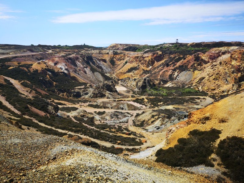
The Romans called copper aes Cyprium, “metal of Cyprus.” That phrase shortened to cyprium and then cuprum, which is where the symbol Cu and the English word “copper” come from. Historians still argue about which name came first, the island’s or the metal’s. The link between them isn’t in doubt.
The source is geology. The Troodos Mountains are a slab of ancient ocean floor pushed up onto land, and that kind of rock hosts copper-bearing sulfide deposits. People were smelting them by the Bronze Age, roughly 4,000 years ago. Heaps of ancient slag still sit in the foothills, and the largest runs to millions of tonnes.
Modern mining peaked under the US-owned Cyprus Mines Corporation, which worked sites such as Skouriotissa and Mavrovouni through the first three quarters of the 20th century. Mavrovouni lies in the north and was lost to the operators in 1974. Output today is small, and copper is no longer a meaningful share of exports. The USGS National Minerals Information Center tracks Cyprus among the minor producers of industrial minerals.
Quarrying: stone, gypsum and clay
Quarrying is the mining sector that actually earns its keep, mostly by supplying the island’s own construction boom. Limestone, sand, gravel and clay go into cement, concrete and bricks. Vassiliko, on the south coast, is the cement hub.
Cyprus also produces:
- Gypsum, from evaporite beds laid down when the Mediterranean nearly dried out about six million years ago.
- Marble and decorative stone, in modest volumes.
- Bentonite, a swelling clay used in drilling fluids and as a binder.
- Umber and ochre, brown and yellow earth pigments. “Cyprus umber” is still a standard name in artists’ paint catalogs.
The cautionary tale is asbestos. The Amiantos mine in the Troodos range closed in 1988, and the waste heaps were a cleanup problem for decades afterward.
Offshore gas: Aphrodite, Cronos and Zohr next door
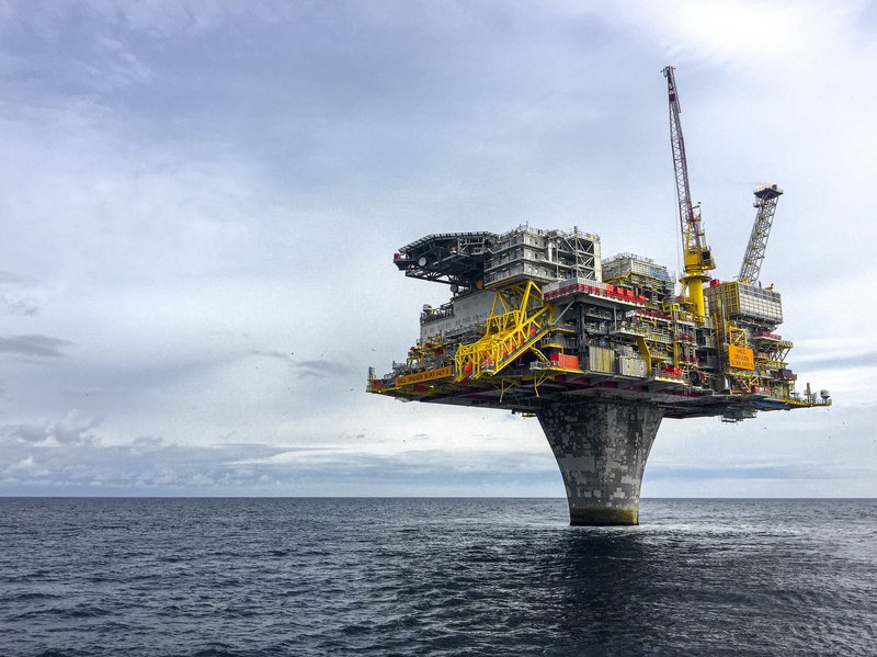
Cyprus has no oil in commercial quantities. It has gas, found under deep water south of the island.
- Aphrodite (2011): found by Noble Energy, now operated by Chevron. Estimates run to roughly 3.5 trillion cubic feet.
- Calypso (2018) and Glaucus (2019): further discoveries by Eni and ExxonMobil in neighboring blocks.
- Cronos (2022): found by Eni and TotalEnergies in the same southern waters.
- Zohr: an Egyptian-waters field discovered by Eni in 2015, the largest gas find in the Mediterranean. It sits close to the Cypriot fields, which is why Egypt keeps appearing in Cyprus’s export plans.
No Cypriot field is producing yet. Cyprus has no pipeline to Europe and a domestic market too small to absorb the output, so the real question is where to send the gas. The most practical route is to pipe it to Egypt’s existing liquefaction plants and ship it out as LNG. Turkey disputes parts of Cyprus’s maritime claims, which complicates drilling in some blocks.
For the next few years, gas is a development story rather than an economic fact. Treat any figure quoting its value as a forecast.
Water: no rivers, many dams, a lot of desalination
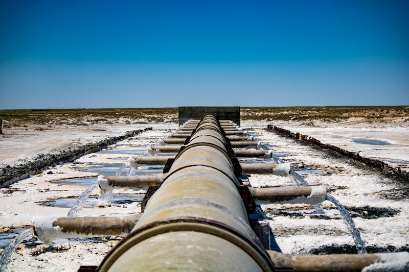
Cyprus has no perennial rivers. Streams run after winter storms and then vanish. Rainfall averages roughly 500 mm a year, and in dry years it is well below that.
The island’s answer was to build dams: more than 100 of them, with combined capacity of around 300 million cubic meters. The biggest, Kouris Dam, holds about 115 million. In recent drought years reservoirs have dropped to a small fraction of capacity. That is why desalination, which started as a backup, now supplies most of the island’s drinking water. Large seawater plants sit near Larnaca, Limassol and Dhekelia, supplemented by mobile units.
Groundwater is the third source, and the one that has been mined hardest. Coastal aquifers have been overpumped for decades, and seawater has crept into them. Farmers feel that most directly.
Arable land and forests
Cyprus covers 9,251 square kilometers, the third-largest island in the Mediterranean. According to the CIA World Factbook, only about a tenth of it is arable. Cereals, potatoes, olives, citrus, grapes and the milk behind halloumi (a protected-origin cheese since 2021) make up most of the output.
Agriculture is now about 2% of GDP, a long way from its role a century ago. Forests cover roughly a fifth of the island, mostly pine in the Troodos and Pentadaktylos ranges. The Paphos forest holds the Cyprus cedar, found nowhere else. Timber is used locally rather than exported, and the forests’ bigger value is as a water catchment and a fire risk.
Salt lakes
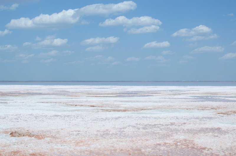
Two shallow lakes fill with winter rain and dry to a white crust each summer. Akrotiri, in the British Sovereign Base Area, is the larger. Larnaca’s, beside the airport and the Hala Sultan Tekke mosque, is the better known. Salt was harvested at Larnaca for centuries, until the practice stopped in the 1980s.
Their value now is ecological. Both are Ramsar wetlands, and flamingos and other migratory birds winter there.
Sun and renewables
Cyprus gets sun for most of the year, and it uses a lot of it for water heating. Rooftop solar heaters are standard on a large majority of homes, one of the highest rates per person anywhere in Europe.
Electricity is the weak point. The island’s grid is isolated, with no connection to a neighboring country, and it still burns imported oil for much of its power. Renewables, mainly solar, supply a fifth or more of electricity, according to the IEA’s country profile. The isolation also limits how much intermittent solar the grid can absorb without storage.
Tourism as a resource
Beaches, climate and archaeological sites bring in more than any mineral. Tourism accounts for over a tenth of GDP directly, and more once hotels, transport and construction are counted. The services sector as a whole produces most of the island’s output, which is why economists describe Cyprus as a service economy rather than a resource economy. Water scarcity and tourism pull in opposite directions in summer, because visitors use far more water per person than residents.
How the 1974 division split the natural resources of Cyprus
The 1974 Turkish military intervention left the Republic of Cyprus controlling the south, with the north under a separate administration that only Turkey recognizes. Resources fell unevenly on each side.
- North: the Morphou citrus belt, the Mavrovouni copper mine, the Kyrenia range, and the port of Famagusta.
- South: most of the Troodos mountains, the large dams and desalination plants, the cement and energy site at Vassiliko, and the rights to the offshore gas blocks.
- British bases: the Akrotiri salt lake.
Gas is the sharpest dispute. The Republic licenses the blocks and Turkish Cypriot leaders argue they have a claim to a share of the revenue. No agreement on that exists.
Resources at a glance
| Resource | Where | Status | Economic role |
|---|---|---|---|
| Copper | Troodos foothills | Small-scale or inactive | Historic, now minor |
| Limestone, sand, gypsum, clay | Island-wide, Vassiliko | Active | Construction supply |
| Umber, bentonite | Troodos region | Small output | Niche exports |
| Natural gas | Offshore south and southeast | Discovered, not producing | Potential major export |
| Fresh water | Dams, aquifers, desalination plants | Chronically short | Limits agriculture and growth |
| Arable land | Mesaoria plain, Morphou, coast | About 10% of the island | About 2% of GDP |
| Forests | Troodos, Paphos, Kyrenia range | Protected, fire-prone | Water catchment, recreation |
| Salt | Larnaca and Akrotiri lakes | Harvest ended | Bird habitat |
| Solar | Island-wide | Growing | Water heating, a fifth of power or more |
| Tourism | Coasts, historic sites | Dominant | More than a tenth of GDP |