Table of Contents
- TLDR
- Does Syria Have Active Volcanoes?
- Why Syria Has Volcanoes At All
- Jabal al-Druze: The Roof of the Hauran
- Al-Safa: Inscriptions and an ISIL Stronghold
- Golan Heights: A Plateau Built From Basalt
- Sharat Kovakab and Dirat al-Tulul
- Syria’s Volcanic Fields at a Glance
- Is There Any Volcanic Hazard Today?
- FAQ
TLDR
Yes, Syria has volcanoes — just not the kind that erupts on the evening news. The south of the country is covered in basaltic lava fields, cinder cones, and one genuine shield-volcano complex, Jabal al-Druze, that tops out at 1,803 meters. None of it has produced a confirmed eruption in recorded history. The fields are geologically young (Pleistocene to Holocene) and part of the same volcanic system that runs through Jordan and Saudi Arabia, but the Global Volcanism Program lists Syria’s volcanoes as having no documented historical activity. The most interesting one, Al-Safa, is better known today for 1,800-year-old Bedouin graffiti and a 2018 siege against ISIL than for anything it did to the landscape.
Does Syria Have Active Volcanoes?
No — not in the sense of a volcano that could erupt next year. Syria’s volcanic fields are classified as Holocene, meaning they’ve been active sometime in the last 11,700 years, but that’s a geological bar, not a warning sign. There’s no confirmed historical eruption anywhere in the country. Some volcano-tourism databases cite roughly 1850 as Al-Safa’s last activity, but the claim traces back to secondhand travelers’ accounts rather than any instrumental or eyewitness record, and the Smithsonian’s Global Volcanism Program doesn’t list a confirmed eruption for it at all.
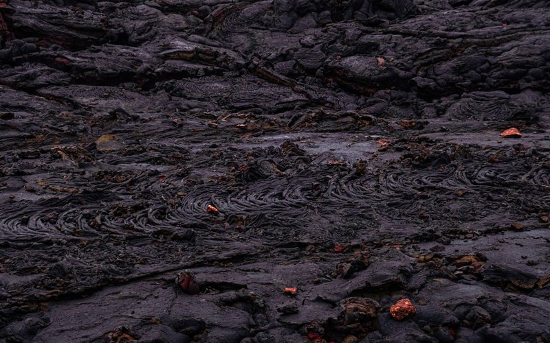
What Syria has instead is a stretch of southern desert — running from the Jordanian border up toward Damascus — that’s black with old lava. Locals call parts of it harra, meaning rough, burnt ground, and that’s a fair description from the ground: jagged basalt, collapsed cones, and almost nothing green.
Why Syria Has Volcanoes At All
Syria doesn’t sit near a subduction zone or a mid-ocean ridge, so this isn’t the kind of volcanism that builds a Fuji or a Rainier. It’s intraplate basaltic volcanism, driven by the slow pulling-apart of the Arabian and African plates along the Dead Sea Transform fault — the same fault system that carved out the Dead Sea and the Sea of Galilee. That fault has been active since the early Miocene, roughly 20 million years ago, and has shifted Arabia about 105 kilometers north relative to the Sinai over that span, according to research published in the American Geophysical Union’s journal Tectonics.
Where that fault crosses older rift structures, magma has found paths to the surface for millions of years, in bursts, not as a single continuous eruption. The result is Harrat Ash-Shaam, the largest volcanic field in western Arabia — a scattered network of lava plateaus and cinder cones that stretches from Saudi Arabia through Jordan and into southern Syria. Syria’s volcanic fields are simply the northern tail of that system, not a separate phenomenon.
Jabal al-Druze: The Roof of the Hauran
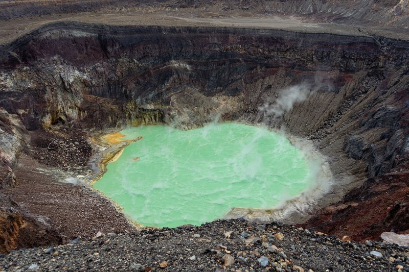
Jabal al-Druze — also called Jabal al-Arab, or the Hauran plateau — is the main event. It’s a field of 118 individual basaltic volcanoes packed onto one uplifted plateau in southwestern Syria, near the Jordanian border, active from the early Pleistocene into the Holocene. Its highest point, Tell Qeni, reaches 1,803 meters, making it the tallest volcanic feature in the country by a wide margin.
The plateau gives the region its name and its population: it’s the historic heartland of Syria’s Druze community, and the black basalt underfoot shows up everywhere in local building — walls, terraces, even old Roman-era ruins built from quarried lava rock rather than the limestone used elsewhere in the Levant. Farmers here have spent centuries breaking up basalt boulders to plant wheat and grapes in the volcanic soil between them, which is unusually fertile once cleared.
Al-Safa: Inscriptions and an ISIL Stronghold
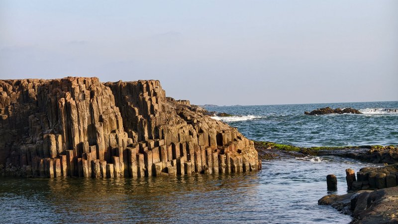
Al-Safa sits northeast of Jabal al-Druze, a harsher, less habitable field covering about 220 square kilometers with at least 38 cinder cones scattered across it. Where Jabal al-Druze has soil worth farming, Al-Safa is closer to a maze of sharp basalt boulders and collapsed lava tubes — the kind of terrain that swallows a person on foot within a few hundred meters of visibility.
That terrain is exactly why it matters twice over. First archaeologically: Al-Safa gave its name to Safaitic, an Old North Arabian script first documented there in 1857, carved by nomadic herders onto the black rock over centuries — thousands of short inscriptions recording names, prayers, and complaints about drought, essentially graffiti that predates Islam by hundreds of years. Second, militarily: during the Syrian civil war, roughly 1,500 ISIL fighters used Al-Safa’s caves and lava tubes as their last redoubt in southern Syria. It took Syrian government forces 104 days of fighting through 2018 to clear the field, finally declaring it secured on November 19 after cornering the remaining militants in its rocky interior — a siege the Atlantic Council’s Digital Forensic Research Lab documented in detail as it unfolded.
Golan Heights: A Plateau Built From Basalt
The Golan Heights, disputed territory on Syria’s southwestern border, is itself a volcanic plateau — about 1,000 square kilometers of basalt that slopes from roughly 1,100 meters above sea level in the north down to 300–350 meters in the south, above the Sea of Galilee. The rock is Plio-Pleistocene basalt of the Bashan Group, ranging from a few tens of meters thick in the south to over a kilometer thick in the north and central plateau.
Like Jabal al-Druze, the Golan is part of the broader Harrat Ash-Shaam field, and its volcanism ties directly to the Dead Sea Transform: a pulse of activity around 13 million years ago is linked to upper-mantle material rising beneath the western edge of the Arabian plate as the fault system took shape. The territory has been occupied and administered by Israel since 1967, which is part of why it rarely shows up in general discussions of “Syrian” volcanoes despite sitting on the same geological structure as Jabal al-Druze just to the east.
Sharat Kovakab and Dirat al-Tulul
Two smaller fields round out the picture, and both are minor enough that even specialist volcano databases carry only a paragraph on each.
Sharat Kovakab is a small, truncated basaltic cone in northwestern Syria, reaching just 534 meters — modest compared to Jabal al-Druze’s 1,803, and Holocene in age like the rest of the country’s fields. Dirat al-Tulul sits about 65 kilometers east of Damascus, in the Rif Dimashq countryside, and forms the northernmost tip of the entire Harrat Ash-Shaam system. It’s dotted with more than 32 cinder cones, locally called tell — the same word used for archaeological mounds elsewhere in the Levant, since a collapsed volcanic cone and a buried ancient settlement mound can look remarkably similar from a distance.
Syria’s Volcanic Fields at a Glance
| Field | Location | Highest Point | Notable For |
|---|---|---|---|
| Jabal al-Druze | SW Syria, near Jordan border | 1,803 m (Tell Qeni) | 118 volcanic cones; Druze heartland; farmed volcanic soil |
| Al-Safa | NE of Jabal al-Druze | — | Safaitic inscriptions; 2018 ISIL siege; lava-tube caves |
| Golan Heights | SW border, Israeli-occupied | ~1,100 m (north) | Basalt plateau over Sea of Galilee; disputed territory |
| Sharat Kovakab | NW Syria | 534 m | Small, isolated truncated cone |
| Dirat al-Tulul | 65 km east of Damascus | — | 32+ cinder cones; northern edge of Harrat Ash-Shaam |
Is There Any Volcanic Hazard Today?
Practically none. There’s no seismic or thermal monitoring network flagging unrest in any of these fields, and no volcanic-hazard advisory covers them — Syria doesn’t appear on hazard-alert lists the way active arcs in Indonesia or Central America do. The bigger geological risk in the region comes from the Dead Sea Transform fault itself, which produces earthquakes independent of any volcanic activity, not from the basalt fields sitting on top of it.
That said, “no recorded eruption” isn’t the same as “extinct.” Fields like Harrat Ash-Shaam have erupted intermittently for millions of years, sometimes going quiet for tens of thousands of years between episodes. Geologists studying the wider Harrat system elsewhere in Arabia have found evidence of eruptions as recent as a few centuries ago in Saudi Arabia, which keeps the entire province classified as dormant rather than dead — even where, as in Syria, nothing has happened within human memory.
FAQ
Is Syria volcanically active today? No confirmed eruption has occurred anywhere in Syria in recorded history. Its volcanic fields are classified as dormant, not extinct, based on their young geologic age.
When did Syria last erupt? There’s no verified date. Roughly 1850 is sometimes cited for Al-Safa in volcano-tourism sources, but the Global Volcanism Program does not list a confirmed historical eruption for any Syrian volcano.
What is the tallest volcano in Syria? Tell Qeni, the high point of the Jabal al-Druze volcanic field, at 1,803 meters.
Are the Golan Heights volcanic? Yes. The Golan is a basalt plateau formed by the same Harrat Ash-Shaam volcanic system that produced Jabal al-Druze, though the territory is currently occupied and administered by Israel rather than Syria.
Why does Syria have volcanoes if it’s not near a plate boundary in the usual sense? It sits on the edge of the Dead Sea Transform fault, where the Arabian and African plates have been sliding past each other for about 20 million years. That fault has repeatedly opened pathways for basaltic magma, producing the scattered lava fields across southern Syria, Jordan, and Saudi Arabia rather than a single classic stratovolcano.