TLDR
Guyana’s caves barely exist online — most search results are misfiled or empty. The real ones: Kumerau Falls caves (Pakaraima Mountains, surveyed by University of Padua speleologists in 2026), the Makatau petroglyph sites near Aishalton, and a scatter of unmapped quartzite passages across the Roraima tepui formation. Nearly all of them sit on Amerindian titled land, reachable only by charter plane or multi-day river travel, and none have a public visitor infrastructure. This is a guide for people willing to go the hard way.
Table of Contents
- Why the internet doesn’t know Guyana has caves
- Kumerau Falls: the caves that just got discovered
- Amerindian cave art in the Pakaraimas
- The geology: why these caves take a million years to grow an inch
- What actually lives down there
- Kaieteur and the wider Roraima sandstone country
- Getting there: permits, guides, and the honest logistics
Why the internet doesn’t know Guyana has caves
Search “caves in Guyana” and Google serves up two Wikipedia stubs — Bad Hole Cave and Belmont Cave — that describe caves in Jamaica, not Guyana. Nobody’s bothered to fix the mismatch. Under those, a couple of tourism directory pages sit empty: no descriptions, no photos, just placeholder listings that exist because a template needed something to fill.
That’s not an accident of bad SEO. It’s a reflection of how little ground-truth exploration has happened here. Guyana’s interior is roughly 80% intact rainforest, most of it without roads, and the geology hiding under that canopy — ancient quartzite tepuis instead of the limestone that forms most of the world’s famous cave systems — has kept explorers out for a different reason than politics or access. These caves are genuinely hard to find.
Kumerau Falls: the caves that just got discovered
The most concrete entry on this list is also the newest. In 2026, a University of Padua team led by speleologist and geologist Francesco Sauro ran an expedition called “Beyond the Falls,” targeting the Kumerau Falls area along the Kurupung River in Guyana’s Region 7, deep in the Pakaraima Mountains.
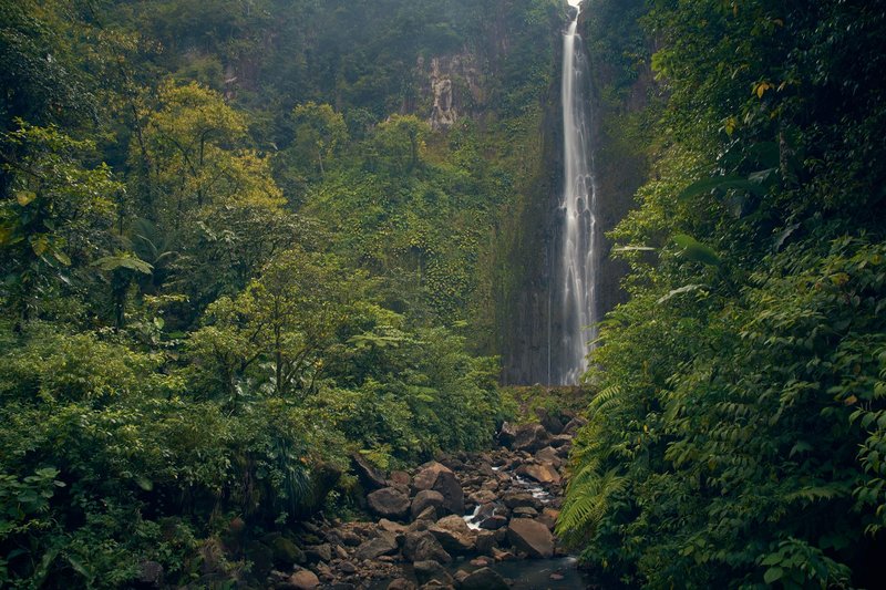
They weren’t starting from zero. British speleologists Helen Sergeant and Jim Davis had first reported a cave here in 1976, but it had never been formally surveyed. The Padua team located it, mapped it, and documented what’s inside: silica speleothems — mineral formations built from dissolved quartz rather than the calcite you’d find in a limestone cave — and a resident fauna adapted to permanent darkness. While they were at it, they found a second, previously unknown cave nearby, running roughly 200 meters through the same quartz arenite bedrock. According to the University of Padua’s Department of Geosciences, both caves formed within the Roraima Supergroup, the same billion-plus-year-old rock package that builds every tepui in the region, including Mount Roraima itself.
This is the one site on this list with an actual scientific paper trail. Everything else is thinner.
Amerindian cave art in the Pakaraimas
The Pakaraima Mountains carry human history that predates any European map of the region. Rock petroglyphs — locally called timehri — mark cave walls and boulder faces across the interior, with the densest concentration around Makatau Mountain, about 3 kilometers outside the village of Aishalton in Guyana’s Deep South. Guyanese anthropologist Denis Williams did the first serious archaeological survey of the site in the 1970s, and it remains one of the country’s most significant documented archaeological zones.
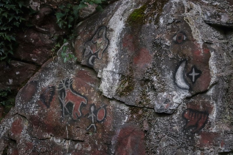
The Akawaio and Patamona peoples, who’ve lived in and moved through the Pakaraimas for generations, hold the practical knowledge that any visitor depends on — which shelters are accessible, which sites are open to outsiders, and which carry restrictions that outrank anyone’s curiosity. The Patamona in particular are known locally as “the mountaineers,” with villages reachable only by foot trail or small aircraft. Treat any visit to a petroglyph site as a request made to a community, not a stop on an itinerary.
The geology: why these caves take a million years to grow an inch
Most of the world’s cave systems form in limestone, where slightly acidic water dissolves calcium carbonate fast enough that you get kilometers of passage in a geologically short window. Guyana’s caves form in quartzite and quartz arenite — rock that’s close to chemically inert. Dissolving quartz takes far more time and far less water chemistry cooperation than dissolving limestone.
The process is called arenization: water works along the contacts between individual quartz grains rather than dissolving the grains themselves, gradually loosening the rock mass until sand-sized particles wash free and get carried out, leaving a void behind. Some of the biggest confirmed systems in this geological province — the Roraima Supergroup that spans the Guyana Highlands across Venezuela, Guyana, and Brazil — run more than a kilometer long and descend over 300 meters, based on research from Venezuela’s Auyán-tepui and Sarisariñama systems. Guyana’s own side of that same rock formation is comparatively unmapped, which is exactly why a single expedition like Kumerau Falls counts as news.
Slow formation means slow everything else. Silica speleothems — the mineral deposits that build up on cave walls and floors here — grow at a fraction of the rate of calcite formations in a typical limestone cave, because there’s so little dissolved silica moving through the groundwater to begin with. A speleothem the width of a pencil in a Guyanese quartzite cave may represent tens of thousands of years of accumulation.
What actually lives down there
Caves in low-solubility rock like this tend to host sparser, more specialized fauna than limestone systems, simply because there’s less organic material washing in and less structural complexity to support a large ecosystem. What the Padua team documented at Kumerau Falls fits that pattern: species adapted specifically to the permanent dark, likely isolated enough by the cave’s remoteness that they’ve had no reason to evolve toward anything else. Formal species identification from that expedition hadn’t been published in detail as of this writing, which is itself telling — this is a place where basic cave biology is still being written for the first time, not reviewed.
Kaieteur and the wider Roraima sandstone country
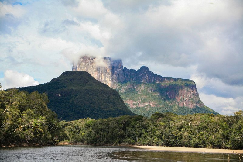
Kaieteur National Park, home to one of the world’s tallest single-drop waterfalls, sits on the same Roraima sandstone that builds the Pakaraima tepuis and the Kumerau Falls caves. The cliffs behind and around Kaieteur Falls are honeycombed with shallow rock shelters and solution pockets, the visible early stages of the same arenization process that eventually carves out passages like the ones at Kumerau — though nothing in the immediate park has been surveyed as a true cave system the way Kumerau Falls now has.
The Iwokrama Forest, adjoining Kaieteur to the south, adds another layer: a nearly one-million-acre reserve managed jointly for conservation and research, where sandstone outcrops and rock shelters have historically served as shelter sites for people moving through the forest. It’s not a cave destination in the way Kumerau Falls is, but it’s the kind of terrain where undocumented sites almost certainly exist and simply haven’t been looked for yet.
Getting there: permits, guides, and the honest logistics
There’s no version of this trip where you drive to a trailhead and park. Guyana’s interior has no road network connecting most of the Pakaraima region to the coast — access is by small charter aircraft into airstrips like Kamarang or Kurupung, or by multi-day river travel, followed by a hike in with local guides.
Most of the land in question is Amerindian titled territory, which means the villages themselves — not a national park office — control access. That’s not a formality. Getting to a site like Makatau, or anywhere near Kumerau Falls, means arranging permission through the relevant village council or through a Guyanese tour operator who already has that relationship, well before you show up. Wilderness Explorers and a handful of other Georgetown-based operators run trips into the Pakaraimas with the local contacts already in place; going without one means a much longer, much less certain trip.
Dry season — roughly mid-August through November, and a shorter window from February to April — is when river levels and trail conditions make interior travel realistic at all. Bring gear for genuine backcountry caving, not a guided walk-through: headlamps with backup batteries, sturdy boots, and the expectation that nothing down there has a handrail. Guyana doesn’t have an established recreational caving industry the way Belize or Mexico does. What it has is a small number of real, barely documented sites, and a short list of people who actually know how to get you to them.