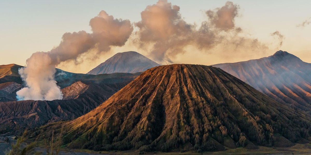
Nicaragua has 19 named volcanoes strung along a single 400-kilometer line called the Cordillera de los Maribios, and depending on how you count, somewhere between five and seven of them are doing something right now — venting gas, rumbling, or actively throwing ash. That’s an unusual amount of visible geology for a country roughly the size of New York State. Most “top volcanoes” lists treat that as scenery. It’s also a logistics question: some of these you can drive up to and peer into tonight, some require a permit and a guide, and one of them evacuated 3,000 people as recently as 2012.
Table of Contents
- Why Nicaragua Has So Many Volcanoes
- Quick Answer
- Nicaragua’s Volcanoes at a Glance
- Masaya: The Lava Lake You Can Drive To
- Cerro Negro: The One You Slide Down
- Telica: Nicaragua’s Most Restless Crater
- San Cristóbal: The Tallest and the Touchiest
- Momotombo: The Volcano That Slept a Century
- Concepción: Ometepe’s Perfect Cone
- Maderas: The Sleeping Twin With a Crater Lake
- Permits, Guides, and When Not to Go
- Seeing Volcanoes Without the Hike
Why Nicaragua Has So Many Volcanoes {#why-nicaragua-has-so-many-volcanoes}
The short version: the Cocos Plate is sliding underneath the Caribbean Plate at roughly 7 to 8 centimeters a year, off Nicaragua’s Pacific coast. As that oceanic slab descends, it melts and feeds magma up through the crust in a fairly evenly spaced row — which is why Nicaragua’s volcanoes line up almost like beads on a string instead of clustering randomly. This chain is part of the Central American Volcanic Arc, itself a segment of the wider Pacific Ring of Fire, the same subduction system that produces Guatemala’s Fuego and Costa Rica’s Arenal.
That spacing also explains why Nicaraguan cities sit so close to active vents. Managua, León, and Chinandega were all built in the shadow of volcanoes that are still moving — not out of bad planning, but because the same volcanic soil that makes the land dangerous also makes it some of the most fertile in Central America.
Quick Answer {#quick-answer}
Telica and San Cristóbal are the two most consistently active, both producing intermittent ash explosions into 2026. Masaya has the most reliable payoff — a visible lava lake you can walk up to on a night tour, no permit or fitness required. Cerro Negro is the one for adrenaline (volcano boarding, not hiking). Concepción and Maderas on Ometepe Island require a licensed guide by law. San Cristóbal’s summit is generally off-limits during active phases; you view it from a distance instead.
Nicaragua’s Volcanoes at a Glance {#at-a-glance}
| Volcano | 2026 Status | Last Eruption | Elevation | Difficulty | Can You Visit |
|---|---|---|---|---|---|
| Masaya | Active — venting, lava lake visible | Ongoing since 2015 | 635 m | None (drive/walk to rim) | Yes, day and night tours |
| Cerro Negro | Active — fumarolic | 1999 (minor) | 728 m | Moderate hike, then board down | Yes, guided tours from León |
| Telica | Active — frequent ash explosions | Ongoing, intermittent through 2026 | 1,061 m | Moderate | Yes, but crater-rim access restricted during unrest |
| San Cristóbal | Active — persistent ash emissions | Ongoing, notable events 2012 and 2024 | 1,745 m | Strenuous, technical | Viewpoints only during active phases |
| Momotombo | Dormant since 2016 | February 2016 | 1,297 m | Strenuous | Yes, guided, when alert level allows |
| Concepción | Low-level unrest | May 2024 (ash) | 1,610 m | Very strenuous, ~8 hrs | Yes, mandatory guide |
| Maderas | Dormant | No historical eruption recorded | 1,394 m | Strenuous, ~8 hrs | Yes, mandatory guide |
Masaya: The Lava Lake You Can Drive To {#masaya}
Masaya is the one that gets called “the mouth of hell” — La Boca del Infierno — and it’s earned it. The Santiago crater has held a convecting lava lake since 2015, glowing orange against the crater walls, visible from a guarded viewpoint just a short walk from the parking lot. No permit, no hiking boots, no guide requirement. That accessibility is unusual; most active lava lakes on Earth sit at the end of multi-day expeditions.
A 2024 landslide dumped debris over part of the lake and cut visibility for a stretch, but by early 2026 the park had reopened fully and night tours were running again, with the glow visible from the rim after dark. INETER, Nicaragua’s geophysical monitoring agency, keeps Masaya at Alert Level 2 — a watch status that restricts how close visitors can get to the crater edge but doesn’t close the park. Rangers hand out gas masks near the rim because the sulfur dioxide output here is genuinely high enough to sting your eyes and throat; this is one of the most gas-rich volcanoes studied anywhere, which is also why it draws volcanologists from the Smithsonian’s Global Volcanism Program year-round.
Cerro Negro: The One You Slide Down {#cerro-negro}
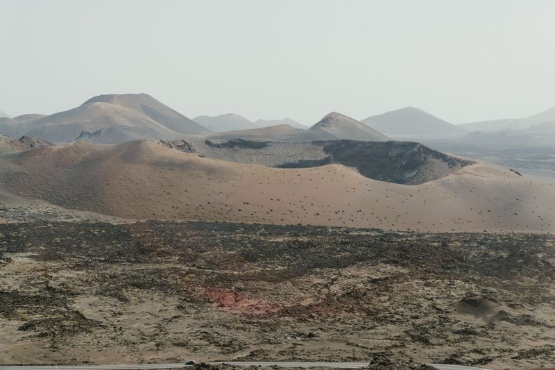
Cerro Negro is the youngest volcano in Central America — it didn’t exist before 1850, and every eruption since has added to its jet-black cinder cone. That’s also why it’s the region’s odd one out: no vegetation, no established trail worn smooth by decades of feet, just a loose slope of volcanic gravel that happens to be perfect for sliding down at speed.
The standard tour runs out of León: a roughly 40-minute drive to the base, then a 45- to 60-minute hike up loose cinder to the summit at 728 meters, where guides hand out a plywood board, a jumpsuit, goggles, and gloves. You sit, lean back, and control speed with your heels — riders report topping 60 km/h (about 37 mph) on the steepest sections. It sounds like a novelty until you’re standing at the top looking down a 40-degree slope of black gravel with steam still drifting from vents nearby.
Telica: Nicaragua’s Most Restless Crater {#telica}
Telica doesn’t get the tourism attention Masaya and Cerro Negro do, which is strange, because it’s arguably Nicaragua’s most consistently active volcano. In January 2025 alone, INETER logged over 90 gas-and-ash explosions in a single 36-hour window, with ash plumes reaching 200 meters above the crater. Satellite imagery has tracked ash drift from Telica as far as 37 kilometers downwind. As of 2026 that pattern continues — not constant eruption, but frequent, unpredictable bursts.
At 1,061 meters, Telica sits near León and is popular as a sunset hike when conditions allow, with camping spots on the rim for people chasing the glow at night. The catch is that “when conditions allow” changes fast. INETER holds it at Alert Level 2 with restricted access directly around the active crater, and local operators cancel or reroute trips on short notice when explosion frequency picks up. Check current status the morning of, not the week before.
San Cristóbal: The Tallest and the Touchiest {#san-cristobal}
San Cristóbal, also called El Viejo, is Nicaragua’s highest volcano at 1,745 meters and one of its most consistently active — it’s been producing small to medium ash eruptions since Spanish colonial records began in the 16th century, and it hasn’t really stopped since 2001. In September 2012, an ash and gas column rose roughly 2.5 miles into the sky and forced authorities to evacuate around 3,000 people from nine surrounding communities. Activity flared again with a notable ash eruption in 2024.
That history is why San Cristóbal is not a casual summit hike the way Concepción or Maderas can be. Ash eruptions here have collapsed into pyroclastic flows — fast-moving currents of hot gas and rock fragments that can exceed 1,472°F — and the summit is generally closed to visitors during active phases. Most people experience San Cristóbal from the highway near Chinandega, where the cone rises dramatically over the lowlands, or from guided lower-slope viewpoints that stay well clear of the crater.
Momotombo: The Volcano That Slept a Century {#momotombo}
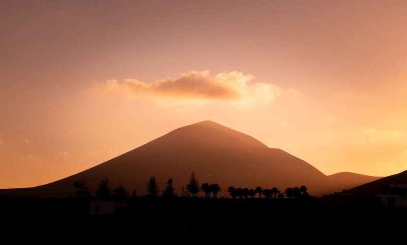
Momotombo is the volcano on Nicaragua’s national symbols — the near-perfect cone overlooking Lake Managua that shows up on postcards and in Rubén Darío’s poetry. It sat quiet for about 110 years before waking up in December 2015 with an eruption that made international headlines precisely because everyone had stopped expecting one; it kept venting intermittently into 2016.
At 1,297 meters, the slopes are steep and the hike is genuinely strenuous, but what makes Momotombo unusual is what’s underneath it: a geothermal field that’s been tapped since the 1980s, currently generating up to 77 megawatts of power from the same heat source that periodically threatens to erupt. Guided hikes run when INETER’s alert level permits it — worth confirming before you commit, since access has opened and closed multiple times since 2016.
Concepción: Ometepe’s Perfect Cone {#concepcion}
Concepción rises 1,610 meters straight out of Lake Nicaragua on Ometepe Island, forming one half of the island’s figure-eight shape (Maderas forms the other). It’s Nicaragua’s second-highest volcano, and its symmetry is the kind that makes you understand why early Spanish chroniclers described it in almost mythic terms.
It’s also not dormant. Concepción produced a notable ash eruption in May 2024, sending grey ash plumes to roughly 18,000 feet, and it’s been in a near-constant pattern of small to medium ash explosions for the past century. A guide is legally required to summit — local guide associations cap groups at six people — and for good reason: the upper trail is exposed, the terrain shifts, and it’s easy to lose the route in cloud cover. Budget a full 8 hours for the roughly 8.65-kilometer round trip, and expect to pay around $25 to $40 per person depending on group size.
Maderas: The Sleeping Twin With a Crater Lake {#maderas}
Maderas is Concepción’s quieter sibling — no recorded historical eruption, cloud forest instead of bare cinder, and a crater lagoon at the summit instead of a smoking vent. It’s shorter at 1,394 meters but the hike is longer and muddier, around 14.5 kilometers round trip and roughly 8 hours through terrain that turns to thick mud in the rainy season.
The reward is the lake itself: a cold, mist-shrouded lagoon sitting in what used to be the magma chamber, ringed by cloud forest loud with howler monkeys. Like Concepción, a licensed local guide is mandatory — the upper trail braids into several false paths, and hikers have gotten lost overnight on the mountain in past years.
Permits, Guides, and When Not to Go {#permits-and-safety}
Ometepe’s two volcanoes — Concepción and Maderas — both require a certified local guide by law, arranged through guide cooperatives in Moyogalpa or Altagracia rather than freelance operators. Masaya and Cerro Negro don’t require guides for the standard tourist routes, but Cerro Negro’s boarding tours are run exclusively through licensed operators for equipment and liability reasons.
INETER, Nicaragua’s Instituto Nicaragüense de Estudios Territoriales, publishes alert levels for the country’s monitored volcanoes, and Telica, Masaya, and San Cristóbal typically sit at Alert Level 2 (watch), meaning restricted access near active craters rather than full closure. Levels change with activity, sometimes within a day, so the trip-planning move is to check status the morning you go rather than trusting a blog post written months earlier — including this one. Rainy season (May through November) adds a second variable: cloud cover kills crater visibility on Telica and Concepción, and trail mud turns Maderas into a genuine slog.
Seeing Volcanoes Without the Hike {#no-hike}
Not every volcano on this list needs boots. Masaya’s paved park road runs most of the way to the crater rim, making it the one legitimately drive-up active volcano on the list, day or night. San Cristóbal and Momotombo are both dramatic from the Pan-American Highway without leaving the car. Ometepe’s ferry crossing from San Jorge gives you Concepción’s full cone rising out of the lake for the entire 45-minute ride, no permit required for that view. And if geothermal energy interests you more than lava, the Momotombo plant sits at the volcano’s base within sight of the crater it draws its heat from — a rare spot where you can see the hazard and the resource in the same frame.