Contents
- TLDR
- The three young volcanic fields
- San Francisco Volcanic Field
- Uinkaret and the Grand Canyon lava dams
- Older volcanic Arizona
- Summary table
- Could Arizona see another eruption?
- How to visit Arizona’s volcanoes
TLDR
Arizona has thousands of extinct volcanoes, three geologically young volcanic fields, and no volcano erupting today. The most recent eruption was Sunset Crater, near Flagstaff, around 1085 CE. The San Francisco Volcanic Field around it is the one most likely to erupt again, and the USGS rates it a moderate threat. Most of the state’s best volcanic sights are in the north, and you can see the best of them in a single day.
The three young volcanic fields
When people search for volcanoes in Arizona, they usually picture one mountain. The real picture is several volcanic fields, each a cluster of vents that built hundreds of small cones over millions of years.
Three are young enough to matter for the “will it erupt again?” question:
- San Francisco Volcanic Field, around Flagstaff, with more than 600 volcanoes.
- Uinkaret Volcanic Field, on the Arizona Strip north of the Grand Canyon.
- Springerville Volcanic Field, in the east near the New Mexico border, with roughly 400 vents.
You’ll also see the Pinacate field named in Arizona searches. It sits across the border in Sonora, Mexico, a short drive south of the Arizona line. It’s a UNESCO-listed biosphere reserve and World Heritage site known for its maar craters and lava fields, but it isn’t in Arizona.
Almost all of these are monogenetic volcanoes. A cinder cone erupts once, over weeks to a few years, then goes quiet for good. The next eruption in the field doesn’t reuse the old vent. It opens a new one somewhere else.
San Francisco Volcanic Field
This is the headline act. The field covers about 1,800 square miles around Flagstaff and has produced volcanoes for roughly six million years. The Arizona Geological Survey describes it as the state’s most significant volcanic hazard area, with the youngest eruptions only about a thousand years old.
Most of the 600-plus vents are cinder cones, the steep, symmetrical piles of ash and rock fragments you picture when you think “volcano.” A few are lava domes, built from thick, sticky magma that piled up instead of flowing. One is a large stratovolcano.
Humphreys Peak and the San Francisco Peaks
Humphreys Peak, at 12,633 feet, is the highest point in Arizona, and it’s what’s left of a stratovolcano that grew over about a million years, from roughly 1.8 million years ago. That volcano once stood much higher. Erosion, glaciers, and a collapse of its east side carved it into the ring of peaks Flagstaff sits under today. The bowl in the middle, the Inner Basin, is the scar of that history.
Humphreys is extinct. Nothing under it is expected to erupt again.
Sunset Crater
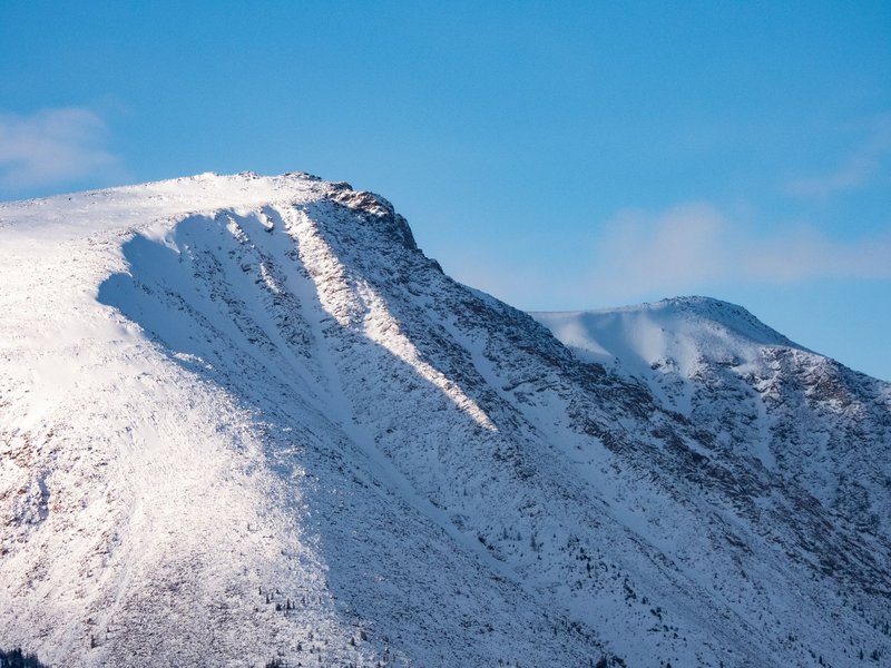
Sunset Crater is the youngest volcano in Arizona. It rises about 1,000 feet above the surrounding plain, topping out at 8,029 feet, and it’s a textbook cinder cone. Tree-ring dating originally put the eruption in the winter of 1064-65. More recent work on the lava flows and the people who lived nearby points to a later date, around 1085 CE, which is the figure most sources now use.
Either way, the eruption was seen. Ancestral Puebloan farmers lived in the area, and the ash blanket acted as a mulch that held moisture in the soil. Settlement actually grew in the following decades, which is part of what makes the Wupatki ruins nearby so interesting.
The cone’s red and orange rim is where the name comes from. The oxidized cinders look lit from within at dusk.
SP Crater
SP Crater is a smaller, older cinder cone northwest of Flagstaff, about 70,000 years old and one of the best-preserved in the field. It rises roughly 800 feet from its base, and a basalt flow runs about four miles from its north side. Its crater is almost perfectly intact because there was never a second eruption to disturb it.
The catch is access. It sits on ranch land reached by a rough dirt road, and you hike the last stretch. It’s a good stop if you want a cone without the crowds.
Domes and other cones
The field also holds a run of lava domes, including O’Leary Peak, Mount Elden (which looms over Flagstaff itself), and Bill Williams Mountain near Williams. Kendrick Peak, at 10,418 feet, is a large cinder-and-lava volcano west of the San Francisco Peaks. Each one has a hiking trail.
Uinkaret and the Grand Canyon lava dams
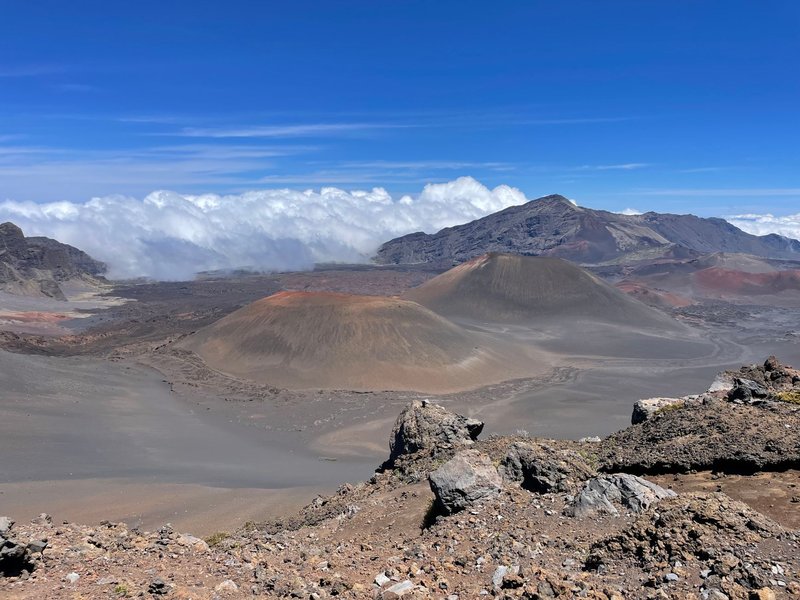
The Uinkaret field sits on the north side of the Grand Canyon. Its best-known feature is Vulcans Throne, a cinder cone that stands right at the canyon’s edge near Toroweap.
Its more dramatic story is what happened when lava met the Colorado River. Basalt flows poured over the canyon rim and down into the gorge, repeatedly damming the river. The dams were large, and the lakes behind them backed up for miles. The river eventually breached every one of them. Remnants of the lava still cling to the canyon walls.
Eruptions here are among the youngest in Arizona, with activity continuing into the last several thousand years. The area is remote. Getting to Toroweap means a long dirt road, and you won’t find a visitor center.
Older volcanic Arizona
Not every volcanic landscape in the state is young. Some of the most striking ones are very old and heavily eroded.
- Superstition Mountains. East of Phoenix, these jagged peaks are the remains of a large volcanic center and caldera that was active roughly 20 to 15 million years ago. The rough, layered cliffs are welded volcanic ash.
- Hopi Buttes and Navajo volcanic field. In the northeast, steep-sided plugs and maar craters formed when magma hit groundwater. Monument Valley’s Agathla Peak is a volcanic plug of this kind, the hardened throat of an ancient volcano left standing after the rock around it eroded away.
- Verde Valley and Sedona area. Basalt caps on the rim and mesas here are older lava flows from vents that are long extinct.
None of these are active, and none have a realistic chance of erupting.
Summary table
| Volcano or field | Type | Age or last eruption | Elevation | Where |
|---|---|---|---|---|
| Sunset Crater | Cinder cone | Around 1085 CE | 8,029 ft | Near Flagstaff |
| SP Crater | Cinder cone | About 70,000 years ago | About 7,000 ft | North of Flagstaff |
| Humphreys Peak | Stratovolcano remnant | Active roughly 1.8 million to 400,000 years ago | 12,633 ft | San Francisco Peaks |
| Kendrick Peak | Cinder and lava volcano | About 1 to 2 million years old | 10,418 ft | West of the Peaks |
| Vulcans Throne | Cinder cone | Young (Uinkaret field) | Rim of the Grand Canyon | Arizona Strip |
| Superstition caldera | Caldera complex | About 20 to 15 million years ago | Peaks over 5,000 ft | East of Phoenix |
Could Arizona see another eruption?
Yes, in the long run. Not this year, and probably not in your lifetime, but the field isn’t dead.
The San Francisco Volcanic Field has erupted many times, and the gaps between eruptions have often been thousands of years, with the last one around 1085 CE. By geological standards, that’s recent. The USGS classifies the field as a moderate threat, and seismic sensors in the Flagstaff area help watch for the earthquake swarms that usually precede an eruption.
Two features matter for what a future eruption would look like. First, it would almost certainly be a new cinder cone, not a revival of Humphreys or Sunset. Second, these eruptions are not explosive like Mount St. Helens. They are smaller, with ash falling downwind, lava flows creeping across the surface, and a cone building over days to months. It would be disruptive and dangerous for the immediate area. It wouldn’t be a regional catastrophe.
If an eruption did happen, there would be warning. Magma moving into the crust shakes the ground, and the signals show up on seismometers well before anything breaks the surface.
How to visit Arizona’s volcanoes
You can see the best of the San Francisco field in a day from Flagstaff.
Sunset Crater Volcano National Monument
This is the easy one. The National Park Service runs a visitor center and a loop road off US-89, about 15 miles north of Flagstaff. The loop continues about 34 miles in total to Wupatki National Monument, passing through the lava flows and ash fields.
The Lava Flow Trail is a one-mile loop through the Bonito lava flow, a sharp, black, jumbled field that looks like it cooled last week. For a view into a crater, Lenox Crater has a short, steep trail. Hiking up Sunset Crater itself has been banned since 1973 because foot traffic wrecked the cinder slope. Entry is a per-vehicle fee, around $25, that also covers Wupatki.
Wupatki National Monument
A few miles further on, the Wupatki ruins sit directly on the ground the eruption reshaped. Wupatki Pueblo, the largest, is a multi-story sandstone-and-basalt village built by people who lived through the aftermath of the eruption.
SP Crater
You need a high-clearance vehicle on the dirt road, then a short, steep hike. No facilities, no fee, and few people. Bring water.
Humphreys Peak and the Inner Basin
Humphreys Peak is a strenuous hike, roughly 10 miles round trip with about 3,300 feet of elevation gain, starting from the Arizona Snowbowl ski area. The summit ridge is above treeline, and afternoon storms in summer are a real risk, so start early. The trail is typically clear from about late June to October.
For a gentler way to see the volcano’s interior, hike the Inner Basin Trail from Lockett Meadow, which is reachable by a dirt road that’s open in the warm months only. The meadow and the aspen groves are at their best in early October.
When to go
- Late spring to early fall is the window for Humphreys and the Inner Basin.
- Autumn is the best overall: golden aspens, less crowding, and clear skies.
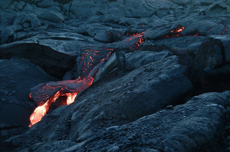
- Winter closes the high trails to most hikers, but Sunset Crater’s loop road generally stays open, and the black cinders look striking under snow.
- Summer is the best time to reach Toroweap, though it’s hot and the road is rough.
Summary
Arizona’s volcanoes are plentiful, but they’re not active. The state has three young volcanic fields, with the San Francisco field around Flagstaff the clear standout, and a long record of older volcanic landscapes elsewhere. Sunset Crater erupted around 1085 CE, and the next eruption in the region will probably open a new cone somewhere in the field. Until then, the volcanoes of northern Arizona are a very good place to hike.