TLDR
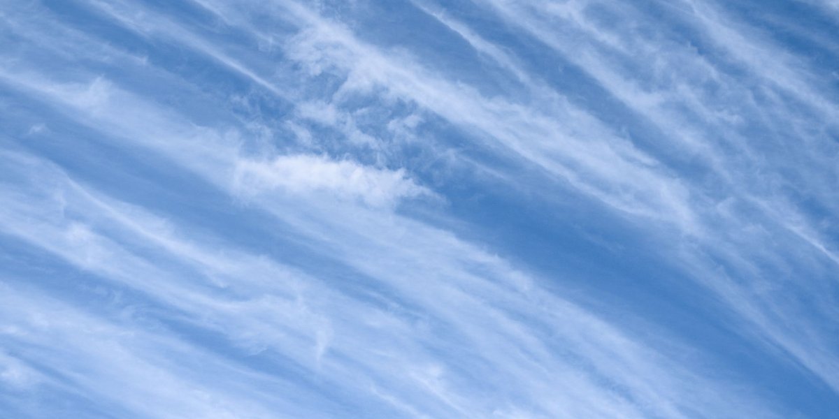
High-level clouds form above roughly 20,000 feet (6,000 meters), where temperatures are cold enough that they’re made almost entirely of ice crystals instead of water droplets. There are three types: cirrus (wispy streaks), cirrostratus (a thin, glassy sheet that produces a ring around the sun), and cirrocumulus (small, rippled patches, sometimes called a “mackerel sky”). Cirrus alone usually means fair weather. A thickening blanket of cirrostratus, especially one that grows a halo, is one of the more reliable early signs that rain or snow is 24 to 48 hours out.
Table of Contents
- What Counts as a High-Level Cloud
- Cirrus: The Wispy Ones
- Cirrostratus: The Sheet That Makes Halos
- Cirrocumulus: The Mackerel Sky
- High, Mid, and Low Clouds: The Quick Contrast
- Contrails, Halos, and the Physics Behind Them
- What High Clouds Are Telling You About Tomorrow
What Counts as a High-Level Cloud
Altitude is the whole game. Anything with a base above about 20,000 feet (6,000 meters) in the mid-latitudes gets filed under “high” — cirrus, cirrostratus, and cirrocumulus, the three members of the cirro- family. Go up there and the air is routinely colder than -40°F, which is exactly why these clouds look and behave so differently from the puffy cumulus you see on a summer afternoon. At that temperature, liquid water can’t hang around. The clouds are built almost entirely from ice crystals, not droplets, according to NOAA’s cloud classification guide.
That ice composition is the reason high clouds look thin and fibrous instead of dense and shadowed. Ice crystals scatter light differently than water droplets, which is also why cirrostratus can produce a halo and a low rain cloud never will.
Cirrus: The Wispy Ones
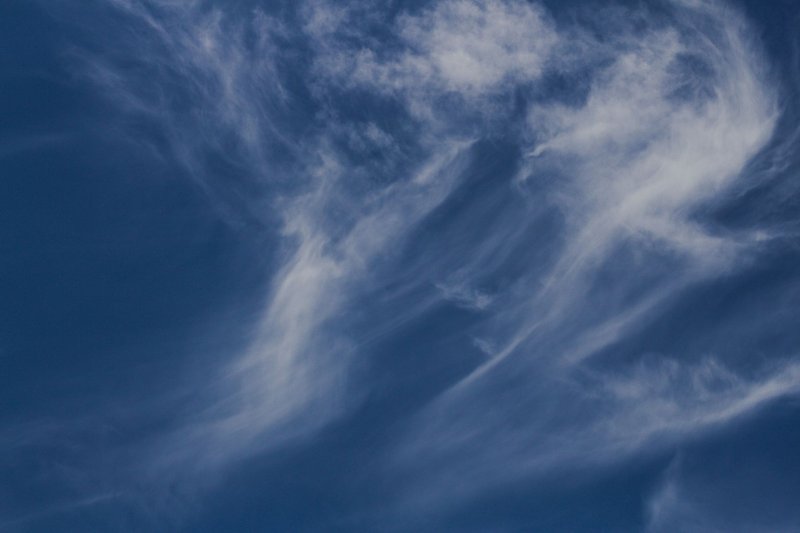
Cirrus is the cloud most people already know by sight, even if they don’t know the name — the detached, feathery streaks that look almost drawn on with a fine brush. The classic shape is called a “mare’s tail,” a curved wisp with a little hook at one end, caused by strong upper-level winds shearing the falling ice crystals sideways as they sink through slower air below.
A sky with scattered cirrus and nothing else is usually a fair-weather sky. These clouds form in the calm, dry air well ahead of any real disturbance, so on their own they don’t signal much. The catch is what comes next: cirrus is frequently the opening act for a warm front, the thin edge of moisture that arrives a full day or two before the front itself. Watch whether the wisps stay scattered or start knitting together into a sheet — that transition is the tell.
Cirrostratus: The Sheet That Makes Halos
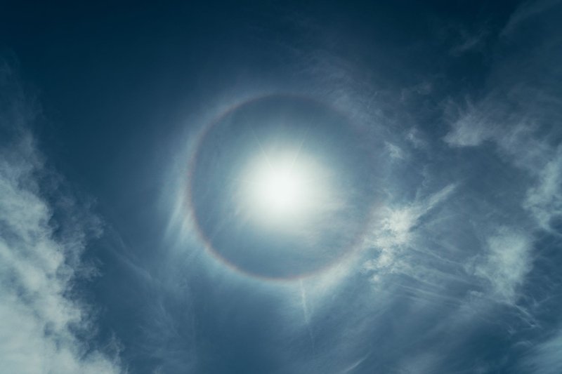
Cirrostratus is what happens when cirrus stops staying politely separated and spreads into a continuous, milky veil across the sky. It’s thin enough that the sun or moon stays visible through it — often the only clue it’s there at all — but thick enough to fuzz out shadows and mute the sky’s blue.
The signature feature is the halo: a pale ring, usually about 22 degrees out from the sun or moon, sometimes with a faint rainbow tinge at the edges. That ring forms because cirrostratus is made of hexagonal ice crystals, and light bends through those six-sided prisms at a remarkably consistent angle no matter how the crystals are oriented in the sky. You will not get a halo from cirrus alone; you need the denser, more uniform crystal population of a cirrostratus sheet to make the geometry work.
Old sailing and farming lore had a name for this: “sun dog ring around the moon, rain or snow soon.” That’s not folklore for the sake of it — it’s a genuine three-cloud sequence (cirrus, then cirrostratus, then thickening mid-level clouds) that shows up ahead of most warm fronts.
Cirrocumulus: The Mackerel Sky
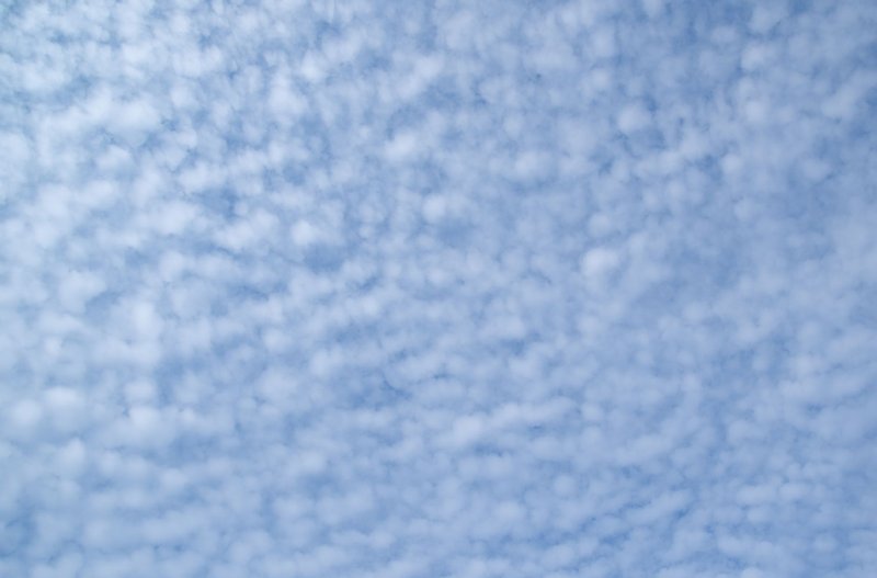
Cirrocumulus is the least common of the three and the easiest to misidentify. It shows up as small, white, rippled patches or grains, often arranged in rows, giving the sky a texture that’s earned the nickname “mackerel sky” for its resemblance to fish scales. Unlike cirrostratus, it doesn’t produce halos, and unlike cirrus, it doesn’t have the long streaky shape — instead it looks granular, almost like a fine-grained cousin of altocumulus that got pushed up to a colder altitude.
It forms when a thin layer of high-altitude air becomes turbulent enough to break into small convective cells, each one just barely condensing before the surrounding dry air erases it again. Because it’s short-lived and localized, cirrocumulus is a weaker forecasting signal than the other two — it hints at instability aloft rather than a specific incoming system.
High, Mid, and Low Clouds: The Quick Contrast
The full cloud classification system sorts every cloud into three altitude bands, and the “cirro-” prefix is reserved exclusively for the top one:
- High clouds (cirrus, cirrostratus, cirrocumulus): above ~20,000 ft, made of ice crystals, thin and pale.
- Mid-level clouds (altostratus, altocumulus): roughly 6,500–20,000 ft, a mix of ice and water droplets, gray and denser than high clouds.
- Low clouds (stratus, cumulus, stratocumulus, nimbostratus): below ~6,500 ft, almost entirely liquid water, the ones that actually produce most of the rain you feel.
The prefixes are a shortcut once you know them: “cirro-” means high and icy, “alto-” means middle, and no prefix at all usually means low. “Nimbo-” or “-nimbus” tacked onto any of them means active precipitation. High clouds themselves almost never produce rain that reaches the ground — the crystals are too sparse and the air below too dry — but they’re frequently the first visible sign that a rain-producing system further down is on its way.
Contrails, Halos, and the Physics Behind Them
Contrails are worth mentioning here because they’re technically artificial cirrus. When a jet engine’s hot, humid exhaust hits air that’s already near saturation at cruising altitude, the water vapor condenses and freezes almost instantly into the same kind of ice crystals that make up natural cirrus. A contrail that evaporates in seconds tells you the surrounding air is dry — fair weather territory. One that lingers and spreads out into a hazy sheet means the upper atmosphere is already close to saturated, which is the same moisture buildup that produces natural cirrostratus. Persistent, spreading contrails on a given day are a legitimate, if unofficial, sign that upper-level moisture is increasing.
The halo itself deserves one more note: it’s not exclusive to the sun. A moon halo forms by the identical mechanism, just dimmer and easier to miss unless you’re specifically looking for it on a clear night with a bright moon and a thin overcast layer.
What High Clouds Are Telling You About Tomorrow
This is the part most cloud guides skip, and it’s the most useful part. Read the sequence, not just the snapshot:
- Scattered cirrus only, blue sky between them: No immediate change expected. Fine for the next day.
- Cirrus thickening and lowering into a hazy veil: A front is likely 24 to 48 hours out. This is the classic setup meteorologists watch for ahead of a warm front.
- Cirrostratus with a visible halo, sky gradually dimming: Rain or snow within roughly a day or two is a reasonable bet, especially if the halo appears in the morning and the cloud deck thickens by afternoon.
- Cirrocumulus scattered through an otherwise clear sky: Mild instability aloft. Not a strong forecasting signal on its own, but worth noting if it shows up alongside a falling barometer.
None of this replaces an actual forecast, but it’s the same read that let people predict weather accurately for centuries before satellites existed. The sky telegraphs what’s coming about a day before it arrives — you just have to know which cloud is doing the talking.