Table of Contents
- TLDR
- What “Active” Actually Means Here
- How Japan Watches Its Volcanoes
- Quick-Scan Comparison
- Mount Fuji
- Sakurajima
- Mount Aso
- Mount Ontake
- Mount Asama
- The Ones That Don’t Make the Postcards
- Checking Before You Go
TLDR
Japan sits on the Pacific Ring of Fire and hosts about 111 active volcanoes — roughly 10% of the world’s total. The Japan Meteorological Agency (JMA) monitors 50 of them around the clock and ranks each one on a five-level alert scale, from “normal” to “evacuate.” Most are dormant enough that you’d never notice; a handful are genuinely, visibly active. Sakurajima smokes and rumbles nearly every week. Mount Aso’s crater floor still steams. Mount Fuji hasn’t erupted since 1707 but is watched as closely as any of them. Mount Ontake is the one every Japanese hiker remembers, after a 2014 eruption with no warning signs killed 63 people on its summit trails.
What “Active” Actually Means Here
“Active volcano” doesn’t mean “erupting right now” — it’s a much wider bucket than that, and it trips people up. JMA classifies a volcano as active if it has erupted within roughly the last 10,000 years or currently shows fumarolic activity: steam vents, sulfur smell, warm ground. By that measure, Mount Fuji counts as active even though its last confirmed eruption was the Hoei event of 1707. So does a volcano that hasn’t so much as hiccupped since the Edo period, as long as the geology underneath is still live.
That’s why the number sounds alarming — 111 — but the day-to-day reality is calmer. Most of those volcanoes are remote, monitored, and quiet. The interesting ones are the small group that actually do something you can see.
How Japan Watches Its Volcanoes
JMA runs seismometers, tiltmeters, GPS stations, and infrasound sensors on its priority volcanoes and assigns each a number from 1 to 5:
- Level 1 — Normal. No restrictions.
- Level 2 — Crater restrictions. Stay out of the immediate crater area.
- Level 3 — Do not approach the volcano. Trails near the summit close.
- Level 4 — Prepare to evacuate. Issued for surrounding residential areas.
- Level 5 — Evacuate. The rare, serious end of the scale.
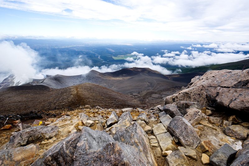
This is the piece most travel guides skip and most data sites bury in a table. The level changes — sometimes within days — based on seismic swarms, gas emissions, or ground deformation. It’s also the single most useful number if you’re actually planning to hike near one of these.
Quick-Scan Comparison
| Volcano | Region | Typical Alert Level | Last Major Activity | Can You Visit? |
|---|---|---|---|---|
| Mount Fuji | Shizuoka/Yamanashi, Honshu | 1 (Normal) | 1707 (Hoei eruption) | Yes — official climbing season, early July to early September |
| Sakurajima | Kagoshima, Kyushu | 3 (near-summit restricted) | Ongoing — frequent minor explosions | Yes — ferry, lookouts, and lava trail; crater off-limits |
| Mount Aso | Kumamoto, Kyushu | Fluctuates 1–3 | Ongoing — periodic ash emissions from Nakadake | Yes, when alert level and gas readings allow; ropeway closes often |
| Mount Ontake | Nagano/Gifu, Honshu | Fluctuates 1–2 | September 2014 phreatic eruption | Yes, with summit-approach limits that shift by season |
| Mount Asama | Nagano/Gunma, Honshu | Fluctuates 1–2 | 2015 minor eruption | Yes — popular hiking area near Karuizawa |
Alert levels move. Treat this table as a starting point, not a live feed — check JMA’s site the week you travel.
Mount Fuji
Fuji is Japan’s most famous volcano and, paradoxically, its quietest active one. It last erupted in December 1707, the Hoei eruption, which dumped ash as far as Edo (now Tokyo), roughly 100 kilometers away. Since then: nothing. No lava, no ash, no confirmed unrest strong enough to move the alert level off “normal” for any sustained stretch.
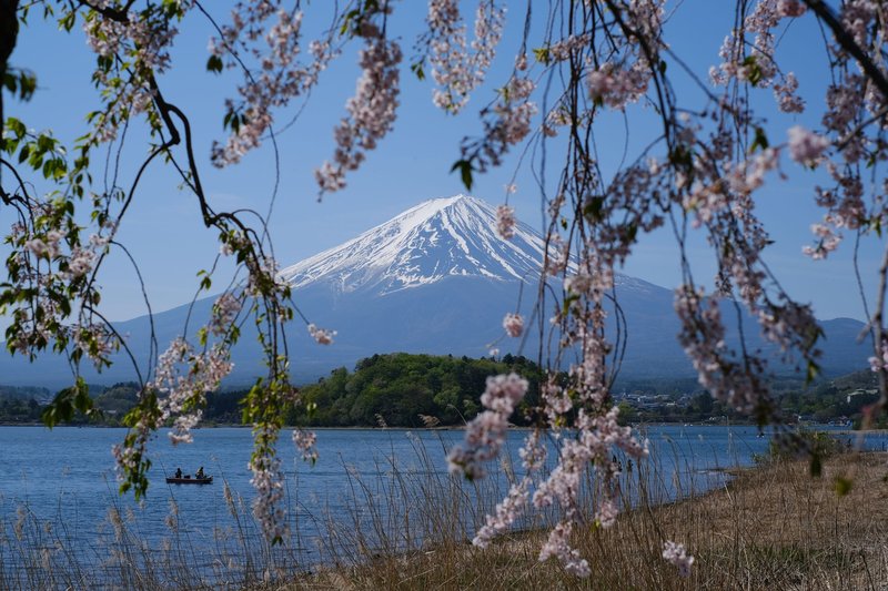
That quiet is exactly why volcanologists keep an eye on it — a 300-year gap after a violent eruption doesn’t mean the system underneath has gone cold, it means pressure has time to build. Fuji is a stratovolcano, the classic cone shape, and its magma chamber sits roughly 15 kilometers down. Climbing season runs early July through early September, when the four main trails (Yoshida, Subashiri, Gotemba, Fujinomiya) are staffed, huts are open, and the summit isn’t buried in snow. Outside that window, people still die attempting off-season climbs — that’s a weather and terrain problem, not a volcanic one, but it’s worth knowing the two risks are separate.
Sakurajima
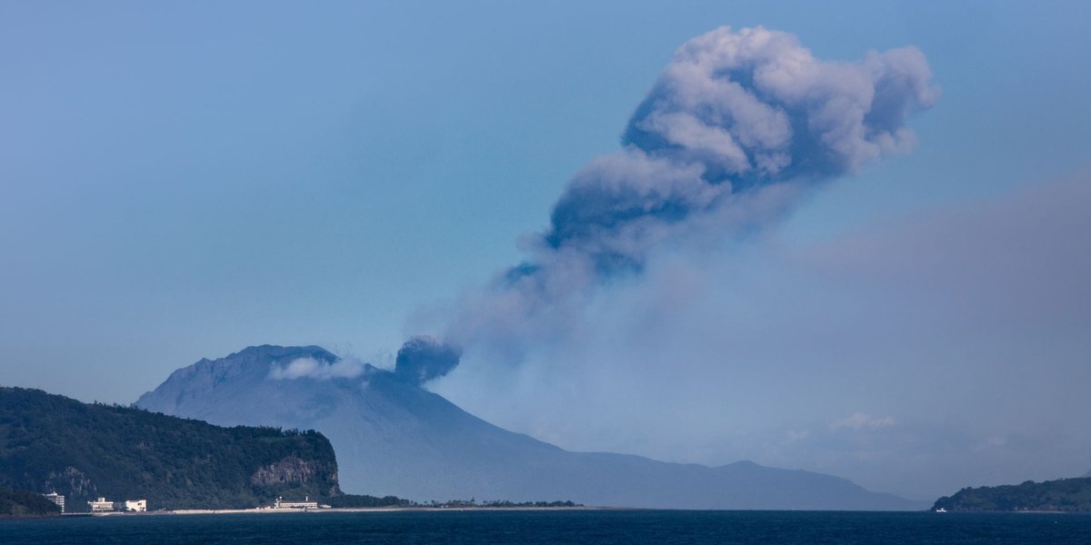
If Fuji is the sleeping giant, Sakurajima is the one that never really stops. It sits in Kagoshima Bay, on Kyushu, and used to be its own island until a 1914 eruption produced enough lava to fuse it to the Osumi Peninsula. The city of Kagoshima, home to around 600,000 people, sits directly across the bay — close enough that ash fall is a weather-forecast category there, not an emergency.
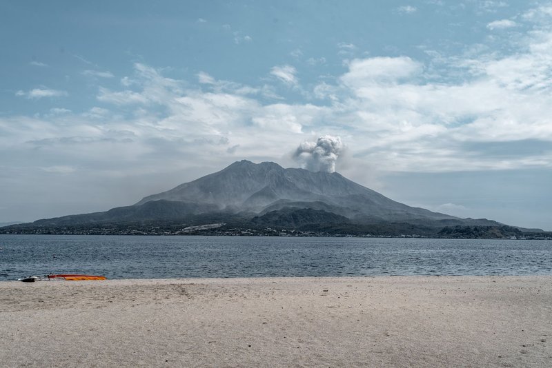
In its most active years, Sakurajima has produced close to a thousand explosive events annually from its Minamidake and Showa craters — plumes, ash columns, the occasional ballistic block landing near the crater rim. Alert level typically sits at 3, meaning the summit and near-crater zone are closed, but the rest of the volcano isn’t. Ferries run constantly from Kagoshima’s waterfront, there’s a dedicated observation lookout with lava fields you can walk across, and a foot bath with a volcano view, because this is still Japan. Residents keep a specific kind of umbrella and windshield wiper made for ash, which tells you more about how normalized this volcano is than any statistic does.
Mount Aso
Aso, also on Kyushu, holds one of the largest calderas on Earth — roughly 120 kilometers around, formed by four catastrophic eruptions between 90,000 and 300,000 years ago. Inside that caldera, people actually live: towns, farms, a rail line, all sitting on the floor of what used to be a volcano violent enough to reshape the regional landscape.
The active part now is Nakadake, one of several peaks inside the caldera, with a crater that periodically fills with a turquoise acidic lake, empties, and vents steam and ash in cycles that can shift over weeks. A ropeway and walking trail take visitors to the crater rim when conditions allow — “when conditions allow” being the operative phrase, since sulfur dioxide readings close it off with little notice. Aso is also one of the better places in Japan to understand what a volcano smells like: sulfur is unmistakable well before you reach the rim.
Mount Ontake
Ontake is the one volcano on this list that changed how Japan thinks about volcanic risk. On September 27, 2014, a phreatic eruption — a steam-driven blast with no magma involved — hit the summit with almost no warning, during peak hiking season on a clear autumn Saturday. Sixty-three people died, most from falling rock and ash rather than heat, making it Japan’s deadliest volcanic disaster in nearly a century.
The unsettling part for volcanologists was the lack of a clean signal beforehand. Phreatic eruptions are driven by groundwater flashing to steam when it contacts hot rock, not by rising magma — the seismic and deformation precursors that usually give days or weeks of warning were faint or absent. Ontake reopened to hikers in stages afterward, with summit-approach restrictions that tighten seasonally and after any uptick in seismic activity. It’s a working reminder that “low alert level” and “zero risk” aren’t the same sentence, especially on a volcano with this specific eruption style.
Mount Asama
Asama straddles the Nagano-Gunma border on Honshu, close enough to the resort town of Karuizawa that eruptions there have made national news for centuries. Its worst chapter was the Tenmei eruption of 1783, which killed an estimated 1,400-plus people through pyroclastic flows and the mudflows that followed, some reaching the Tone River basin dozens of kilometers away.
Modern Asama is far tamer but still routinely active — minor eruptions in 2004, 2009, and 2015 each briefly pushed ash over nearby prefectures and closed hiking trails. It’s a popular climb precisely because it’s accessible and mostly well-behaved, with clear sightlines into an active crater that most volcanoes don’t offer without serious risk.
The Ones That Don’t Make the Postcards
Fuji, Sakurajima, Aso, Ontake, and Asama get the attention, but they’re not the full picture. Unzen, on Kyushu, produced a 1991 pyroclastic flow that killed 43 people, including the volcanologists Katia and Maurice Krafft — a disaster that reshaped how scientists study eruption columns from a safe distance. Miyakejima, south of Tokyo, forced its entire population to evacuate for four years starting in 2000 due to continuous toxic gas emissions, not lava. Izu-Oshima, an island volcano within ferry distance of Tokyo, has a documented eruption cycle roughly every 30–40 years and last went off in 1986.
None of these show up in the standard “most active volcanoes in Japan” round-ups, but they’re the ones that explain why the country takes monitoring as seriously as it does — the killers, historically, haven’t always been the famous ones.
Checking Before You Go
If a trip near any of these is in the plans, the alert level the week you travel matters more than anything in this article. JMA publishes current levels for every monitored volcano, and prefectural tourism sites typically mirror trail closures in real time. The Smithsonian Institution’s Global Volcanism Program tracks eruption history and current activity for every volcano on this list with more technical depth, and the USGS Volcano Hazards Program is a solid plain-English resource if the JMA classifications feel like a lot to parse on short notice.
Japan’s relationship with its volcanoes isn’t cautious avoidance — it’s closer to familiarity. Onsen towns exist because of this geology, ropeways run to active crater rims, and Kagoshima residents shrug at ash fall the way other cities shrug at rain. The volcanoes aren’t going anywhere. Knowing which ones are actually doing something, and which ones just look dramatic on a map, is most of the battle.