TLDR
California has 8 active volcanic areas monitored around the clock by the USGS California Volcano Observatory (CalVO). Only one has erupted in recorded history: Lassen Peak, which blew intermittently from 1914 to 1917. The rest are considered active because they’ve erupted within the last few thousand years and still have magma sitting under them — not because they’re rumbling right now. Three rank as “very high threat” (Shasta, Lassen, Long Valley/Mammoth), three as “high threat” (Medicine Lake, Clear Lake, Mono-Inyo Craters), and two as “moderate threat” (Coso, Salton Buttes). All eight currently sit at normal alert status.
Table of Contents
- Active, dormant, or extinct: what the labels actually mean
- 1. Mount Shasta
- 2. Lassen Peak
- 3. Long Valley Caldera and Mammoth Mountain
- 4. Medicine Lake Volcano
- 5. Clear Lake Volcanic Field
- 6. Mono-Inyo Craters
- 7. Coso Volcanic Field
- 8. Salton Buttes
- How CalVO actually watches these volcanoes
Active, dormant, or extinct: what the labels actually mean
Most articles throw around “active volcano” without defining it, which is how you end up confused about why a mountain that hasn’t erupted since before the pyramids still counts. Here’s the actual distinction geologists use.
An active volcano has erupted within the Holocene — roughly the last 11,700 years — or shows current signs of magma movement: earthquake swarms, ground deformation, gas emissions. A dormant volcano hasn’t erupted recently but still has an active magma system underneath it and could erupt again. A volcano is only called extinct when geologists are confident its magma supply has cut off for good, which is a much harder thing to prove than it sounds.
In practice, the eight areas below are all technically “active” by the Holocene definition, and CalVO treats “active” and “dormant” as functionally the same category for monitoring purposes — both mean “watch it.” None of them are erupting today. One of them erupted within the last 150 years. The rest last erupted anywhere from a few centuries to about 11,000 years ago, which sounds ancient until you remember that a volcano’s internal clock doesn’t reset on a human timeline.
1. Mount Shasta
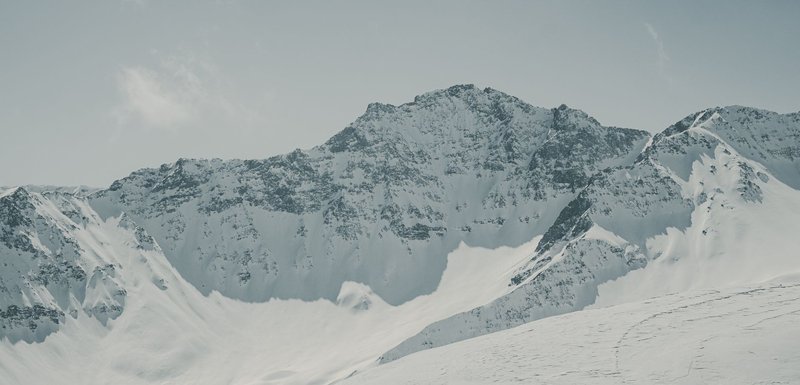
Threat level: Very high | Last eruption: Around 1250 CE | Elevation: 14,179 feet | Status: Normal/Green
Shasta is the one everyone already assumes is active, and they’re right — it’s the largest volcano by volume in the Cascade Range and the second-tallest peak in the chain after Rainier. For years, textbooks credited it with an 1786 eruption reported by a French sea captain sailing past the coast. That claim didn’t survive scrutiny: researchers found no matching ash layer and eventually pinned the captain’s smoke plume on a wildfire, not a volcano, as Scientific American reported. Shasta’s real last eruption dates back roughly 750 years, to around 1250 CE.
That doesn’t make it any less of a concern. Shasta’s combination of size, year-round glacier cover, and proximity to the town of Mount Shasta and Interstate 5 is exactly why the USGS ranks it a very-high-threat volcano — a future eruption could trigger lahars, fast-moving mudflows of melted glacier ice and debris, down the same drainages people drive and hike through today. Bunny Flat, the standard summit trailhead above Mount Shasta City, sits directly on the mountain’s flank.
2. Lassen Peak
Threat level: Very high | Last eruption: 1914–1917 | Elevation: 10,457 feet | Status: Normal/Green
Lassen is the answer to the trivia question buried in most searches about this topic: it’s the only California volcano to have erupted in recorded history, and the most recent Cascade Range eruption before Mount St. Helens went off in 1980. The sequence started small, with a phreatic steam blast in May 1914 that eventually carved a 1,000-foot crater at the summit. It peaked a year later, on May 22, 1915, when an explosive eruption sent ash 200 miles east and devastated the surrounding slopes — an event the USGS documents in detail. Smaller eruptions continued sputtering into 1917, then stopped.
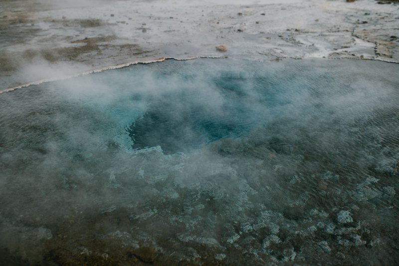
More than a century later, the evidence is still visible without needing an eruption to prove it. Lassen Volcanic National Park’s Bumpass Hell trail winds through boiling mud pots and steam vents fed by the same magma system, and the devastated area below the peak — still sparsely vegetated compared to the surrounding forest — is a short walk from the main park road near the town of Mineral.
3. Long Valley Caldera and Mammoth Mountain
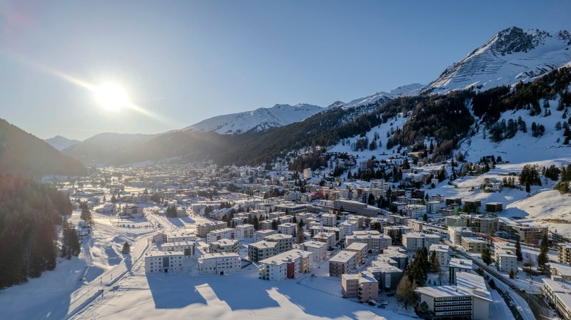
Threat level: Very high | Last activity: Ongoing unrest since 1978; youngest lava roughly 250–600 years old | Elevation (Mammoth Mountain): 11,059 feet | Status: Normal/Green, closely watched
Long Valley is less a mountain than a scar — a 20-mile-long caldera punched out by a single catastrophic eruption about 760,000 years ago that buried much of the western U.S. in ash. It’s been quiet since, but not still. A magnitude 5.4 earthquake in 1978 kicked off a period of unrest that’s never fully settled: a swarm of four magnitude-6 quakes hit in a single day in May 1980, and the ground at the resurgent dome in the caldera’s center has risen more than two feet since monitoring began.
The most tangible sign of the system underneath is at Horseshoe Lake, on Mammoth Mountain’s flank, where roughly 100 acres of trees died starting in the late 1980s after magmatic carbon dioxide began seeping up through the soil — a hazard the USGS tracks closely because the gas can pool in low spots at concentrations dangerous to people. Mammoth Lakes, the town at the caldera’s edge, sits on top of a live volcanic system that also happens to host one of California’s most popular ski resorts.
4. Medicine Lake Volcano
Threat level: High | Last eruption: Around 950 CE (Glass Mountain flow) | Elevation: 7,913 feet | Status: Normal/Green
Medicine Lake doesn’t look like a volcano from the ground, which is the point. It’s a shield-shaped giant — the largest volcano by volume in the entire Cascade Range, Shasta included — so broad and low-relief that its 7,913-foot summit caldera reads more like a high plateau than a peak. Its youngest flow, the glassy black obsidian field known as Glass Mountain, erupted roughly 1,000 years ago and is still sharp enough underfoot to shred hiking boots.
The volcanic field sprawls across the Modoc Plateau near Lava Beds National Monument, and much of the surrounding landscape — lava tube caves, cinder cones, spatter rings — is a direct record of the same eruptive history that built Glass Mountain.
5. Clear Lake Volcanic Field
Threat level: High | Last eruption: Roughly 11,000 years ago | Elevation (Mount Konocti): 4,305 feet | Status: Normal/Green
Clear Lake is the field most likely to surprise people, because its most visible activity today isn’t volcanic at all — it’s industrial. The same magma body that last erupted about 11,000 years ago still heats groundwater beneath the surface, and that heat powers The Geysers, the largest geothermal power complex on Earth, straddling the Sonoma-Lake county line just southwest of the lake.
Mount Konocti, the field’s tallest cone at 4,305 feet, rises directly above the town of Kelseyville and has a county-park trail to its summit. The lake itself is the oldest lake in North America, older than the volcanic field that shaped its basin.
6. Mono-Inyo Craters
Threat level: High | Last eruption: Roughly 250 years ago (Paoha Island, Mono Lake) | Elevation: Up to about 9,000 feet at the highest domes | Status: Normal/Green
If you want to see California’s most recent volcanism outside Lassen, this is where to go. The Mono-Inyo chain is a 25-mile string of craters, domes, and obsidian flows running from Mono Lake south past Mammoth Mountain, and it’s the youngest volcanic chain in the state. Its most recent eruption built Paoha Island, the pale dome rising out of Mono Lake, only about 250 years ago — meaning it was likely still steaming when European trappers were working their way into the Sierra.
Panum Crater, the southernmost of the Mono Craters, has a short, well-marked loop trail right off Highway 395 that puts you on the rim of a plug dome in under half an hour, no permit or backcountry gear required.
7. Coso Volcanic Field
Threat level: Moderate | Last eruption: Roughly 1,000 years ago | Elevation (Sugarloaf Mountain): About 6,470 feet | Status: Normal/Green
Coso is the volcano most Californians will never set foot on, and not because it’s remote — it’s largely fenced inside the Naval Air Weapons Station China Lake, a live military range. Its youngest domes erupted within roughly the last 1,000 years, and the field today is better known for what it enables than what it once did: the Coso Geothermal Field on the same ground is one of the largest geothermal energy operations in the country, drawing on the same underground heat that built the domes.
From outside the base, the field’s dark, blocky lava domes are visible from Highway 395 near Little Lake and Fossil Falls, north of Ridgecrest.
8. Salton Buttes
Threat level: Moderate | Last eruption: Roughly 2,000–3,000 years ago | Elevation: Under 200 feet above the Salton Sea | Status: Normal/Green
The Salton Buttes are the least volcano-shaped entries on this list — five low rhyolite domes poking up along the southeastern shore of the Salton Sea, easy to mistake for hills until you know what you’re looking at. They’re also sitting on top of one of the most seismically restless patches of ground in the state: the Salton Trough, where the San Andreas Fault terminates, generated a swarm of roughly 1,700 small earthquakes over four days in 2020 that briefly raised eyebrows at CalVO before subsiding without any sign of an eruption.
The domes themselves last erupted an estimated 2,000 to 3,000 years ago, but the geothermal energy underneath never cooled off — the surrounding Salton Sea Geothermal Field packs one of the densest concentrations of geothermal power plants anywhere in the country into a few square miles near Niland and Bombay Beach.
How CalVO actually watches these volcanoes
None of these eight are being watched out of institutional habit. The USGS California Volcano Observatory runs continuous seismic networks, GPS stations that measure ground deformation down to the millimeter, and gas and satellite monitoring across all eight areas, and publishes a weekly status update for each one. Every California volcano currently sits at Normal alert level and Green aviation color code — the lowest tier on a four-level scale — which means background seismicity within the range these systems have shown historically, nothing more.
That status can change. Long Valley and the Salton Buttes have both had real earthquake swarms in the past two decades that didn’t lead anywhere. The next one might not either. But it’s also the reason CalVO exists instead of just publishing a list once and moving on — an active volcano, by definition, is one worth checking on.