TLDR
Djibouti has five or six volcanic centers, depending on who is counting: Ardoukoba, Boina, Garbes, Manda-Inakir, Tiho, and sometimes Mousa Ali on the Ethiopia-Eritrea border. The most recent confirmed eruption was Ardoukoba, which split open in November 1978. Before that, Manda-Inakir erupted in 1928-1929. None of them is a classic cone-shaped peak. Most are fissures and lava fields, sitting in one of the few places on Earth where a continent is tearing in two.
Contents
- Why Djibouti has volcanoes
- The volcanoes of Djibouti, one by one
- Five or six? Why the lists disagree
- Summary table
- Timeline of recent eruptions
- Active, dormant, extinct: where Djibouti’s volcanoes fall
- Monitoring and safety
- Seeing the volcanic landscape
Why Djibouti has volcanoes
Djibouti sits on the Afar triple junction, the spot where three tectonic plates pull away from each other: the Nubian (African) plate, the Arabian plate, and the Somali plate. The Red Sea splits Africa from Arabia to the north. The Gulf of Aden opens to the east. The East African Rift runs south. Afar is where all three meet, and the crust there is stretched thin enough that magma reaches the surface.
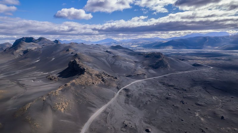
That stretching shows up in Djibouti as two rift zones. The Asal-Ghoubbet rift runs northwest from the Gulf of Tadjoura, and the Manda-Inakir rift lies farther north near the Eritrean border. Both are lined with fissures, basalt flows and small cones. These are not subduction volcanoes like the ones around the Pacific. They are rift volcanoes, fed by basalt that wells up as the ground spreads apart, and they tend to erupt fluid lava from cracks rather than blast ash from a summit.
The same process created the Danakil Depression to the west and Lake Assal, which sits about 155 meters below sea level and is the lowest point in Africa.
The volcanoes of Djibouti, one by one
Ardoukoba
Ardoukoba is the one everyone cites, and for good reason. It is a fissure volcano in the Asal rift, a low ridge of lava and cinders only a few hundred meters high. Its name comes from the local Afar language, and the 1978 eruption is the best-documented volcanic event in the country.
It began on November 6, 1978, after a swarm of earthquakes. A fissure opened and lava poured out for a few days, building the cone and spilling basalt toward the Ghoubbet-al-Kharab bay. The remarkable part was what happened to the land. The Asal rift widened by roughly a meter or more in a matter of days, a rift-opening event that geologists had rarely watched in real time on land. Researchers still use Ardoukoba as a reference for how rifts spread: in sudden jolts of dike injection, not slow creep.
Manda-Inakir
Manda-Inakir is the northern rift system, near the Eritrea border, made up of fissures, lava domes and basaltic cones. It is the other Djibouti volcano with a reported 20th-century eruption, dated to 1928-1929. The record from that period is thin, since there were no instruments and few observers in the area, so details such as the size and duration come from limited accounts.
Boina, Garbes and Tiho
These three are lower-profile volcanic centers in the Afar region of Djibouti. They appear in the standard lists with Holocene-age activity, meaning they have erupted within roughly the last 10,000 years, but none has a documented eruption in historical times. If you are looking for dramatic photos, there are none to find. They are mostly lava fields and eroded cones, and little scientific attention has gone their way compared with Ardoukoba.
Mousa Ali
Mousa Ali is the highest of the group at about 2,000 meters, a stratovolcano on the junction of Djibouti, Eritrea and Ethiopia. Some sources assign it to Djibouti, others to Eritrea or Ethiopia, and the border position is why. It has no confirmed historical eruption, though it is often classed as potentially active based on its young volcanic rock.
Five or six? Why the lists disagree
Wikipedia lists five volcanoes in Djibouti. Other catalogs, including Volcanolive, add Mousa Ali. The difference is only a border issue: Mousa Ali sits right on the tripoint, so whether it counts as a Djibouti volcano depends on where you draw the line. This post treats five as the core Djibouti list and mentions Mousa Ali as the sixth.
A second source of confusion is naming. Some catalogs record one volcanic field under several names, and elevations vary by a few meters between sources. For firm numbers, the Smithsonian Global Volcanism Program is the standard reference, and it is where most other lists get their data.
Summary table
| Volcano | Rift zone | Type | Last known eruption |
|---|---|---|---|
| Ardoukoba | Asal-Ghoubbet | Fissure volcano | November 1978 |
| Manda-Inakir | Manda-Inakir | Fissures, domes, cones | 1928-1929 |
| Boina | Afar region | Volcanic field | Holocene, no dated eruption |
| Garbes | Afar region | Volcanic field | Holocene, no dated eruption |
| Tiho | Afar region | Volcanic field | Holocene, no dated eruption |
| Mousa Ali (border) | Afar triple junction | Stratovolcano | No confirmed historical eruption |
Timeline of recent eruptions
- 1928-1929: Manda-Inakir erupts. This is the first documented eruption in the country in the modern era.
- November 1978: Ardoukoba fissure eruption in the Asal rift. The rift widens by about a meter or more within days.
- Since 1978: No confirmed eruption in Djibouti.
That is a short list. Djibouti averages roughly one eruption per half century, which is quiet by East African standards. Ethiopia’s Afar region, just next door, has seen more recent activity, including the 2005 Dabbahu rifting episode.
Active, dormant, extinct: where Djibouti’s volcanoes fall
These labels are blurry, and volcanologists mostly avoid them. A common working rule is that a volcano is considered active if it has erupted in the Holocene, the last 10,000 years or so. By that rule, Ardoukoba, Manda-Inakir, Boina, Garbes and Tiho all qualify. Ardoukoba and Manda-Inakir are the only two with eruptions in living memory.
“Dormant” is the better word for the quiet ones. The tectonics that built them has not stopped. The Asal rift is still spreading by roughly a centimeter or two per year, and new fissures can open on short notice. A volcano with no recorded eruption is not a volcano that cannot erupt.
Monitoring and safety
There is no confirmed, continuous volcano monitoring network in Djibouti, according to the information available. Seismic activity is tracked by international networks and by research groups that have installed temporary instruments in the Asal rift, but nothing equivalent to the observatories you find in Italy or Hawaii. Anyone relying on a “volcano alert” for Djibouti is relying on regional earthquake data.
For visitors, the practical risks are not lava. They are heat, remote roads and a lack of water. The Asal region can pass 40 degrees Celsius in summer, and the lava fields are rough, sharp ground. Local guides in Djibouti City and Tadjoura run trips to the area, and going with one is the sensible choice.
Seeing the volcanic landscape
You do not need to find a specific cone to see the effects. Lake Assal is reachable by road from Djibouti City in around two to three hours. The shoreline is white salt crust against black basalt, with the Ardoukoba lava flows nearby. The salt flats at the lake are among the most saline bodies of water on the planet, outside Antarctica’s Don Juan Pond.
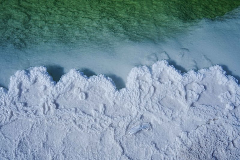
The Ghoubbet-al-Kharab bay, which Ardoukoba’s lava nearly cut off from the Gulf of Tadjoura, is also worth a stop. The geology there is easy to read: black lava on one side, open water on the other, and clear fissures running across the ground. For a wider look at the region’s rifting, the U.S. Geological Survey publishes background on how volcanoes and rift systems work.
Summary
Volcanoes in Djibouti exist because the country straddles the Afar triple junction, where Africa and Arabia are splitting apart. Ardoukoba (1978) and Manda-Inakir (1928-1929) are the only two with historical eruptions, and Ardoukoba is the one that matters most for science. The remaining centers, Boina, Garbes and Tiho, are young but quiet, and Mousa Ali sits on the border with an uncertain national label. None is a tourist volcano in the Vesuvius sense. What you get instead is a landscape where the rift itself is the attraction.