Table of Contents
- TLDR
- True Cave or Crevice? It Matters
- 1. The Caves Trail, Clearwater Lake Provincial Park
- 2. Caddy Lake Rock Tunnels, Whiteshell Provincial Park
- 3. Agassiz Chamber, Grand Rapids Uplands
- 4. Moose Arm Pit, Grand Rapids Uplands
- 5. Little Limestone Lake’s Karst Country
- 6. Lake St. George and Walter Cook Caves Ecological Reserves
- Safety, Season, and Permits
TLDR
Search “caves in Manitoba” and you’ll mostly find one trail. There’s more than that, but the first thing to know is that almost none of it is a true cavern with a ceiling and a back wall you can’t see. Most of what people call caves here are wave-cut crevices, split rock, and blasted tunnels. The Caves Trail at Clearwater Lake is the easiest and most crowded stop, a 0.8 km boardwalk loop where snow can sit in the shadows into July. The Caddy Lake Rock Tunnels in Whiteshell are a canoe-through experience, not a hike. For actual cavern-scale spaces, you have to go north into the Grand Rapids Uplands, where the Speleological Society of Manitoba has catalogued more than 200 sites, including Agassiz Chamber and Moose Arm Pit. None of it requires ropes or gear beyond sturdy boots and a headlamp, but almost all of it requires driving a few hours past Winnipeg.
True Cave or Crevice? It Matters
Manitoba sits on a bed of Paleozoic dolomite and limestone, and water has been working on it for thousands of years. But the shapes that water carves depend entirely on how it got there.
Along Clearwater Lake and through much of the Interlake region, wave action against ancient shorelines split slabs of dolomite away from the cliff face, leaving narrow, roofed passages between the rock and the wall behind it. Geologists call these solution or wave-cut features. They’re real, they’re cool to walk through, and they’re not caves in the strict sense — no groundwater system carved them out from the inside.
Further north in the Grand Rapids Uplands, it’s a different story. There, karst processes — groundwater dissolving carbonate rock over long stretches of time — have produced actual cavern chambers, some with ceilings you can’t see from the entrance. That’s where you’ll find karst inventory work documented by Manitoba’s own geological survey, cataloguing sinkholes, chambers, and drainage systems that behave like caves anywhere else in the world.
The distinction matters for planning. If you want a short walk with your kids, the crevices are perfect. If you want something closer to genuine spelunking, you need to go north and you need to know what you’re doing.
The Caves Trail, Clearwater Lake Provincial Park
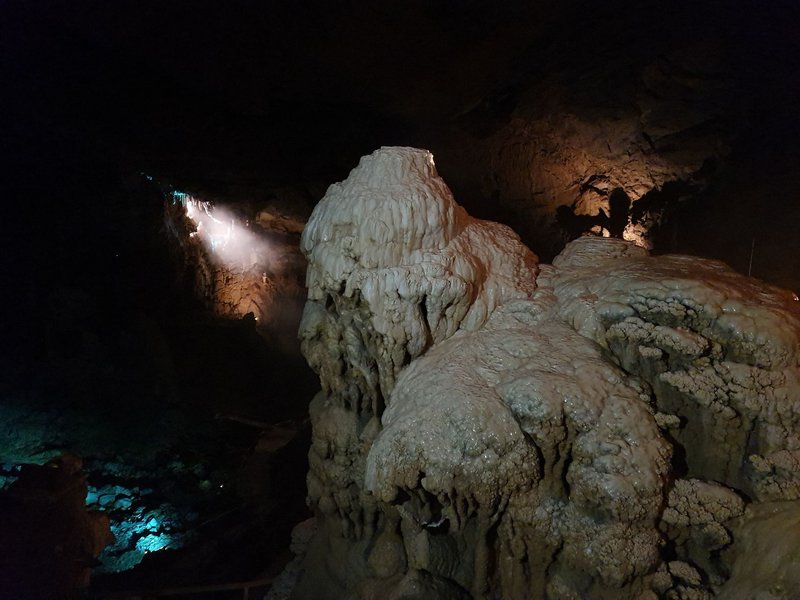
This is the cave most people mean when they search for caves in Manitoba, and it’s the one with a parking lot. The self-guided trail runs about 0.8 km through Clearwater Lake Provincial Park, near The Pas, and takes most visitors around 45 minutes round trip.
The “caves” here are large slabs of dolomite that sheared away from the cliffs above and now sit tilted against the escarpment, creating dark, narrow passages between rock and wall. Boardwalks, stairways, and viewing platforms keep foot traffic off the fragile plant growth that’s colonized the gaps — mosses and a few hardy species that only survive because the crevices stay cool and shaded year-round. Snow can linger in the deepest pockets into July, which surprises people showing up in shorts in the middle of summer.
It’s the most popular hike in the park for a reason: minimal elevation gain, clear signage, and a payoff you can see within ten minutes of the trailhead. Bring your park vehicle pass — Manitoba provincial parks require one, and rangers do check.
Caddy Lake Rock Tunnels, Whiteshell Provincial Park
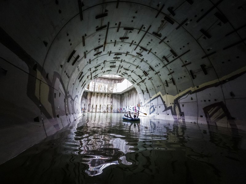
These aren’t natural at all, and that’s what makes them interesting. Around a century ago, railway crews blasted two tunnels through solid Canadian Shield granite near Caddy Lake to let water pass through and keep the tracks from flooding. The result looks and feels exactly like a cave: jagged rock overhead, a bend in the passage that blocks the light, and an echo that carries every paddle stroke.
You experience these by canoe or kayak, not on foot. The first tunnel sits about three kilometres from the public launch on Caddy Lake — roughly 45 minutes of paddling each way in calm conditions — and opens into South Cross Lake on the other side. The second tunnel, about three miles further along, has a lower ceiling and gets closed off during high water, but its length and lower foot traffic make it the better pick if you’re after quiet. Birds nest in the rock overhead and will swoop the passage as you pass through, which is startling the first time and expected every time after.
Rentals are available at resorts on Caddy Lake if you’re not hauling your own boat.
Agassiz Chamber, Grand Rapids Uplands
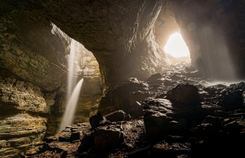
This is where Manitoba stops being coy about the word “cave.” Agassiz Chamber is the largest wave-cut cavern documented within the Silurian escarpment north of Grand Rapids — roughly 10 metres high and 20 metres across, with circular, bowl-shaped recesses scooped into the back and side walls where water pooled and spun sediment against the rock for centuries.
It sits in the Grand Rapids Uplands, one of the three regions where the Speleological Society of Manitoba has concentrated its cataloguing work, and it isn’t signposted or maintained the way Clearwater Lake’s trail is. There’s no boardwalk, no interpretive panel, no cell signal most of the way in. This is a site for people comfortable navigating with a map and GPS, not a casual afternoon stop.
Moose Arm Pit, Grand Rapids Uplands
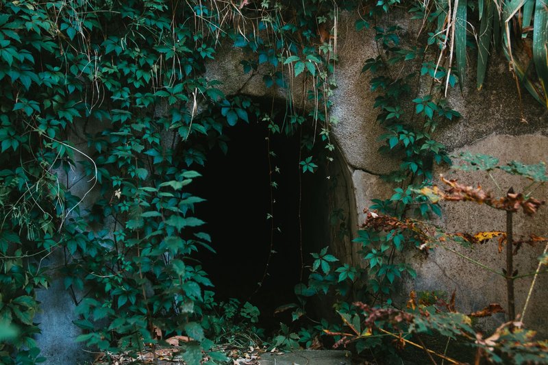
Also in the Grand Rapids Uplands and often mentioned in the same breath as Agassiz Chamber, Moose Arm Pit is counted among the longest and largest caves catalogued in the region. Unlike a wave-cut chamber that opens along a cliff face, a “pit” cave typically drops from a sinkhole-style entrance, which changes the kind of caution it demands — footing at the entrance matters as much as what’s inside.
Access here is genuinely remote. The Speleological Society of Manitoba, which has surveyed the region since the 1970s and now lists over 200 catalogued caves across the province, treats sites like this one as serious caving territory rather than tourist stops. If you’re not already comfortable with backcountry navigation and cave safety basics, this is a site to read about rather than visit solo.
Little Limestone Lake’s Karst Country
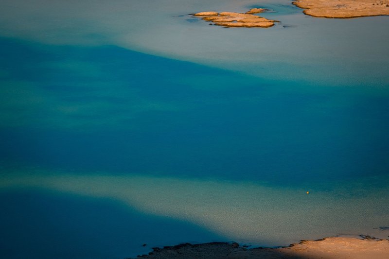
Little Limestone Lake, about 65 km north of Grand Rapids, is better known for turning a startling turquoise blue in summer than for its caves — but the two are connected. The lake is the world’s largest known marl lake, meaning its water carries a heavy load of dissolved calcium carbonate. When the water warms, that carbonate precipitates out into fine calcite crystals suspended near the surface, scattering light and producing the color shift. As the water cools, the calcite redissolves and the lake clears again.
That same carbonate-rich groundwater is what makes the surrounding land classic karst terrain: porous limestone bedrock riddled with small caves, sinkholes, and hollows carved by slow percolation rather than surface erosion. Several of these hollows serve as overwintering sites for bats and snakes, which makes the area ecologically sensitive as well as geologically interesting. There’s no formal cave trail here — this is a landscape to appreciate from the shoreline and the lookout points around Little Limestone Lake Provincial Park, not a destination for cave exploration on foot.
Lake St. George and Walter Cook Caves Ecological Reserves
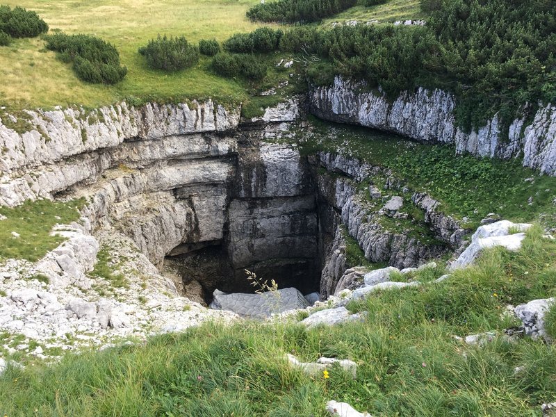
Manitoba has set aside two small ecological reserves specifically to protect cave and karst features in the Interlake region: Lake St. George Caves Ecological Reserve and Walter Cook Caves Ecological Reserve. Both are protected under IUCN reserve categories that restrict development and limit access to research and low-impact visitation, which is part of why they stay so undocumented online — there’s no tourism infrastructure built around them by design.
These reserves matter less as hiking destinations and more as evidence of how much cave terrain the province is actively protecting rather than promoting. If your interest in caves in Manitoba runs toward conservation and geology rather than a day out, these reserves are the throughline: small, deliberately unpublicized, and part of the same karst system that produces Little Limestone Lake’s color and the Grand Rapids Uplands’ chambers.
Safety, Season, and Permits
A provincial park vehicle pass covers the Caves Trail at Clearwater Lake and any other developed provincial park site — check current rates before you go, since they’re adjusted periodically. Caddy Lake and the Whiteshell tunnels don’t require a permit beyond your park pass, but you do need your own boat or a rental; there’s no walking route to either tunnel.
For the Grand Rapids Uplands sites like Agassiz Chamber and Moose Arm Pit, there’s no formal permit system, but there’s also no rescue infrastructure. Tell someone your route, carry a headlamp with backup batteries, and don’t go in alone if you can avoid it. Footing inside wave-cut chambers and pit entrances is often wet rock over uneven rubble, and a sprained ankle two hours from the nearest road is a genuinely different problem than the same injury on a boardwalk at Clearwater Lake.
Timing depends on the site. The Caves Trail is walkable from late spring through fall, though snow can persist in the shaded crevices into July. Caddy Lake’s tunnels are a summer paddling trip and the second tunnel closes during high water in spring runoff. The northern karst sites are best attempted in the drier months of mid-summer, when trails into the Uplands are more passable and daylight hours are longest.