TLDR
Afghanistan has no active volcanoes. Zero, according to the Smithsonian’s Global Volcanism Program, which tracks eruptions going back through the Holocene (the last roughly 11,700 years). What the country does have are four extinct volcanic fields — Dacht-i-Navar, Vakak, Loman, and Zardolou — all clustered in the Ghazni region southwest of Kabul, and all quiet since the Pleistocene. The frequent, sometimes deadly earthquakes that do hit Afghanistan come from a completely different process: two continents grinding into each other, not magma pushing toward the surface.
Table of Contents
- So, does Afghanistan have active volcanoes?
- The four volcanic fields, compared
- Meet Dacht-i-Navar, the group’s headliner
- Why a continental collision doesn’t make volcanoes
- Then what’s causing Afghanistan’s earthquakes?
So, does Afghanistan have active volcanoes?
No. Not one. The last confirmed volcanic activity anywhere in the country happened during the Pleistocene, which ended around 11,700 years ago — long before anything resembling written history. Every volcanic feature mapped in Afghanistan is classified as extinct or dormant, and none show the seismic swarms, gas venting, or ground deformation that would flag renewed activity.
That hasn’t stopped the question from trending every time a major Afghan earthquake makes headlines. It’s a fair thing to wonder: a country that shakes as often as Afghanistan does feels like it should have a volcano or two in the mix. It doesn’t, and the reason is baked into the geology of the region itself, not a matter of volcanoes going quiet.
The four volcanic fields, compared
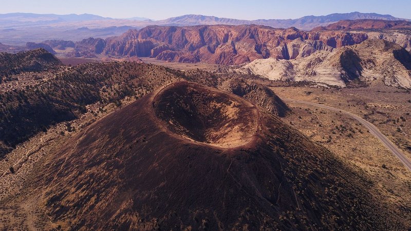
All four of Afghanistan’s known volcanic fields sit within roughly 150 km of each other in Ghazni and Wardak provinces, southwest of Kabul on the way toward Kandahar. None of them look like the classic cone-shaped stratovolcano most people picture — they’re clusters of lava domes, the stubby, thick-lava formations that pile up rather than erupt explosively outward.
| Volcanic Field | Location | Notable Features | Last Activity |
|---|---|---|---|
| Dacht-i-Navar | 33°57′N 67°55′E, Ghazni province, ~100 km SW of Kabul | Lava domes and stratovolcanoes; tallest peaks top 4,500 m (14,800 ft) | Pleistocene |
| Vakak (Wakak) | ~115 km WSW of Kabul, Ghazni region | 18 small lava domes; one sits inside an old caldera | Pleistocene |
| Loman | Ghazni/Wardak border area | Four Quaternary lava domes | Pleistocene |
| Zardolou | Ghazni/Wardak border area | Six to seven Quaternary lava domes | Pleistocene |
Dacht-i-Navar is the one geologists actually study in any depth — it’s the only field with a dedicated Smithsonian Global Volcanism Program profile that goes beyond a bare listing. The other three barely register outside specialist databases, which tracks with how unremarkable they’ve been for the last several thousand years.
Meet Dacht-i-Navar, the group’s headliner
Dacht-i-Navar sits at the southern edge of the Dacht-i-Navar depression, a high, arid basin that itself sits over 3,000 meters up. The domes and small stratovolcanoes here are built from silica-rich lava, the same thick, slow-moving stuff that tends to pile up into steep mounds instead of flowing far. Some of the summits clear 4,500 meters — taller than anything in the contiguous United States outside California and Colorado, for scale.
What makes Dacht-i-Navar worth a second look isn’t scale, though. It’s that the field appears to have been fed by localized crustal melting rather than a subducting oceanic plate — a leftover process from an earlier, more tectonically active phase of the region’s history, before the current collision zone locked into place. That’s a detail that shows up in the petrology literature and nowhere in the tourist brochures, because there aren’t any.
Vakak, Loman, and Zardolou are smaller and less documented, but they share the same basic story: dome-building eruptions, no explosive record, and total silence since well before the current interglacial period began.
Why a continental collision doesn’t make volcanoes
Here’s the part that actually explains the whole puzzle. Most of the world’s active volcanoes — the Cascades, Japan, Indonesia — sit above subduction zones, where an oceanic plate dives under a continental one. Oceanic crust carries water, and when it gets dragged down to around 100 km depth, that water lowers the melting point of the mantle above it, generating the magma that eventually surfaces as an eruption. It’s a well-oiled machine: water in, magma out.
Afghanistan’s mountains were built by a different mechanism entirely. The Indian plate is driving north into Eurasia at roughly 40 mm per year, and beneath the Hindu Kush that collision is continent-on-continent, not ocean-on-continent. Continental crust is too buoyant and too dry to sink and melt the way oceanic crust does — instead, it crumples, thickens, and pushes up mountain ranges. A 2021 study in Nature Communications on the Hindu Kush found that a remnant slab is still detaching at depth beneath the region, generating some of the deepest earthquakes on Earth. But there’s no water-rich oceanic crust involved, so there’s no magma factory to feed volcanoes.
Put simply: earthquakes and volcanoes both come from plate tectonics, but they’re not the same output. One needs melted rock reaching the surface. The other just needs rock under enough stress to break.
Then what’s causing Afghanistan’s earthquakes?
The Hindu Kush region is one of the most seismically active spots on the planet that isn’t sitting on an active volcanic arc. Earthquakes there regularly originate at depths of 100 to 250 km — genuinely unusual, since most damaging quakes worldwide happen in the top 20 km of crust. That depth is the signature of the detaching slab mentioned above: a slab of old lithosphere still sinking and snapping under the collision’s ongoing pressure, according to USGS earthquake hazard data for the region.
This is why Afghanistan can rattle from a magnitude 6 quake one year and show zero volcanic unrest the next, and why the two hazards get confused so often. They share a tectonic parent — the India-Eurasia collision — but they’re separate children. The collision builds pressure that releases as fault ruptures far more often than it ever produces magma, which is exactly why the country’s volcanic fields have sat untouched since the Pleistocene while its fault lines stay busy.
If you’re trying to keep the two straight: an earthquake is stress being released instantly along a crack in rock. A volcanic eruption is molten rock finding a path to the surface. Afghanistan has plenty of the first mechanism and, at present, none of the second.