Table of Contents
- TLDR
- What “Active” Actually Means
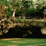
- Dotsero Crater: Colorado’s One Active Volcano
- How Dangerous Is Dotsero?
- What an Eruption Would Look Like Today
- Colorado’s Broader Volcanic Past
- Visiting Dotsero Crater
TLDR
Yes, Colorado has one active volcano: Dotsero Crater, a maar volcano in Eagle County that last erupted roughly 4,200 years ago. The USGS ranks it 82nd on its national volcanic threat assessment — well below high-risk peaks like Mount St. Helens or Kilauea. It’s not expected to erupt anytime soon, but it’s not classified as extinct either. Colorado also has extensive remnants of past volcanic activity — the San Juan Volcanic Field, Hahns Peak, the Spanish Peaks — but none of those are considered active.
What “Active” Actually Means
The word “active” gets thrown around loosely in popular coverage of volcanoes, and it matters here.
Geologists use three broad classifications:
- Active: Has erupted within the last 10,000 years (the Holocene epoch), or shows current signs of unrest like seismicity, gas emissions, or ground deformation.
- Dormant: No recent eruption, but not geologically “dead” — could reawaken given the right conditions.
- Extinct: No eruption in recorded geological history and no plausible pathway to future activity.
The 10,000-year cutoff isn’t arbitrary. It marks the boundary of the current interglacial period, and it’s the timescale over which tectonic and magmatic processes can realistically persist. A volcano that erupted 9,000 years ago has plumbing that could still be warm.
By that standard, Dotsero Crater qualifies. It erupted around 2,200 BCE — well within the Holocene — which puts it on the USGS monitoring list, even if the risk level is low.
Dotsero Crater: Colorado’s One Active Volcano
Dotsero sits at the confluence of the Colorado and Eagle Rivers, right where I-70 bends through the Glenwood Canyon corridor in Eagle County. If you’ve driven that stretch of highway and noticed a dark, bowl-shaped depression on the north side, that was it.
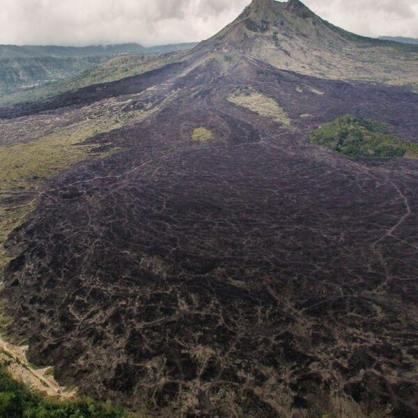
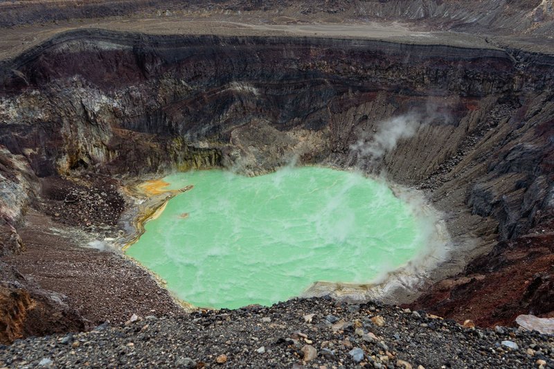
The crater is a maar — a type of volcano formed when rising magma contacts groundwater. The resulting steam explosion punches a wide, shallow crater rather than building a cone. Dotsero’s crater is about 0.4 miles (640 meters) wide and 250 feet (76 meters) deep, which makes it the largest maar in the Rocky Mountain region.
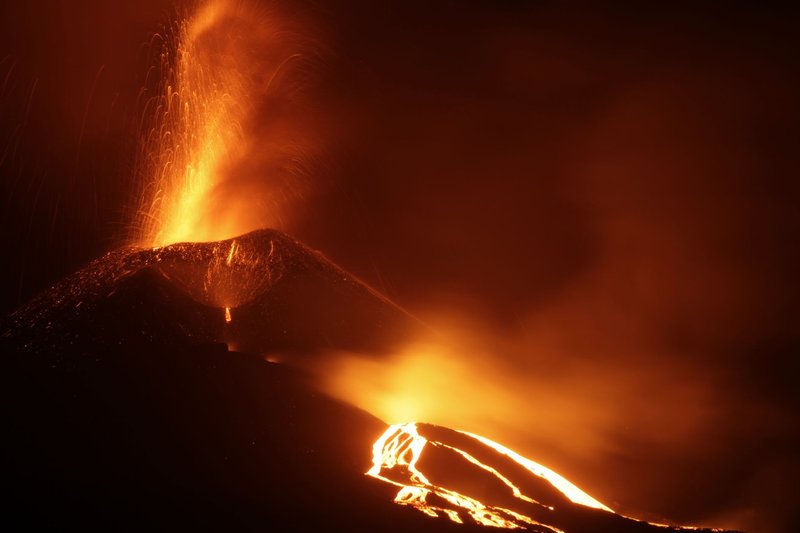
The eruption that formed it, approximately 4,200 years ago, was a phreatomagmatic event: magma hit the water table and the energy release was violent and rapid. It would have produced a column of ash, steam, and pyroclastic material — not a slow lava flow, but a sudden explosive blast. The area around Dotsero still shows basaltic lava flows and cinder deposits from that event.
There’s no ongoing volcanic unrest at Dotsero. No gas venting, no recorded seismic swarms specific to the volcano, no ground uplift measured by GPS monitoring stations. It sits quiet. But 4,200 years is a blink in geologic time, which is why it stays on the active list.
How Dangerous Is Dotsero?
The USGS publishes a National Volcanic Threat Assessment that ranks 161 volcanoes in the United States by two factors: the probability of eruption and the potential consequences if one occurs. Dotsero ranks 82nd.
For context: Mount St. Helens ranks 4th. Kilauea ranks 1st. The volcanoes at the top of the list are either frequently active or sit near large population centers — or both. Dotsero is neither.
Its relatively low ranking reflects a few things:
- No signs of reawakening. There’s no magmatic heat signal, no hydrothermal activity, no unusual seismicity.
- Low eruption frequency. One eruption in 4,200 years is not a busy volcanic system.
- Moderate exposure. Eagle County isn’t densely populated, though I-70 — one of the most critical freight and transit corridors in the American West — passes within a mile of the crater.
The USGS does not consider Dotsero a high-priority monitoring target. It’s assessed but not continuously instrumented the way Yellowstone or the Cascades volcanoes are.
What an Eruption Would Look Like Today
This is the question most coverage skips entirely, and it’s the most interesting one.
If Dotsero erupted again, the style would likely mirror its original eruption: phreatomagmatic, explosive, and short-lived. Not a Hawaii-style lava flow that you could outrun on foot, but a sudden ash column and pyroclastic surge.
The immediate consequences would be local. The crater zone and the Eagle River valley would take the worst of it: ash fallout, possible lahars (volcanic mudflows) down the Colorado River drainage, and the destruction of everything within a few kilometers of the vent.
The larger problem would be I-70. A significant ash event — even modest compared to the 1980 Mount St. Helens eruption, which deposited ash across multiple states — would close Colorado’s main east-west artery. Supply chains for Denver and the Front Range, ski resort access, and cross-country freight would all be disrupted. Ash in jet engines is also a serious aviation hazard; Denver International Airport sits roughly 150 miles downwind depending on wind patterns.
None of this is imminent. But it illustrates why volcanologists track Dotsero at all. The risk isn’t just the crater — it’s the infrastructure density of everything downstream.
Colorado’s Broader Volcanic Past
Dotsero is the punchline to a longer story. Colorado has been geologically restless for tens of millions of years, and the evidence is visible across the state if you know what you’re looking at.
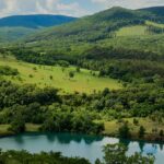
The San Juan Volcanic Field is the most dramatic example. The San Juan Mountains in southwestern Colorado are the eroded remains of a massive volcanic province that was active from roughly 35 to 23 million years ago. The region produced some of the largest volcanic eruptions in North American history — calderas that collapsed after ejecting hundreds of cubic miles of material. The town of Creede sits inside one of those calderas. Lake City sits inside another. The mountains themselves are the remnants of volcanic necks, lava flows, and ash sheets stacked up over millions of years. Nothing here is active, but the scale of what happened is hard to overstate.
Hahns Peak, near Steamboat Springs in northern Colorado, is a Quaternary volcanic feature — meaning it formed within the last 2.6 million years. It’s classified as dormant. The cone is intact and the geology is recent enough to be geomorphically fresh, but there’s no evidence of Holocene activity, so it doesn’t make the active list.
The Spanish Peaks near Walsenburg are another well-known volcanic landmark — a pair of intrusive igneous bodies (laccoliths) that pushed up through sedimentary rock and have since been exposed by erosion. They’re not volcanoes in the eruptive sense; no magma ever broke the surface there. But the radial dike systems extending outward from the peaks are some of the most photographed geological features in the state.
Colorado’s volcanic history spans from the Precambrian to the Holocene. For a full rundown of every known volcanic site in the state — with locations, elevations, and geological notes — the complete list of volcanoes in Colorado covers the breadth of what’s out there. What you see in Dotsero is the tail end of a very long story.
Visiting Dotsero Crater
Dotsero Crater is accessible, and geologically speaking, it’s one of the more approachable volcanic features you can visit in the country. No entrance fee, no permit required, no crowds.
The town of Dotsero sits just off I-70 at Exit 133, about 30 miles east of Glenwood Springs. The crater itself is on private and public land north of the highway, and access varies. The basaltic lava flows east of town, known locally as the “Dotsero lava flow,” are more consistently accessible and give a clear picture of the eruption’s output.
A few practical notes:
- The terrain is rough. Basaltic lava fields have sharp, irregular surfaces — wear sturdy footwear.
- There’s no formal trail system or interpretive signage. This is self-guided geology, not a national park experience.
- Cell service in the Eagle River canyon is unreliable. Download your maps before you go.
- The best light for photography is morning, with the crater walls catching early sun from the east.
If you want context before visiting, the Colorado Geological Survey publishes free geological maps of the area that show the crater, lava flows, and surrounding stratigraphy in detail.
The Bigger Picture
Colorado doesn’t rank among the country’s volcanic hotspots — that distinction goes to the Pacific Northwest, Alaska, and Hawaii. But Dotsero is a genuine active volcano by every standard definition, and its position beside a major interstate makes it worth understanding beyond the “it’s probably fine” reassurance that most coverage offers.
The San Juan Volcanic Field, the calderas under mountain towns, the Quaternary cones scattered across the Rockies — they’re all reminders that the landscape was shaped by processes that haven’t fully stopped. They’ve just slowed down to a timescale that makes them easy to ignore.
Dotsero last erupted when humans in Egypt were still building the pyramids. In geological terms, that’s recent.