Here’s the short version: Saint Vincent and the Grenadines has exactly one active volcano, and its name is La Soufrière. At 1,234 metres it’s also the highest point in the country. Everything else volcanic on the island — and there’s plenty — is old, eroded, and asleep.
That single peak has shaped the country more than any politician. It killed roughly 1,600 people in 1902, emptied the northern third of the island in 1979, and forced 20,000 people from their homes in 2021. If you want to understand why Saint Vincent looks the way it does — black-sand beaches, absurdly fertile soil, a population crammed into the south — La Soufrière is the answer.
Table of Contents
- The short answer
- Meet La Soufrière
- Eruption history at a glance
- The 1902 catastrophe
- 1979 and 2021: the modern eruptions
- The dormant peaks nobody talks about
- Why Saint Vincent is volcanic at all
- Is La Soufrière active right now?
- Hiking La Soufrière
The short answer {#the-short-answer}
One active volcano: La Soufrière, in the north of the main island of Saint Vincent. The Grenadines — the chain of smaller islands trailing south toward Grenada — have no active volcanoes of their own, though they sit on the same volcanic arc and a few are built on ancient volcanic rock.
“La Soufrière” comes from the French for sulphur outlet, which is why the Caribbean has several volcanoes with the same name. Saint Vincent’s is the one that has erupted five times since record-keeping began in 1718, most recently in April 2021.
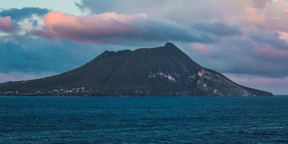
Meet La Soufrière {#meet-la-soufriere}
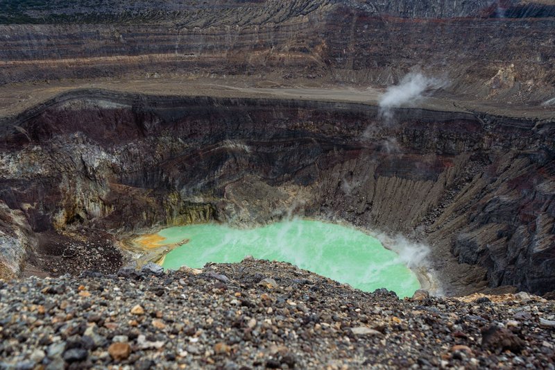
La Soufrière is a stratovolcano — the classic steep-sided cone built from alternating layers of lava and ash. It dominates the northern end of Saint Vincent, and on a clear day you can see it from most of the island. The summit holds a crater roughly 1.6 kilometres across, and depending on which decade you visit, that crater has held a lava dome, a steaming new cone, or a crater lake.
The volcano is young in geological terms, and it’s the most active of a line of volcanic centres running down the island’s spine. That youth is exactly why it’s dangerous: it hasn’t had time to wear down, its plumbing is still connected to the magma below, and its slopes are steep enough that an eruption sends material racing toward the coast in minutes.
The northern flanks are also the most fertile land in the country, which is the cruel bargain of living near a volcano. The same ash that buries villages breaks down into mineral-rich soil that grows the best arrowroot, bananas, and breadfruit on the island. People keep moving back because the farming is worth it.
Eruption history at a glance {#eruption-history}
Five significant eruptions have been documented. The Smithsonian’s Global Volcanism Program tracks each one, and the pattern is sobering — La Soufrière erupts roughly every 60 to 90 years, and the violent ones cluster early in the 20th century.
| Year | VEI | Deaths | What happened |
|---|---|---|---|
| 1718 | 3 | Unknown | First recorded eruption; explosive |
| 1812 | 4 | ~56–80 | Heavy ashfall reached Barbados, 160 km east |
| 1902 | 4 | ~1,600 | Deadliest; pyroclastic flows swept the north |
| 1971–72 | — | 0 | Quiet lava dome growth in the crater lake |
| 1979 | 3 | 0 | Explosive; full evacuation, no fatalities |
| 2020–21 | 4 | 0 | Effusive then explosive; ~20,000 evacuated |
VEI is the Volcanic Explosivity Index, a 0-to-8 scale where each step up means roughly ten times more material ejected. A VEI 4 like 1902 or 2021 is a serious eruption — the kind that drops ash on neighbouring islands.
The 1902 catastrophe {#the-1902-catastrophe}
On 7 May 1902, La Soufrière erupted with a violence the island hadn’t seen in living memory. Pyroclastic flows — superheated avalanches of gas, ash, and rock moving faster than a car — poured down the northern and eastern slopes and reached the sea. The death toll was around 1,600, concentrated among the Carib and estate communities in the north who had nowhere to run.
The timing is one of volcanology’s eerie footnotes. La Soufrière’s main blast came less than a day before Mont Pelée on Martinique, 150 kilometres north, destroyed the town of Saint-Pierre and killed roughly 30,000 people on 8 May. Two Caribbean volcanoes on the same arc, erupting within 24 hours of each other. Scientists still debate whether that was pure coincidence or a sign of stress moving along the plate boundary, and the consensus leans toward coincidence — the two systems aren’t directly connected — but the synchronicity has haunted the region ever since.
The 1902 eruption is why monitoring exists in the eastern Caribbean at all. It was a wake-up call that these islands sit on live machinery.
1979 and 2021: the modern eruptions {#modern-eruptions}
The story of the last 50 years is mostly a story of not dying — which, for a volcano this size, counts as a triumph of preparation.
1979 began on Friday the 13th of April with an explosive eruption that built a new lava dome in the summit crater. The difference from 1902 was forecasting. Authorities evacuated roughly 20,000 people from the northern danger zone before the worst of it. Nobody died. The eruption ran for several months and reshaped the crater, but the human cost was close to zero.
2020–21 followed the same script with a darker middle act. The volcano started quietly in late December 2020, oozing a new lava dome — an effusive phase that researchers from the University of the West Indies watched closely. Then on 9 April 2021 it switched modes and went explosive, throwing an ash column more than eight kilometres into the sky and dropping ash across the island and as far as Barbados. Around 20,000 people in the red zone were evacuated, many to cruise ships and shelters in the south. Water supplies were contaminated, crops were buried, and the recovery took years. But again, the death toll from the eruption itself was effectively nil. The Pan American Health Organization coordinated the regional emergency response.
The lesson across both modern eruptions is blunt: La Soufrière hasn’t gotten gentler. The evacuations got smarter.
The dormant peaks nobody talks about {#dormant-peaks}
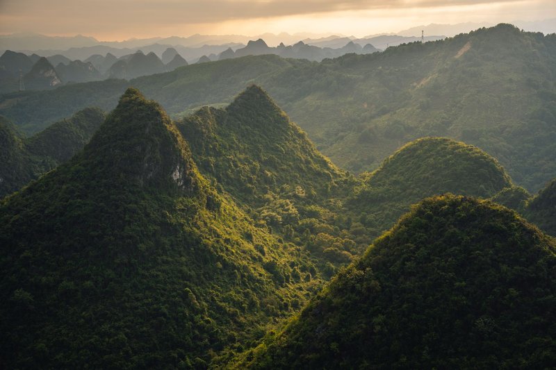
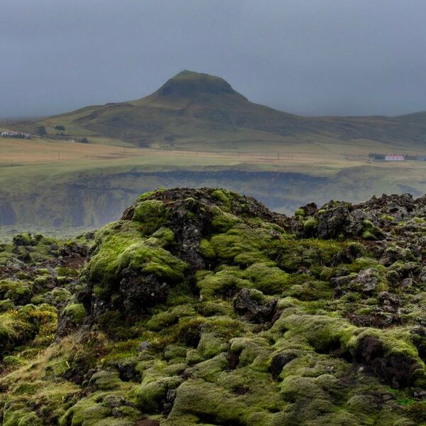
La Soufrière hogs the attention, but it’s only the youngest member of a volcanic chain that runs the length of Saint Vincent. Move south from the active crater and the volcanoes get progressively older, more eroded, and more thoroughly asleep. These are the green, jungle-covered peaks that travel brochures crop into the background.
Grand Bonhomme is the tallest of the dormant lot, a deeply weathered massif in the island’s central highlands and the second-highest summit in the country after La Soufrière itself. Richmond Peak and Mount Brisbane sit along the same backbone — old volcanic centres worn into ridgelines and ravines over hundreds of thousands of years.
None of these have erupted in human history, and there’s no evidence they’re going to. They’ve been eroding far longer than La Soufrière has existed, their magma chambers long cooled. What they offer instead is the island’s interior rainforest: the central ridge catches the trade winds, wrings out the rain, and feeds the rivers that water the south. The dead volcanoes built the watershed that makes Saint Vincent livable.
Why Saint Vincent is volcanic at all {#why-volcanic}
The plain-English version: the Atlantic seafloor is sliding underneath the Caribbean.
Saint Vincent sits on the Lesser Antilles volcanic arc, the curved chain of islands that runs from the Virgin Islands down to Grenada. Along the eastern edge of this arc, the dense oceanic crust of the North and South American plates is being forced down beneath the lighter Caribbean Plate — a process geologists call subduction. As that descending slab sinks deeper, it heats up and releases water into the rock above it. The water lowers the melting point of the overlying mantle, which begins to melt and rise as magma.
That magma is what builds the islands. Every volcanic peak in the Lesser Antilles — La Soufrière on Saint Vincent, Mont Pelée on Martinique, the Soufrière Hills on Montserrat — is the surface expression of the same slow collision happening 100-plus kilometres down. The U.S. Geological Survey explains the mechanics of subduction-zone volcanism in detail, and the Lesser Antilles is a textbook case.
Subduction zones produce exactly the kind of volcano La Soufrière is: sticky, gas-rich magma that doesn’t flow easily, builds pressure, and erupts explosively. That’s the geological reason the island’s eruptions are violent rather than the gentle lava fountains you see in Hawaii.
Is La Soufrière active right now? {#is-it-active-now}
As of 2026, La Soufrière is quiet but actively monitored. After the 2021 eruption ended, the alert level was gradually lowered as seismic activity, ground deformation, and gas emissions settled back to background. There’s no eruption in progress and no imminent warning.
“Quiet” is not the same as “extinct,” and nobody at the monitoring agencies treats it that way. The volcano is watched around the clock by the UWI Seismic Research Centre at the University of the West Indies, which runs the seismometers, GPS stations, and gas sensors on the volcano and publishes the official alert level. If you’re planning a trip or just want the current status, that’s the authoritative source — not a travel blog, and not the date on this page.
The honest framing: a volcano that erupted in 1718, 1812, 1902, 1979, and 2021 will erupt again. The 60-to-90-year rhythm suggests the next event is more likely decades away than years, but volcanoes don’t keep appointments. What’s certain is that it will be forecast far better than 1902 was.
Hiking La Soufrière {#hiking}
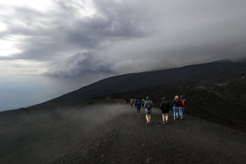
This is the part the encyclopedias skip. When La Soufrière isn’t erupting, climbing it is the best day hike in the country — and reaching a 1,234-metre active crater rim is a genuinely rare experience.
There are two main approaches. The windward (eastern) trail starts near Rabacca on the Atlantic side and is the more popular route: it begins through old plantation land and bamboo before climbing into stunted cloud forest, and runs roughly three to four hours up. The leeward (western) trail from the Caribbean side is longer, steeper, and quieter, better suited to hikers who want the harder day. Both top out at the crater rim, where on a clear morning you can look down into the crater and out across the island to the Grenadines.
A few honest logistics:
- Difficulty is moderate to strenuous. It’s not technical, but it’s a long, sustained climb that’s frequently muddy and slippery near the top. Decent shoes matter.
- Go early. The summit clouds over by mid-morning most days, and a socked-in crater is a wasted climb. Pre-dawn starts are normal.
- Take a guide for the leeward route. The western trail is poorly marked in places, and a local guide is cheap insurance.
- Check the alert level first. Access closes when the volcano is restless. The post-2021 trail and crater changed shape, so conditions differ from older trip reports.
It’s a workout, the weather is unreliable, and the reward is standing on the edge of the thing that made the entire island. Worth the early alarm.