
New Mexico’s biggest natural resource, by dollars, is oil. The state is the second-largest crude producer in the country, behind only Texas, and most of that crude comes from one corner of the southeast. But oil is only the top line. Under and above the state you’ll also find most of America’s potash, a century-old copper district, the leftovers of a uranium boom, a few rivers that millions of people depend on, and some of the best wind and sun in the lower 48.
This guide goes through the natural resources in New Mexico one category at a time, with the numbers that matter, the places they come from, and what each one costs the people who live nearby.
Contents
- Natural Resources in New Mexico at a Glance
- A Quick Tour of the Map
- Oil and Natural Gas
- Coal
- Uranium
- Copper and Other Metals
- Potash and Industrial Minerals
- Water
- Wind, Solar and Geothermal
- Land and Scenery
- What’s Changing Now
Natural Resources in New Mexico at a Glance
| Resource | Main region | Status today |
|---|---|---|
| Oil | Southeast (Permian Basin) | Booming; second in the US |
| Natural gas | Southeast and northwest (San Juan Basin) | Major producer, mostly alongside oil |
| Coal | Northwest (San Juan Basin) | Shrinking as plants close |
| Uranium | Northwest (Grants district) | No active mines; cleanup ongoing |
| Copper | Southwest (Grant County) | Producing at two large open-pit mines |
| Potash | Southeast (near Carlsbad) | Supplies most US production |
| Perlite, gypsum, other minerals | North and south | Steady industrial output |
| Water | Rio Grande, Pecos, San Juan; aquifers | Scarce and tightly allocated |
| Wind | Eastern plains, central highlands | Fast growing, large new projects |
| Solar | Statewide, strongest in the south | Fast growing |
| Geothermal | Southwest and the Jemez Mountains | Small, with room to expand |
| Land and scenery | Statewide | Drives tourism, ranching and recreation |
A Quick Tour of the Map
New Mexico’s resources cluster in a few distinct zones.
- Southeast: The Delaware Basin, the New Mexico side of the larger Permian Basin, holds the oil. The potash belt sits just north of Carlsbad, on top of the same ancient salt beds.
- Northwest: The San Juan Basin produces natural gas, coalbed methane and coal. The Grants Mineral Belt, to its southeast, holds the uranium.
- Southwest: Copper country, centered on the Silver City area, with the rough, dry Gila region around it.
- North-central: The Rio Grande valley carries most of the state’s surface water and population. The Jemez volcanic field adds geothermal heat.
- East: The High Plains sit on the Ogallala aquifer and catch the wind that now spins the state’s biggest turbine farms.
The New Mexico Bureau of Geology and Mineral Resources groups the state’s holdings into energy, minerals, water and landscapes, which is a handy way to think about them. We’ll follow roughly the same split.
Oil and Natural Gas
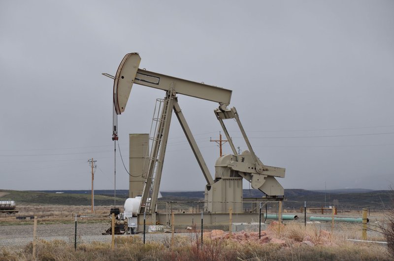
Oil is the resource that moves the state budget. Eddy and Lea counties, in the southeast, sit on the Delaware Basin, one of the richest oil-bearing formations in North America. New Mexico has pumped close to 2 million barrels a day in recent years, roughly an eighth of all US crude, according to the US Energy Information Administration. It passed every state except Texas in the early 2020s and hasn’t given the spot back.
Natural gas has two homes. In the southeast it comes up as a byproduct of oil drilling. In the northwest, the San Juan Basin is a much older gas field, and its Fruitland coal beds make it one of the largest coalbed methane fields in the country.
The money is the point. Royalties and taxes on oil and gas pay for a large share of the state’s general fund, often more than a third in boom years. State Land Office royalties also feed the permanent funds that help pay for public schools. The Jicarilla Apache Nation, whose land sits on the San Juan Basin, earns significant revenue from gas on its own territory.
That dependence cuts both ways. When prices fall, state revenue falls with them. Wells also leak methane, and flaring wastes gas that could be sold, which is why New Mexico adopted some of the stricter methane rules in the country. And the Permian produces several barrels of salty “produced water” for every barrel of oil, which has to be disposed of or treated somewhere. We’ll come back to that in the water section.
Coal
New Mexico’s coal comes from the San Juan Basin, mostly the same northwest corner as the gas. Like oil and gas, it is a non-renewable resource. It was never as large an industry as oil, but it fed the power plants that lit much of the Southwest.
That chapter is closing. The San Juan Generating Station near Farmington shut down in 2022. The Four Corners Power Plant, which burns coal from the nearby Navajo Mine, has been slated to stop by 2031. Both sit on or beside the Navajo Nation, and both employed Navajo workers, so the closures hit local jobs and tribal revenue as well as the electric grid. The state’s 2019 Energy Transition Act set up funding for displaced workers and the affected communities.
Uranium
If you’ve seen the Grants area on a map, you’ve seen the reason for the nickname “Uranium Capital of the World” it once carried. Starting in the 1950s, the Grants Mineral Belt, a band of sandstone stretching from the Ambrosia Lake area toward Mount Taylor, supplied fuel for the Cold War arsenal and then for nuclear power plants. New Mexico was the nation’s leading uranium producer for decades.
No uranium mines operate in the state today. What’s left is the cleanup.
- Jackpile-Paguate Mine, on Laguna Pueblo, was among the largest open-pit uranium mines in the world in the 1970s. It was reclaimed in the 1990s and later added to the federal Superfund list.
- Church Rock saw a tailings dam fail in July 1979, months after Three Mile Island, releasing roughly 94 million gallons of radioactive liquid and 1,100 tons of solid waste into the Puerco River. By volume, it ranks among the largest radioactive releases in US history, and it got a fraction of the attention.
- Across the Navajo Nation, which stretches over parts of New Mexico, Arizona and Utah, hundreds of abandoned uranium mines remain. The EPA’s Navajo Nation uranium cleanup program tracks the work, which has been going on for decades.
Companies have proposed reopening some mines as uranium prices recovered, with Mount Taylor drawing the most debate. The mountain is sacred to the Navajo, Acoma, Zuni, Laguna and Hopi, and the history here is the reason many residents want cleanup finished before anything new opens.
Copper and Other Metals
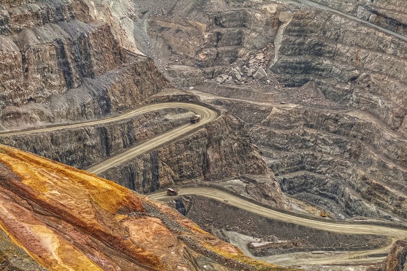
The Santa Rita area near Silver City has been mined for copper since before New Mexico was a state. The Chino mine, a huge open pit that has operated since 1910, and the nearby Tyrone mine, both operated by Freeport-McMoRan, make Grant County the center of the state’s metal output. New Mexico typically ranks among the top five copper-producing states, though Arizona is far ahead of everyone.
Copper matters more every year because wiring, motors and batteries all need it. Mining it also moves enormous amounts of rock and uses a lot of water in a place that doesn’t have much.
Other metals have shorter stories:
- Molybdenum came from the Questa mine in Taos County until it closed. The site is now a Superfund cleanup.
- Gold and silver built towns like Mogollon and Kelly, and left behind a landscape of ghost towns.
- Turquoise from the Cerrillos Hills near Santa Fe was mined by Pueblo people long before Europeans arrived, and traded across the continent.
- Rare earth elements show up in places like the Gallinas Mountains in Lincoln County. Geologists are surveying New Mexico for the critical minerals that batteries and electronics rely on, though none of these deposits has become a major mine.
Potash and Industrial Minerals
Potash is New Mexico’s quiet heavyweight. The name comes from “pot ashes,” the old way of making potassium salts, and the modern version is a fertilizer ingredient. Most of what the US produces comes from beds near Carlsbad, according to the US Geological Survey. Two companies, Mosaic and Intrepid Potash, run the operations. The area also produces langbeinite, a potassium-magnesium-sulfate mineral used on crops that can’t tolerate chloride, which is mined commercially only in New Mexico in the US.
The potash lives in the Salado Formation, a thick layer of salt left behind when a shallow Permian sea evaporated about 250 million years ago. The same salt now holds the Waste Isolation Pilot Plant, the federal repository for transuranic waste, roughly 2,150 feet underground. The salt behaves like a slow, self-sealing material, so it can close around buried waste.
The potash and oil industries share the same land, and they don’t always get along. Drilling through potash beds can ruin them, which led to long-running rules that decide who gets to operate where.
A few more minerals round out the list:
- Perlite, a volcanic glass that expands like popcorn when heated, comes from deposits in northern New Mexico and goes into insulation, potting soil and filters. The state is the nation’s top producer.
- Gypsum forms the white dunes at White Sands, the largest gypsum dune field on Earth.
- Pumice, zeolites, humate, sand and gravel are dug in quantity. They’re not glamorous, but every road and building needs them.
Water
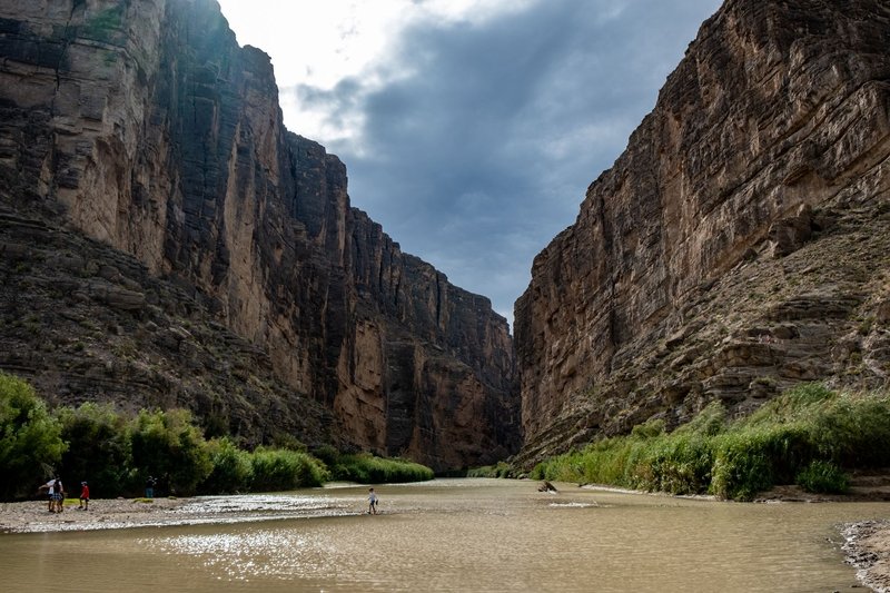
Water is the resource New Mexico has the least of and argues about the most.
Surface water. The Rio Grande runs the length of the state, and Albuquerque, Santa Fe and Las Cruces all depend on it directly or indirectly. The Pecos, San Juan and Canadian rivers carry the rest. Most of this water is already spoken for. The 1938 Rio Grande Compact divides the river among Colorado, New Mexico and Texas, and Elephant Butte Reservoir stores the supply that southern farmers use. The San Juan-Chama Project even pipes water under the Continental Divide from a San Juan River tributary into the Rio Grande basin, which is how Albuquerque eventually stopped relying only on its own aquifer.
Groundwater. Under the eastern plains, the Ogallala aquifer supports farms and dairies around Clovis and Portales, but it recharges slowly and the water table has dropped in many areas. Further south, the Roswell Artesian Basin was once so full of pressurized water that wells flowed on their own. Pumping has reduced that sharply.
Who uses it. Irrigated agriculture takes roughly three-quarters of the water withdrawn in the state. Cities, industry and energy use the rest. Oil and gas needs water for drilling and fracking, and then produces more of it than it uses, though that water is too salty for most purposes. How much of it can be treated and reused is an open question that both regulators and industry are working through.
Climate matters too. Snowpack in the southern Rockies feeds the Rio Grande, and the river now swings between flood years and years when stretches near Albuquerque go dry.
Wind, Solar and Geothermal
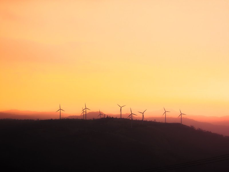
New Mexico’s best-known energy story is changing, and it is part of a broader move toward renewable energy. According to the EIA’s state profile, wind provided about 38% of the state’s electricity in 2023. The turbines cluster on the eastern plains and the central highlands near Clines Corners, where steady winds blow across open ground. SunZia, a roughly 3,500-megawatt wind project in the central part of the state, is paired with a transmission line that sends power to Arizona and California. It has been billed as the largest clean energy project in US history.
Solar potential is even larger. Much of the state gets more than 3,000 hours of sunshine a year, and large solar farms near Albuquerque and in the south have been multiplying. Sandia National Laboratories, based in Albuquerque, has done significant solar research for decades.
Geothermal is the small one. The Lightning Dock field in Hidalgo County, in the state’s southwestern corner, runs a geothermal plant and heats greenhouses. The Jemez volcanic field, home of the Valles Caldera, has hot rock beneath it that researchers have long studied. Neither is likely to match wind or solar soon, but both show the heat exists.
Land and Scenery
Some of New Mexico’s most valuable assets don’t get dug up. The state land base is about a third federal, and the State Land Office manages roughly 9 million surface acres and 13 million acres of mineral rights, leasing them for grazing, oil, solar and wind.
Scenery brings in money too. Carlsbad Caverns, White Sands, Bandelier and the Gila Wilderness draw visitors by the million. The Gila, designated in 1924, was the first wilderness area in the world to receive that protection. Outdoor recreation and tourism support tens of thousands of jobs.
Agriculture still shapes the map. New Mexico is among the leading pecan producers in the country, and the Hatch Valley is known for its chile. Ranching occupies most of the open land, and dairies in the east and south have made the state a major milk producer.
Land use can pit one value against another. Chaco Culture National Historical Park, a World Heritage Site, sits inside the San Juan Basin gas fields. In 2023 the Interior Department blocked new federal oil and gas leasing within a 10-mile radius for 20 years, after Pueblo and Navajo leaders raised concerns about the cultural landscape.
What’s Changing Now
Three shifts are rewriting New Mexico’s resource story at the same time.
- Oil and gas dominate, but the state is trying to diversify. Revenue from the Permian funds new programs, and lawmakers have been building permanent funds to protect against the next price crash.
- Power generation is turning clean. The Energy Transition Act requires investor-owned utilities to reach 100% carbon-free electricity by 2045. Coal plants are closing, and wind and solar are filling the gap.
- Water is becoming the limiting factor. Every other resource, from copper mining to hydrogen production to new subdivisions, depends on it. How the state allocates, treats and reuses water, including produced water from oil fields, will decide how much growth is possible.
For a state whose economy has always been built on what lies underground, the next chapter depends more on what falls from the sky, and how well it’s shared.