You came here for examples, so here they are: the Tibetan Plateau, the Altiplano, the Colorado Plateau, the Deccan, the Columbia Plateau, and the Antarctic Ice Sheet. Those are the six that show up on almost every list. This post gives you those, plus a handful of lesser-cited ones, the actual numbers behind them, and a table you can copy straight into your notes.
A plateau is just an elevated area of mostly flat land that rises sharply above its surroundings on at least one side. Geographers sort them by how they got pushed up. That classification is the useful part, because once you know the type, you can predict what the place looks like and why it’s there.
Table of Contents
- Quick comparison table
- Intermontane plateaus
- Volcanic plateaus
- Piedmont plateaus
- Continental plateaus
- Dissected plateaus
- Plateau examples in the United States
- FAQ
- Mini-glossary
Quick comparison table
| Plateau | Country / Region | Approx. area | Average elevation | Type |
|---|---|---|---|---|
| Tibetan Plateau | China, India, Nepal | ~2,500,000 km² | ~4,500 m | Intermontane |
| Antarctic Plateau | Antarctica | ~2,000,000+ km² | ~3,000 m | Continental (ice) |
| Altiplano | Bolivia, Peru, Chile | ~170,000 km² | ~3,750 m | Intermontane |
| Deccan Plateau | India | ~1,900,000 km² | ~600 m | Volcanic |
| Columbia Plateau | USA (OR, WA, ID) | ~160,000 km² | ~750 m | Volcanic |
| Colorado Plateau | USA (CO, UT, AZ, NM) | ~340,000 km² | ~1,800 m | Dissected |
| Ethiopian Highlands | Ethiopia | ~530,000 km² | ~2,000 m | Volcanic |
| Massif Central | France | ~85,000 km² | ~700 m | Volcanic |
| Patagonian Plateau | Argentina | ~770,000 km² | ~500 m | Piedmont |
| Laurentian (Canadian Shield) | Canada | very large | ~300 m | Continental |
Intermontane plateaus
These form between mountain ranges, often when two continental plates collide and the land caught in the middle gets squeezed upward. They’re the highest plateaus on Earth, and there’s a reason for that — they’re built by the same forces that build mountains.
Tibetan Plateau (China, India, Nepal). The big one. It covers roughly 2.5 million square kilometers and sits at an average elevation around 4,500 meters, which is why it’s nicknamed “the Roof of the World.” It formed when the Indian plate slammed into Eurasia, the same collision that raised the Himalayas on its southern rim — the kind of plate-collision process that also produces the world’s great fold mountain ranges. It’s the largest and highest plateau on the planet, and it feeds Asia’s biggest rivers — the Yangtze, the Mekong, the Indus — from its glaciers and snowmelt. NASA’s Earth Observatory has documented how the plateau drives the Asian monsoon, because that much elevated land changes how the whole continent’s air circulates.
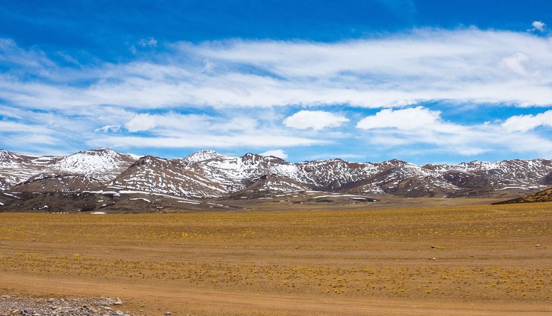
Altiplano (Bolivia, Peru, Chile). A high basin in the central Andes, averaging about 3,750 meters. It holds Lake Titicaca, the highest large navigable lake in the world, and the salt flats of Salar de Uyuni. It got trapped between the western and eastern branches of the Andes as the Nazca plate dove under South America.
Volcanic plateaus
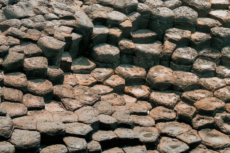
These are built up rather than pushed up. Runny basaltic lava floods out of long fissures over millions of years, layer on layer, until it stacks into a flat tableland. Geologists call these flood basalts.
Deccan Plateau (India). Covers most of peninsular India. The Deccan Traps — the volcanic rock underneath much of it — erupted around 66 million years ago, right around the time the dinosaurs disappeared, and some researchers argue the two events are linked. The U.S. Geological Survey treats the Deccan Traps as a classic large igneous province, one of the biggest volcanic features on land.
Columbia Plateau (USA). Spread across Oregon, Washington, and Idaho. Between roughly 17 and 6 million years ago, basalt floods buried about 160,000 square kilometers in lava up to a few kilometers thick. The Columbia River later cut through it, exposing the layered cliffs you can still see today.
Ethiopian Highlands. Sometimes called the Roof of Africa. Stacked basalt flows linked to the same hotspot activity that’s slowly tearing open the East African Rift.
Piedmont plateaus
A piedmont plateau sits at the foot of a mountain range, bounded by mountains on one side and a plain or sea on the other. The word literally means “foot of the mountain.”
Patagonian Plateau (Argentina). A vast, windswept tableland of arid steppe stepping down from the Andes toward the Atlantic. It’s drier than the mountains that wall it off to the west, because the Andes wring the moisture out of the weather before it ever arrives — the same rain-shadow effect that creates many of the world’s cold desert biomes.
Appalachian Piedmont (USA). The gently rolling belt between the Appalachian Mountains and the Atlantic coastal plain, running from Alabama up through the mid-Atlantic. The “fall line,” where rivers tumble off the harder piedmont rock onto soft coastal sediment, is why cities like Richmond and Raleigh sit where they do.
Continental plateaus
These rise broadly above the surrounding land or sea, usually lifted by large-scale movements of the crust rather than nearby mountains. The most extreme example isn’t even rock.
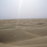
Antarctic Plateau. The interior of East Antarctica is a plateau buried under ice averaging around 3,000 meters thick, with a continental rock base beneath. It includes the South Pole and the coldest naturally recorded spot on Earth — Vostok Station logged −89.2°C in 1983, a figure logged in NOAA’s climate records. It’s arguably the largest plateau by area if you count the ice cap.
Laurentian Plateau (Canadian Shield). An ancient, scraped-flat expanse of some of the oldest exposed rock on the planet, spanning much of eastern and central Canada. Glaciers stripped its soil down to bare bedrock, leaving the lake-dotted landscape that covers a huge chunk of the country.
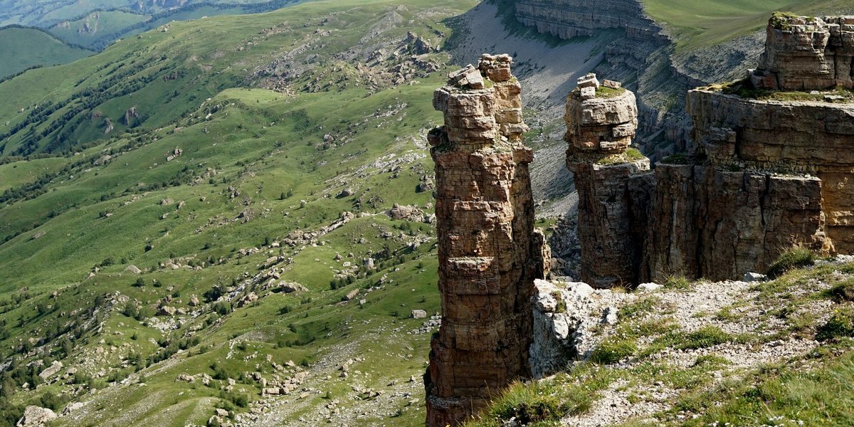
Dissected plateaus
Any plateau, regardless of how it formed, becomes “dissected” once rivers carve deep valleys and canyons into it. The classic case is also one of the most photographed places on Earth.
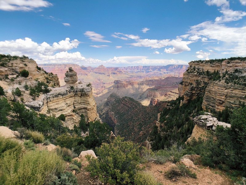
Colorado Plateau (USA). Centered on the Four Corners — Colorado, Utah, Arizona, New Mexico. It was uplifted as a coherent block, then the Colorado River and its tributaries spent millions of years slicing through it. The result is the Grand Canyon, Zion, Bryce, and Canyonlands. The National Park Service notes the Grand Canyon exposes nearly two billion years of rock in its walls, a cross-section you only get because the plateau rose while the river kept cutting down.
Plateau examples in the United States
If you specifically need American examples for an assignment, here are the ones worth naming:
- Colorado Plateau — dissected; home to the Grand Canyon.
- Columbia Plateau — volcanic flood basalt across the Pacific Northwest.
- Colorado Piedmont / Appalachian Piedmont — piedmont tablelands.
- Ozark Plateau — a dissected upland across Missouri and Arkansas.
- Allegheny and Cumberland Plateaus — the western, deeply eroded edge of the Appalachians.
FAQ
What is the largest plateau in the world? The Tibetan Plateau, at roughly 2.5 million square kilometers. If you count the ice-covered interior of Antarctica as a plateau, it rivals or exceeds Tibet in area.
What is the highest plateau in the world? The Tibetan Plateau again, averaging about 4,500 meters above sea level — the reason it’s called the Roof of the World.
What are the main types of plateaus? Five categories cover almost everything: intermontane (between mountains), volcanic (built by lava), piedmont (at a mountain’s foot), continental (broad crustal uplift), and dissected (any plateau cut up by erosion).
Is a plateau the same as a mesa or butte? No — same family, different scale. A plateau is a large flat-topped highland; a mesa is a smaller flat-topped hill broken off from one; a butte is a smaller column left when a mesa erodes further.
Mini-glossary
- Tableland — another word for a plateau; flat on top, steep on the sides.
- Flood basalt — vast sheets of fluid lava that stack into volcanic plateaus.
- Escarpment — the steep slope or cliff at a plateau’s edge.
- Uplift — the tectonic raising of crust that lifts continental and intermontane plateaus.
- Dissection — the carving of a plateau by rivers into valleys and canyons.
The shortcut for any assignment: name one example per type. Tibetan for intermontane, Deccan or Columbia for volcanic, Patagonian for piedmont, Antarctic for continental, Colorado for dissected. Get those five down and you’ve covered the whole map.