Table of Contents
- Quick Facts
- The River Gambia
- Fisheries
- Agricultural Land
- Mineral Resources
- Forests and Wildlife
- Renewable Energy Potential
- Offshore Oil and Gas
- Challenges and Environmental Pressures
- The Big Picture
The Gambia is the smallest country on mainland Africa — a narrow sliver of land wrapped around a single river, roughly 48 kilometers wide at its broadest point. That geography is not a limitation. It’s a defining feature that shapes every major natural resource the country has.
Quick Facts {#quick-facts}
| Resource | Key Detail |
|---|---|
| River Gambia | ~1,130 km total length; navigable for ~480 km in The Gambia |
| Arable land | ~56% of total land area |
| EEZ (maritime zone) | ~15,700 km² |
| Heavy mineral deposits | Titanium, zircon, silica sand along coastline |
| Forest cover | Approx. 43% of land area (declining) |
| Solar irradiance | ~5.5 kWh/m²/day — well above the global average |
The River Gambia {#the-river-gambia}
Every conversation about The Gambia’s natural resources starts here, because the river is the reason the country exists in its current shape. The Gambia River runs east to west across the entire country, and the national borders were essentially drawn around British control of the waterway during the colonial era.
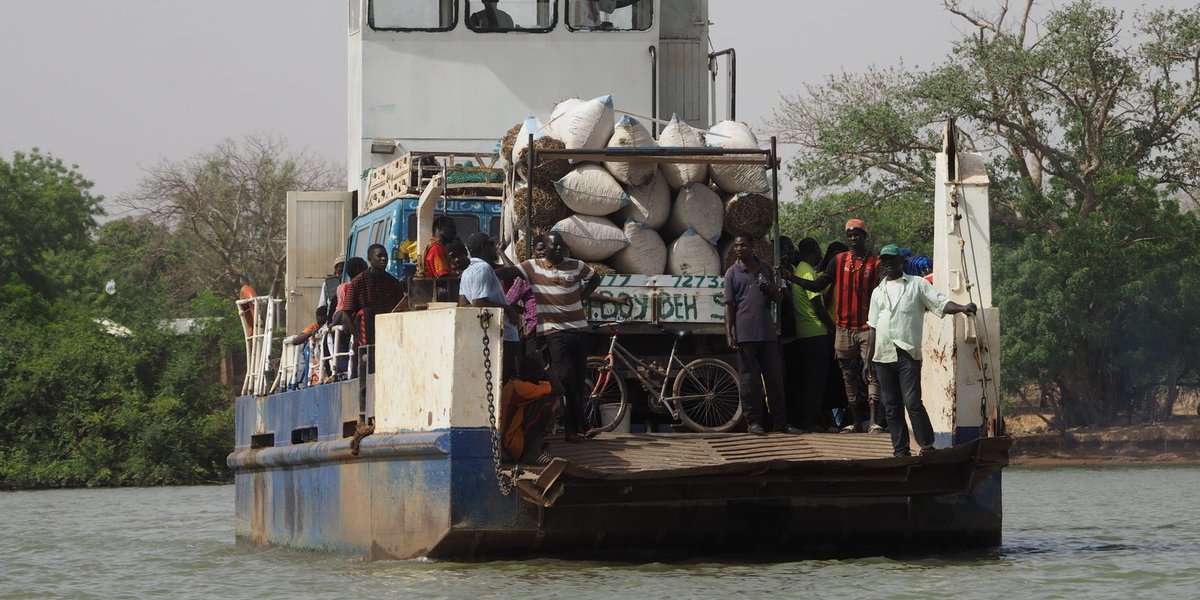
The river does three things for the country simultaneously: it’s a highway, a food source, and a freshwater reserve. For upstream communities, it’s the primary transport route. The tidal reach extends about 150 km inland, which means saltwater intrudes significantly into agricultural zones — a growing problem as sea levels rise.
The river is also navigable for large vessels up to Kuntaur, roughly 250 km upstream, which gives The Gambia a functional inland port system most of its neighbors lack at this scale.
Fisheries {#fisheries}
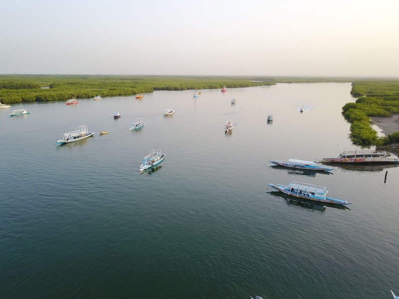
The Gambia’s exclusive economic zone covers about 15,700 km² of Atlantic Ocean — a significant resource for a country of two million people. Fish is the single most important source of animal protein in the national diet, and the sector employs a substantial portion of the coastal population, particularly in processing and artisanal fishing.
Artisanal fisheries dominate the domestic catch. The main commercial species include bonga (a type of shad), barracuda, tilapia from the river, and various marine species along the coast. Bonga alone accounts for a large share of smoked and dried fish consumed domestically.
The commercial fishing sector involves foreign fleets operating under bilateral agreements — particularly from China, Senegal, and European nations. These agreements have been controversial: The Gambia receives licensing fees, but critics argue that industrial trawling depletes stocks faster than they can regenerate, directly competing with artisanal fishers who depend on nearshore catches.
Overfishing is a real and documented threat. According to the FAO, many West African fish stocks are already at or beyond maximum sustainable yield, and The Gambia’s waters are part of that regional pressure.
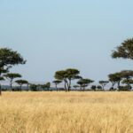
Agricultural Land {#agricultural-land}
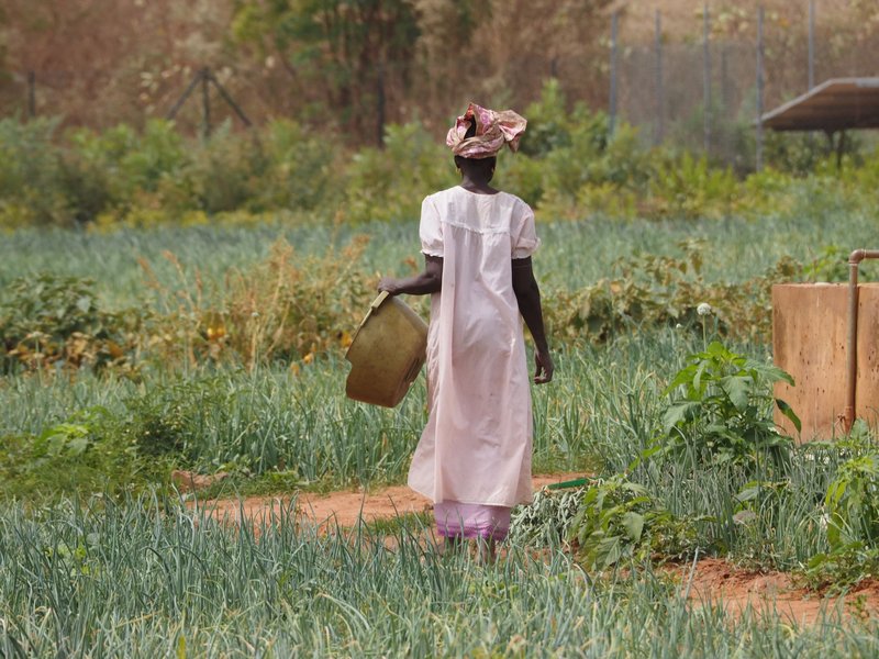
Agriculture accounts for roughly 20–30% of GDP and employs the majority of the rural population, so what the land can grow matters enormously. The Gambia has two distinct growing zones shaped by the river: the river valley lowlands (called banto faros) and the upland areas.
Groundnuts (peanuts) have been the dominant cash crop since the colonial period and remain the country’s primary agricultural export. The Gambia was once called the “Groundnut Republic” — a nickname that captures both the crop’s importance and the vulnerability it creates. When global peanut prices drop, it hurts.
Rice is the country’s staple food crop, cultivated primarily in the lowland swamp zones. Production covers only a fraction of domestic demand, making rice imports a persistent budget pressure.
Other significant crops include millet, sorghum, maize, sesame, and cotton. Horticulture — vegetables and fruits grown for domestic markets and export — has grown considerably in recent years and has been promoted as a diversification strategy, particularly for women farmers.
The agricultural sector’s core vulnerability is the same as the river’s: saltwater intrusion. As saline tidal waters push further inland, productive rice fields convert to salt flats. Some communities that cultivated the same plots for generations have watched them become unworkable within a decade.
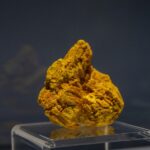
Mineral Resources {#mineral-resources}
The Gambia is not a major mining country — but it does have commercially significant mineral deposits that have been exploited in a limited way and remain largely underdeveloped.
Heavy mineral sands along the Atlantic coastline contain concentrations of ilmenite (titanium ore), zircon, and rutile. These deposits sit in the coastal dune systems and have attracted exploration interest for decades. Titanium is used in everything from aerospace components to white paint pigment; zircon goes into ceramics and refractory materials. The deposits exist — the question has always been whether extraction can be done economically and sustainably at The Gambia’s scale.
Silica sand is present in quantity along the coast and in river sandbars. It’s used in construction and glass manufacturing. Some informal sand extraction from the river already occurs and has become an environmental concern, as it accelerates erosion and damages fish habitats.
Kaolin (white clay) and laterite (iron-rich soil used as a road base) are also found in various parts of the country and have small-scale local uses.
No significant gold or petroleum reserves have been confirmed onshore. The mineral sector’s contribution to GDP remains minimal.
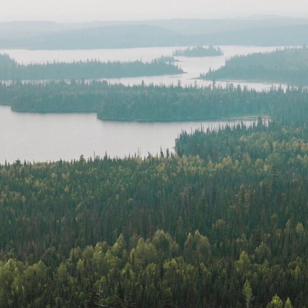
Forests and Wildlife {#forests-and-wildlife}
About 43% of The Gambia’s land area is classified as forest or woodland — a figure that looks healthy on paper but has been declining steadily. The forests include dry deciduous woodland, gallery forest along the river, and mangrove ecosystems at the coast and river mouth.
The mangroves are particularly valuable. They act as nursery habitat for fish, buffer the coastline against erosion, sequester carbon, and filter runoff before it enters the river. The Tanbi Wetland Complex near Banjul — a mix of mangrove, mudflat, and open water — covers about 6,000 hectares and is a Ramsar-listed wetland of international importance.
Protected areas include Abuko Nature Reserve, the country’s oldest, and Kiang West National Park along the south bank of the river. These areas support diverse wildlife including hippos, crocodiles, manatees, and extensive birdlife. The Gambia is a noted birding destination — over 570 species have been recorded, a remarkable number for such a small country. The neighboring region shares some of this ecological richness; for a sense of the broader biodiversity in the area, the endemic species of Senegal offer an instructive regional comparison.
Deforestation pressure comes from fuelwood collection, charcoal production, and agricultural expansion. Wood fuel still provides the majority of household energy for most Gambians outside Banjul.
Renewable Energy Potential {#renewable-energy-potential}
This is where The Gambia’s underdeveloped resource story gets genuinely interesting. The country sits in the Sahel belt, receiving approximately 5.5 kWh of solar radiation per square meter per day — well above what makes solar economically viable. For reference, Germany operates a large solar industry on about 3.0 kWh/m²/day.
Current electricity access in The Gambia is limited and unreliable. Grid infrastructure outside Banjul is weak, and many rural areas depend entirely on diesel generators, which are expensive and polluting. The case for utility-scale solar and off-grid solar home systems is strong on economics alone, before considering the environmental argument.
Wind resources along the Atlantic coast also show commercial potential, though less dramatic than solar.
The International Renewable Energy Agency (IRENA) has identified The Gambia as having significant untapped solar potential. Several donor-funded solar projects have been installed, but grid-scale deployment remains limited. The Gambia has committed under various international frameworks to increase renewable capacity, but financing and grid infrastructure remain constraints.
Offshore Oil and Gas {#offshore-oil-and-gas}
This section exists because most articles covering The Gambia’s natural resources skip it, and it may matter a lot to the country’s economic trajectory.
The Gambia has an offshore sedimentary basin — the same geological structure that has yielded oil in neighboring Senegal. Senegal made major offshore discoveries (the Sangomar field, SNE discovery) in the mid-2010s and began production in 2024. The Gambia’s offshore blocks share the same basin geology.
Exploration licenses have been granted to international oil companies, and seismic surveys have been conducted. No commercial discovery has been confirmed in Gambian waters as of mid-2026, but the exploration activity reflects genuine geological interest — not wishful thinking. A commercial find would transform the country’s fiscal position entirely.
Challenges and Environmental Pressures {#challenges-and-environmental-pressures}
The pattern across all of The Gambia’s natural resources is the same: significant potential, limited exploitation, and growing environmental pressure that threatens the baseline.
Saltwater intrusion is expanding the area of unproductive land as sea levels rise and freshwater flows in the river decline during dry seasons.
Deforestation degrades soil, reduces water retention, and eliminates the forest products that rural communities depend on.
Overfishing by both artisanal and industrial fleets risks depleting stocks that the domestic food supply depends on.
Limited capital and infrastructure mean that mineral deposits, renewable energy potential, and even agricultural land go underused — not because the resources aren’t there, but because the investment and systems to exploit them aren’t in place.
The Gambia also has one of the highest population growth rates in the region, which adds demand pressure across all resource categories simultaneously.
The Big Picture {#the-big-picture}
The natural resources of The Gambia are real, documented, and in some cases substantial for a country this size. The River Gambia is the geographic spine of everything — transport, freshwater, fisheries, irrigation. The coastal zone adds fisheries and mineral deposits. The agricultural land feeds most of the population and underpins the export economy.
What the country lacks is not resources — it’s the capital, infrastructure, and institutional capacity to convert those resources into reliable economic output. Most of what’s here remains at early-stage or subsistence exploitation level.
The variable to watch is offshore energy. If the Gambian basin delivers what the geology suggests is possible, it would be a different conversation — and a different country.