Table of Contents
- TLDR
- Why Scotland Doesn’t Have Active Volcanoes Anymore
- Edinburgh’s Volcanic Trio
- Ardnamurchan: The Volcano You Can Drive Through
- Glen Coe’s Caldera Collapse
- The Cuillins of Skye
- Ben Nevis: Britain’s Highest Peak Is a Collapsed Volcano
- Mull and Its Volcanic Complex
- St Kilda and Rockall: Volcanoes at Sea
- A Timeline of Scotland’s Fire
- Seeing Them for Yourself
TLDR {#tldr}
Search “volcanoes in Scotland” and Google hands you Edinburgh. Fair enough — Arthur’s Seat and Castle Rock are volcanoes, and they happen to sit under a capital city. But Scotland’s volcanic history covers the whole country, from a peninsula in the west you can drive straight through the middle of an old magma chamber, to a caldera in Glen Coe, to islands 40 miles out in the Atlantic that are nothing but the eroded stumps of extinct central volcanoes. None of it is active. The last Scottish eruption happened around 55 million years ago, when the spreading ridge that was trying to split Britain apart gave up and moved west to become Iceland instead.
Scotland has no volcano that has erupted in the last 12,000 years, so none appear on the world volcano map, which plots the ones that have, including those active this week.
| Site | Age | What’s Left |
|---|---|---|
| Glen Coe | ~412 million years | A collapsed caldera, ring fault still visible |
| Ben Nevis | ~400–410 million years | Summit plateau is a caldera floor |
| Arthur’s Seat, Edinburgh | 341–335 million years | Volcanic plug and lava flows |
| Castle Rock, Edinburgh | ~340 million years | Volcanic plug (Castle sits on it) |
| Ardnamurchan | ~60 million years | Ring complex, drivable magma chamber |
| Cuillins, Skye | ~60–61 million years | Gabbro peaks, eroded volcanic roots |
| Mull | 60.5–58 million years | Central complex, caldera remnants |
| St Kilda | ~55–60 million years | Layered gabbro and granite intrusions |
| Rockall | ~55 million years | Eroded igneous centre, mostly underwater |
Why Scotland Doesn’t Have Active Volcanoes Anymore {#why-no-active-volcanoes}
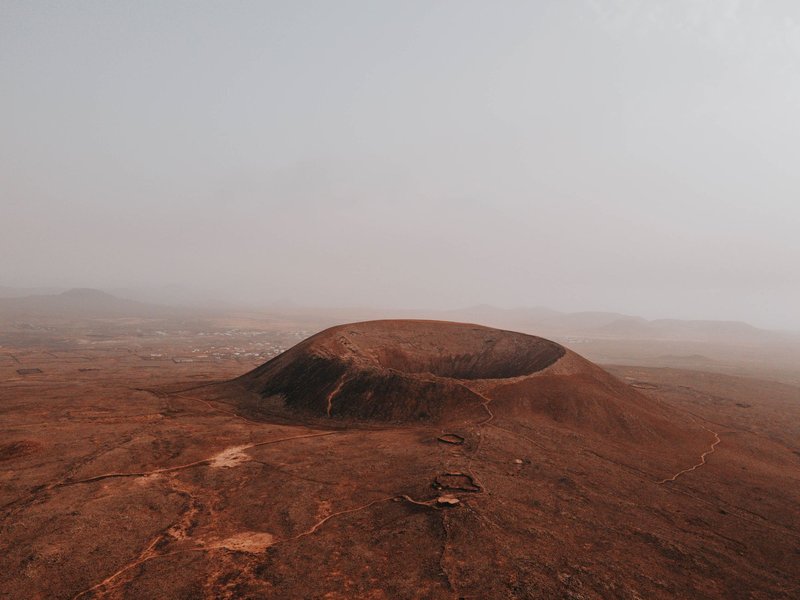
Here’s the part almost nobody answers directly: Scotland isn’t volcanically dead by accident. It’s dead because a rift failed.
Around 60 million years ago, as North America and Greenland began tearing away from Europe, a chain of volcanoes lit up along what’s now Scotland’s west coast — Skye, Ardnamurchan, Mull, St Kilda, Rockall. This was the opening act of the North Atlantic, and for a while it looked like the spreading ridge might carve its new ocean straight through the Scottish mainland.
It didn’t. The Geological Society describes this as a “starter ocean” attempt that managed only a few kilometres of actual spreading before the rift jumped west. The plate boundary that would go on to build Iceland — and keep building it, with genuine eruptions, to this day — abandoned Scotland as a dead branch. No active rift, no fresh magma supply, no more volcanoes. Everything since has been slow erosion, chewing 60-million-year-old rock down to the roots.
That’s the whole answer to “why isn’t Scotland active now”: the crack that would have kept it going closed somewhere else.
Edinburgh’s Volcanic Trio {#edinburgh-trio}
Since it’s what most people are actually picturing, let’s deal with Edinburgh properly. The city sits on the exposed innards of three related volcanic features, all part of the same Carboniferous-age system, dated to roughly 341–335 million years old.
Arthur’s Seat is the main event — a volcanic plug, meaning it’s solidified magma that once sat inside the throat of an active vent. A glacier moving west to east during the last ice age scraped away the softer rock around it and left the tail of debris that now forms the Salisbury Crags side of Holyrood Park. Less than half of the original structure survives, which is actually useful: you’re not looking at the outside of an old volcano, you’re standing inside what used to be its plumbing.
Castle Rock is the same story on a smaller scale — another plug, this one lucky enough to get a castle built on top of it, because a sheer volcanic crag makes for excellent medieval real estate. Calton Hill, the third of the trio, is a lower, less dramatic remnant of the same eruptive phase.
None of this is obscure information; it’s the reason every “volcanoes in Scotland” search result narrows to Edinburgh within one paragraph. The gap is that almost nothing tells you what’s happening the other five hundred miles of the country.
Ardnamurchan: The Volcano You Can Drive Through {#ardnamurchan}
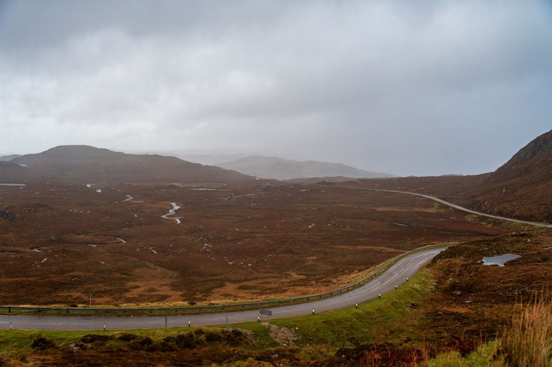
Drive the single-track road from Kilchoan toward Sanna Bay, on the Ardnamurchan peninsula, and the landscape does something strange: it flattens into a low, almost lunar basin, ringed on every side by dark, lumpy hills. You are, quite literally, driving through the magma chamber of a 60-million-year-old volcano.
The ring of hills is what’s left of the ring dykes and cone sheets that fed the eruption — magma injected along circular fracture patterns as the chamber below repeatedly emptied and resettled. The gabbro exposed here, known as the Great Eucrite, is considered the textbook example of a ring dyke anywhere in the world, which is why geology students get bussed in from across Europe to look at a car park’s worth of rock.
Unlike Glen Coe or Ben Nevis, you don’t need specialist eyes to get the scale of it. Stand on high ground near Ben Hiant and the near-complete ring of hills reads as exactly what it is: the footprint of something enormous that isn’t there anymore.
Glen Coe’s Caldera Collapse {#glen-coe}
Glen Coe is older than everything on the west coast chain by a wide margin — its volcano erupted around 412 million years ago, during the Silurian, more than 350 million years before Ardnamurchan existed.
What makes it geologically famous isn’t the eruption, it’s the collapse. As the magma chamber beneath the volcano emptied, the roof gave way in pieces along a ring-shaped fault system, dropping a chunk of the surface down into a caldera. Glen Coe is the site where geologists first recognized and described this kind of “cauldron subsidence” in ancient rock — it’s the type example, the one every textbook since has referenced. Crustal stretching over the following few hundred million years pulled the original caldera out to roughly 13 by 8 kilometres, which is most of what you’re driving through on the A82 today.
The eruption itself wasn’t a single blast. Current estimates put the whole sequence — build-up, eruptions, collapse — at somewhere between one and two million years, which sounds long until you remember the mountain has been sitting there since.
The Cuillins of Skye {#cuillins}
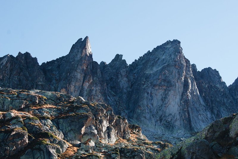
The Black Cuillin ridge — the serrated, scramble-only skyline that makes Skye look like nowhere else in Britain — isn’t a mountain range in the usual sense. It’s gabbro: dark, coarse, iron-and-magnesium-rich rock that cooled slowly inside a magma chamber roughly 60 to 61 million years ago, during the same Paleocene pulse that built Ardnamurchan and Mull.
Most mountain ranges get their shape from continental collision, plates crumpling against each other over tens of millions of years. The Cuillins got theirs from erosion working the opposite way — stripping softer rock away from an intrusive igneous mass until only the hardest core was left standing. That’s why the ridge is so jagged and unforgiving to walk: gabbro doesn’t erode into gentle slopes, it fractures into blades.
The Cuillins were one of the main eruptive centres of what’s now called the North Atlantic Igneous Province, the same rifting event responsible for most of the volcanic sites on this list.
Ben Nevis: Britain’s Highest Peak Is a Collapsed Volcano {#ben-nevis}
Britain’s tallest mountain owes its height to a volcanic accident. Around 400–410 million years ago, the summit area of an ancient Devonian volcano collapsed nearly 600 metres straight down into its own molten granite chamber, in a caldera-forming event similar in mechanism to Glen Coe, just older and on a different scale.
The give-away, geologically, is the mix of rock types visible near the top: pale granite that only forms slowly, kilometres underground, sitting right next to dark basaltic lava that only forms at the surface. Those two rocks shouldn’t be neighbours unless something dropped one down next to the other — which is exactly what the collapse did. Concentric ring dykes from the same event lace the surrounding rock.
The paradox people rarely clock: Ben Nevis is Britain’s highest point today largely because the harder rock at the collapsed core resisted glacial erosion better than the softer schists around it. The mountain is tall because a volcano caved in.
Mull and Its Volcanic Complex {#mull}
Mull’s central volcanic complex was active in a tight window — recent dating puts it at roughly 60.5 to 58 million years, barely 2.5 million years of activity squeezed into the same Paleocene pulse as Ardnamurchan and Skye. Ben More, the island’s highest peak, is built from the lava flows of that period, part of the Mull Lava Group draped over older Mesozoic sedimentary rock.
Mull’s complex shows caldera collapse followed by resurgence — the floor dropping, then silicic magma pushing back up through it — a more layered sequence than the single collapse at Glen Coe or Ben Nevis. It’s a good site to point to if you want to make the argument that Scotland’s volcanic history isn’t one event repeated; each centre behaved a little differently even within the same tens-of-millions-of-years window.
St Kilda and Rockall: Volcanoes at Sea {#st-kilda-rockall}
If you want to make the “Scotland’s volcanoes” story feel properly national rather than mainland-only, St Kilda and Rockall are the pieces that get left out. St Kilda, an archipelago 40 miles west of the Outer Hebrides, is the eroded remnant of a central volcano active around 55 to 60 million years ago — its oldest exposed rock is a banded, layered gabbro intrusion, later cut through by granite as the system evolved.
Rockall is the same story taken to its logical extreme: a volcanic centre from the same North Atlantic Igneous Province, roughly 55 million years old, eroded down to a single granite islet barely 25 metres across that sticks out of the North Atlantic like a full stop. Almost the entire original volcanic edifice is gone or submerged. It’s not a place anyone visits casually, but it’s a genuine answer to “where else in Scotland is there volcanic rock” that essentially never comes up.
A Timeline of Scotland’s Fire {#timeline}
Laid out by age, the pattern becomes obvious: two separate volcanic episodes, separated by roughly 350 million years of quiet.
The first wave — Glen Coe and Ben Nevis — belongs to the Silurian and Devonian, tied to an older phase of mountain-building (the Caledonian orogeny) rather than continental rifting. The second wave — Edinburgh, Ardnamurchan, Skye, Mull, St Kilda, Rockall — belongs to the Paleocene, all within a roughly 10-million-year window between about 65 and 55 million years ago, all driven by the same North Atlantic rifting event.
Nothing has erupted in Scotland since. The country’s had 55 million years to just sit there and erode, which is why every site on this list is a stump, a plug, or a caldera floor rather than anything resembling an intact cone.
Seeing Them for Yourself {#visiting}
Edinburgh’s trio needs no planning: Arthur’s Seat is a walkable hour from the city centre, and the summit path gives you the clearest read on the plug-and-tail shape carved by the old glacier. Go early or late in the day — it’s one of the most climbed hills in Britain and the crowds thin out fast outside midday.
Glen Coe rewards a slow drive rather than a hike if you’re short on time — pull off at the Glencoe Lochan or Study car parks and the ring-fault topography is visible without a single step. For the full caldera picture, the Lochaber Geopark runs guided routes that connect the geology to what you’re actually looking at.
Ardnamurchan is the one built for driving: the Kilchoan-to-Sanna road takes you straight through the ring complex, no hiking boots required, though the short climb up Ben Hiant gets you the aerial view of the ring of hills.
Skye’s Cuillins are the outlier — the Black Cuillin ridge is scrambling-and-climbing terrain, not a casual walk, and several sections require rope experience. If you just want to see the shape of the thing, the view from Elgol or Glen Brittle gives you the full jagged skyline without the exposure.
St Kilda and Rockall are a different category of commitment entirely — St Kilda takes a dedicated boat crossing from Harris or Skye and a fair weather window, and Rockall is realistically not a visitor site at all. Both are worth knowing about even if you never set foot on them; they’re the reason “Scotland’s volcanoes” is a bigger story than one city park.