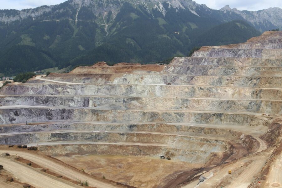
Oregon’s volcanic terrain — from jagged peaks to broad lava plains — has shaped the state’s landscapes, rivers and outdoor routes for millennia. You see the story in roadcuts, forests and alpine ridges where past eruptions left rock, ash and distinctive landforms.
There are 22 Volcanoes in Oregon, ranging from Belknap Crater to Three-Fingered Jack; the list presents each peak with County,Elevation (m),Last eruption — you’ll find below.
Which of these volcanoes are considered active or monitored?
A small number are classified as active or closely watched — for example Mount Hood, the Three Sisters area and Newberry are among those with recent monitoring; the USGS and Oregon state agencies maintain real-time monitoring, hazard maps and alerts to check before planning visits.
How should I plan a safe visit to these volcanoes?
Check current trail and road conditions, respect seasonal closures and posted hazards, carry navigation and emergency gear, and follow Leave No Trace; for site-specific rules and volcanic alerts consult local land managers (USFS/BLM/state parks) and USGS advisories.
Volcanoes in Oregon
| Name | County | Elevation (m) | Last eruption |
|---|---|---|---|
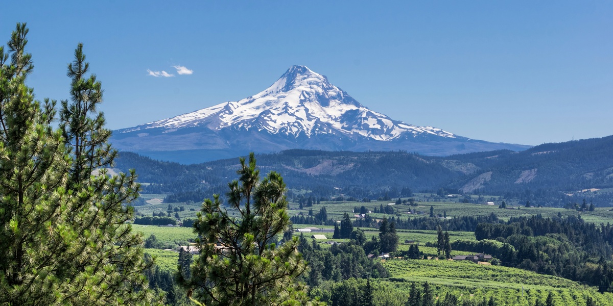
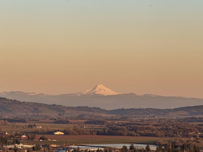
| Mount Hood | Clackamas & Hood River | 3,429 | 1780s (approx) |
| Mount Jefferson | Jefferson & Linn | 3,199 | prehistoric |
| South Sister | Deschutes | 3,157 | prehistoric |
| Middle Sister | Deschutes | 3,063 | prehistoric |
| North Sister | Deschutes | 3,074 | prehistoric |
| Broken Top | Deschutes | 2,797 | prehistoric |
| Mount Bachelor | Deschutes | 2,763 | prehistoric |
| Three-Fingered Jack | Jefferson | 2,326 | prehistoric |
| Mount Thielsen | Douglas & Klamath | 2,796 | prehistoric |
| Diamond Peak | Lane | 2,665 | prehistoric |
| Mount Mazama (Crater Lake) | Klamath | 2,485 | c.5,700 BCE |
| Newberry Volcano | Deschutes | 2,433 | c.1250 CE |
| Paulina Peak | Deschutes | 2,433 | c.1250 CE |
| Big Obsidian Flow | Deschutes | 2,150 | c.1250 CE |
| Belknap Crater | Deschutes | 2,033 | prehistoric |
| Lava Butte | Deschutes | 1,390 | prehistoric |
| Belknap/Deschutes volcanic field (general) | Deschutes | 2,033 | prehistoric |
| Mount McLoughlin | Klamath | 2,894 | prehistoric |
| Pelican Butte | Klamath | 2,284 | prehistoric |
| Mount Bailey | Klamath | 2,164 | prehistoric |
| Fort Rock (tuff ring) | Lake | 1,219 | prehistoric |
| Boring Lava Field | Multnomah & Clackamas | 1,056 | prehistoric |
Images and Descriptions
Mount Hood
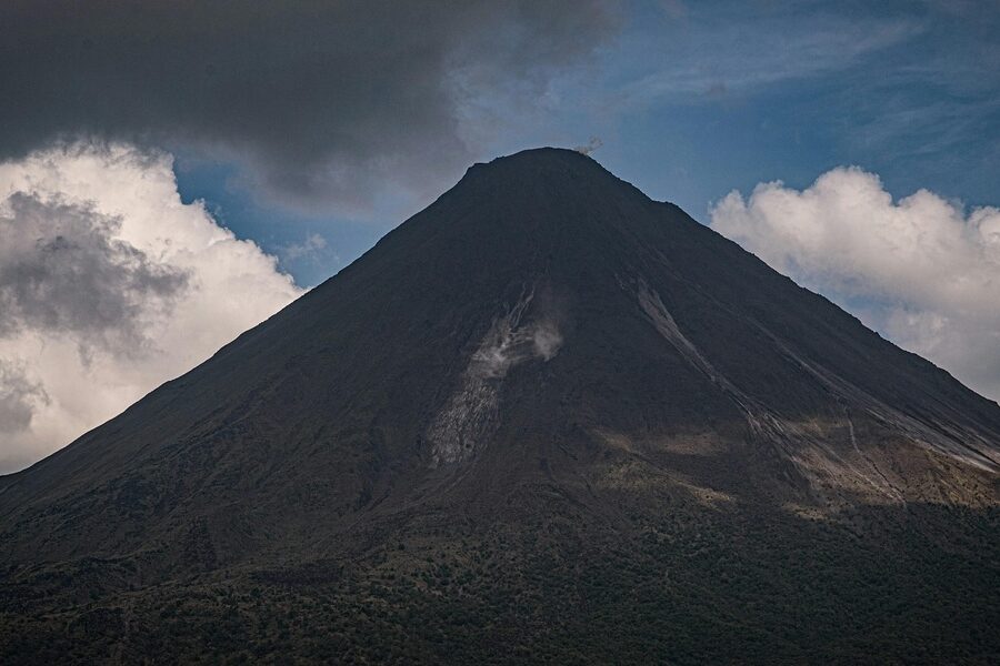
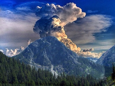
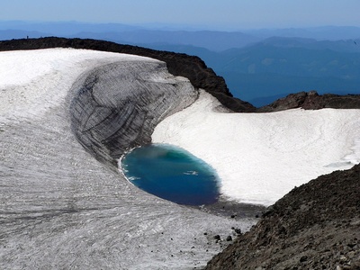
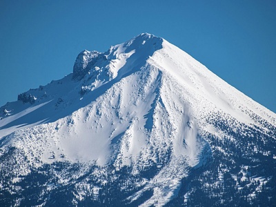
High stratovolcano and Oregon’s tallest peak; active with fumaroles and recent dome growth. Hazards include lahars, ash and pyroclastic flows. Iconic, heavily climbed and accessible via trails and road approaches, major recreation and monitoring focus.
Mount Jefferson
Large stratovolcano in the central Cascades, heavily glaciated and extinct-to-dormant. Main hazards would be ash and rockfall if reactivated. Remote backcountry access with trail approaches, notable for its rugged flanks and volcanic domes.
South Sister
Largest of the Three Sisters cluster, a stratovolcano with recent volcanic domes. Considered potentially active in the Holocene. Hazards include eruptions, lava domes and ash. Popular for mountaineering with trails and technical routes.
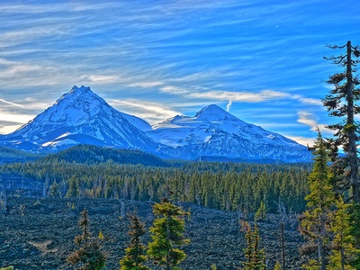
Middle Sister
Eroded stratovolcano in the Three Sisters group; glaciated and inactive in historical time. Hazards low but rockfall and steep terrain are notable. Access via backcountry trails in the Cascade Range Wilderness.
North Sister
Oldest of the Sisters, a heavily eroded volcano of lava and intrusive rock. Dormant for many thousands of years; hazards primarily rockfall and steep alpine terrain. Attracts climbers and hikers to remote high-country routes.

Broken Top
Eroded composite volcano near the Three Sisters, formed of lava domes and andesite flows. Long extinct; notable for dramatic jagged summit and alpine hiking. Hazards limited to steep cliffs and rockfall on rugged trails.
Mount Bachelor
Large shield-to-stratovolcano forming a major ski mountain. Last erupted in the late Pleistocene–Holocene. Hazards include future lava flows but low immediate risk. Highly accessible with ski resort, trails and roads.
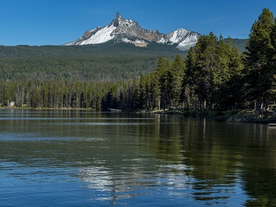
Three-Fingered Jack
Steep volcanic plug remnant of an eroded stratovolcano; jagged spire and cliffs. Long inactive; hazards limited to rockfall and difficult climbing. Remote hiking and scrambling access in Willamette & Deschutes National Forests.
Mount Thielsen
Sharp, horn-like extinct volcano carved by glaciation; once a stratovolcano. Low volcanic risk today; alpine hazards include steep technical routes and weather. Scenic, remote climbs with challenging access.
Diamond Peak
Shield-like stratovolcano in the central Cascades; heavily forested flanks and alpine summit. Dormant for many thousands of years. Notable for panoramic views; reached by backcountry trails in Siuslaw and Willamette National Forests.
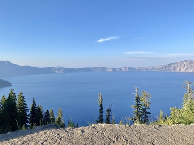
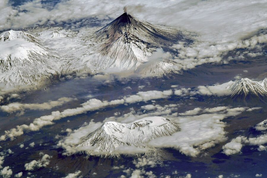
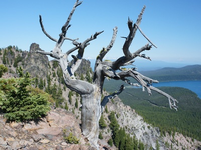
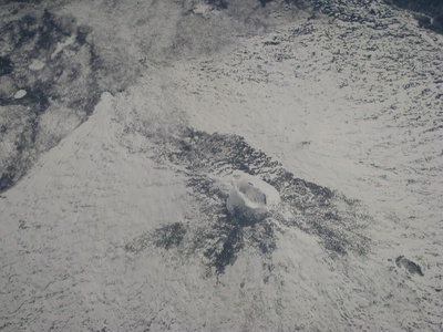
Mount Mazama (Crater Lake)
Collapsing stratovolcano that formed Crater Lake after a massive eruption ~7,700 years ago. Now a caldera lake with steep rims; hazards historically catastrophic. Crater Lake National Park offers rim roads, viewpoints and hikes.
Newberry Volcano
Large shield volcano with a caldera, lava flows and the Big Obsidian Flow. Holocene activity; last major eruptions about A.D. 1250. Hazards include lava flows and ash. Very accessible via Newberry National Volcanic Monument, trails and scenic drives.
Paulina Peak
Highest point of Newberry caldera and a prominent volcanic summit. Associated with Newberry’s Holocene eruptions. Hazards include local lava flow potential though currently quiet. Popular viewpoint with road and trail access.
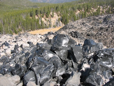
Big Obsidian Flow
Young, glassy rhyolitic lava flow on Newberry’s flank, visually striking and geologically young. Represents Newberry’s latest eruptive phase; hazards typical of silicic eruptions but presently dormant. Easy access via monument trails and interpretive sites.
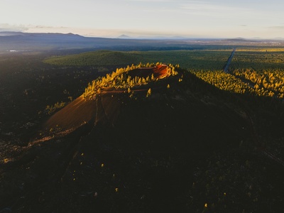
Belknap Crater
Basaltic cinder cone and lava flows on the western Cascades flank; part of central Oregon volcanic activity. Dormant in recent history. Notable for accessible lava beds and mountain biking/trail access near Bend.
Lava Butte
Cinder cone in the Deschutes volcanic field near Bend, formed by basaltic eruptions. Dormant; hazards minimal now. Very accessible with a paved road to the summit viewpoint and interpretive center at Lava Lands Visitor Center.
Belknap/Deschutes volcanic field (general)
Regional field of cinder cones, lava flows and vents west of Bend. Holocene activity but generally dormant. Hazards would be local lava flows and ash. Popular for hiking, mountain biking and exploring lava terrains.
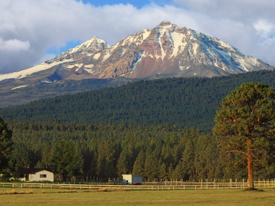
Mount McLoughlin
Prominent stratovolcano in southern Oregon with classic conical profile. Inactive in historical time but geologically young. Hazards low today; widely visible from Klamath Basin and reached by established summit trails.
Pelican Butte
Shield-like stratovolcano near Upper Klamath Lake with steep flanks. Dormant for thousands of years. Notable for panoramic views and backcountry skiing; access via Forest Service roads and trails in summer.
Mount Bailey
Volcanic cone near Crater Lake, rounded and forested. Long inactive; hazards minimal. Offers lesser-known hiking routes and commanding views of nearby higher peaks and Crater Lake area.
Fort Rock (tuff ring)
Ring-shaped tuff edifice formed by explosive interaction of lava and water. Famous landmark and archaeological site. Extinct; hazards none. Easily visited from Fort Rock Basin with short walks to the rim and interpretive signage.
Boring Lava Field
Small volcanic field of dozens of cinder cones and shield vents around Portland metropolitan area. Last erupted in the Pleistocene–Holocene; considered dormant. Hazards low now but notable for urban geology and many city parks built on volcanic features.