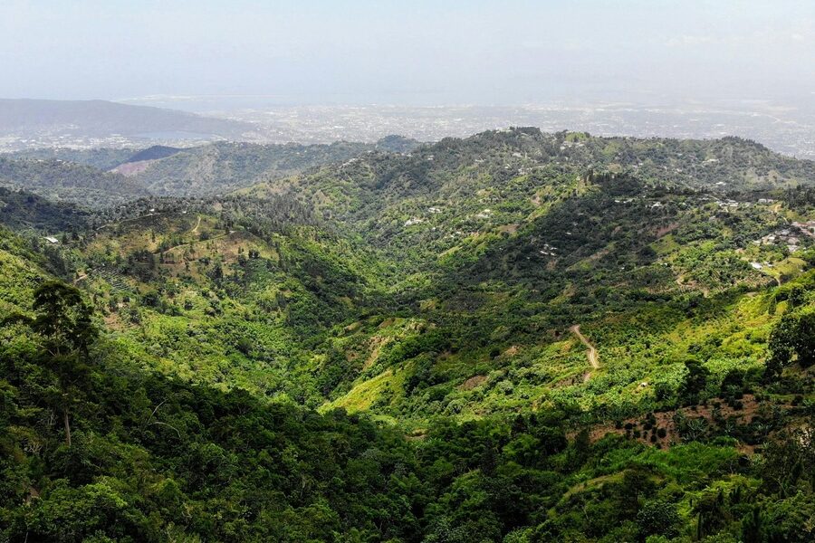
Nepal’s varied terrain—from the Terai plains up to the high Himalaya—supports a wide mix of soils, forests, water resources, minerals and unique medicinal species that local communities and the national economy depend on. A clear overview helps readers see how these resources connect to land use, livelihoods and conservation priorities.
There are 29 Natural Resources of Nepal, ranging from Arable land (cropland resource) to Yarsagumba (Ophiocordyceps sinensis). Each entry is presented with Type,Location,Quantity/value (unit) so you can quickly compare what exists where and in what amount; you’ll find below.
How are these resources distributed across Nepal’s regions?
Distribution generally follows elevation and climate: the Terai concentrates fertile cropland and wetland resources, the mid-hills hold most forests and community watersheds, and the high mountains contain alpine pastures, glacier-fed water sources and niche items like Yarsagumba. The list’s Location column makes regional patterns easy to spot.
How reliable are the Quantity/value (unit) figures?
Numbers combine recent government assessments, sector reports and scientific studies, but some values are estimates or fluctuate seasonally (especially biological products). Use the figures as a comparative guide and check original sources or dates when precision is required.
Natural Resources of Nepal
| Name | Type | Location | Quantity/value (unit) |
|---|---|---|---|
| Hydropower potential | Energy | Koshi, Gandaki, Karnali, Mahakali basins | ~83,000 MW (gross theoretical) |
| Installed hydropower capacity | Energy | Nationwide major river sites | ~2,500 MW (installed) |
| Surface freshwater resources | Water | All river basins (Koshi, Gandaki, Karnali, Mahakali) | ~200,000,000,000 m3/year (annual flow) |
| Groundwater resources | Water | Terai plains, Kathmandu Valley, hills | ~6,000–8,000,000,000 m3/year (recharge estimate) |
| Glaciers | Glacier | High Himalaya (Karnali,Gandaki,Koshi) | ~3,250 glaciers covering ~5,323 km2 |
| Arable land (cropland resource) | Land | Terai, Inner Terai, valleys | ~3,600,000 ha (arable area) |
| Forest area | Forests/NTFP | Terai, mid-hills, high mountain | ~5,800,000 ha (~58,000 km2) |
| Timber (commercial species group) | Forests/NTFP | Terai (Sal), mid-hills (pine, oak) | Sal-dominated forests ~1,000,000 ha (area estimate) |
| Bamboo | Forests/NTFP | Terai and lower hills | ~1,000,000 ha (approx. bamboo-bearing area) |
| Non-timber forest products (NTFPs) overall | Forests/NTFP | Across forests from Terai to alpine | ~USD 150,000,000/year (trade estimate) |
| Yarsagumba (Ophiocordyceps sinensis) | Forests/NTFP | High Himalaya (Manang, Mustang, Dolpa) | ~USD 200–400,000,000/year (market variability) |
| Medicinal and aromatic plants (MAPs) | Forests/NTFP | Hills and mountains nationwide | ~USD 80,000,000/year (export estimate) |
| Protected areas network | Biodiversity | Nationwide (e.g., Chitwan, Sagarmatha) | ~34,000 km2 (~23% of land area) |
| Wildlife/ecotourism resources | Biodiversity | Chitwan, Bardia, Koshi, Annapurna | Flagship species sustain tourism (e.g., rhino, tiger) |
| Rangelands and pastures | Land | Highlands, trans-Himalayan plateaus | ~1,500,000 ha (grazing land estimate) |
| Wetlands and Ramsar sites | Water/Biodiversity | Koshi Tappu, Ghodaghodi, Beeshazar | Koshi Tappu ~175 km2 (reserve area example) |
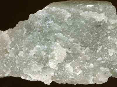
| Limestone (cement raw material) | Minerals | Makwanpur, Bara, Sindhupalchok | >500,000,000 tonnes (reserves estimate) |
| Marble | Minerals | Dolpo, Bajhang, Humla | >50,000,000 tonnes (commercial deposits) |
| Coal | Minerals | Gandaki and central belt (Ramechhap, Bara) | ~5,500,000 tonnes (estimated reserves) |
| Gypsum | Minerals | Central and eastern districts | Commercial occurrences (reserves tens of millions tonnes) |
| Talc and soapstone | Minerals | Western and central hills | Significant deposits (commercial quarries present) |
| Mica | Minerals | Karnali and western districts | Small but exploitable deposits (historic production) |
| Silica sand and kaolin | Minerals | Terai and river terraces | Commercial deposits used in glass, ceramics and brickmaking |
| Iron ore occurrences | Minerals | Scattered in central and eastern hills | Identified deposits (small to moderate tonnage) |
| Copper (known deposits) | Minerals | Ramechhap, Solukhumbu and central belts | Identified deposits with economic potential (exploration ongoing) |
| Lead-zinc occurrences | Minerals | Western and mid-hills | Multiple identified occurrences (small deposits) |
| Gemstones (garnet, aquamarine, ruby) | Minerals | Dolpo, Mustang, central Himalaya | Small-scale deposits with artisanal extraction |
| Solar energy potential | Energy | Nationwide, highest in southern plains | Solar irradiation ~3.5–6.0 kWh/m2/day (insolation range) |
| Wind energy potential | Energy | Ridge lines, mid-hill corridors | Estimated technical potential ~3,000 MW (national estimate) |
Images and Descriptions
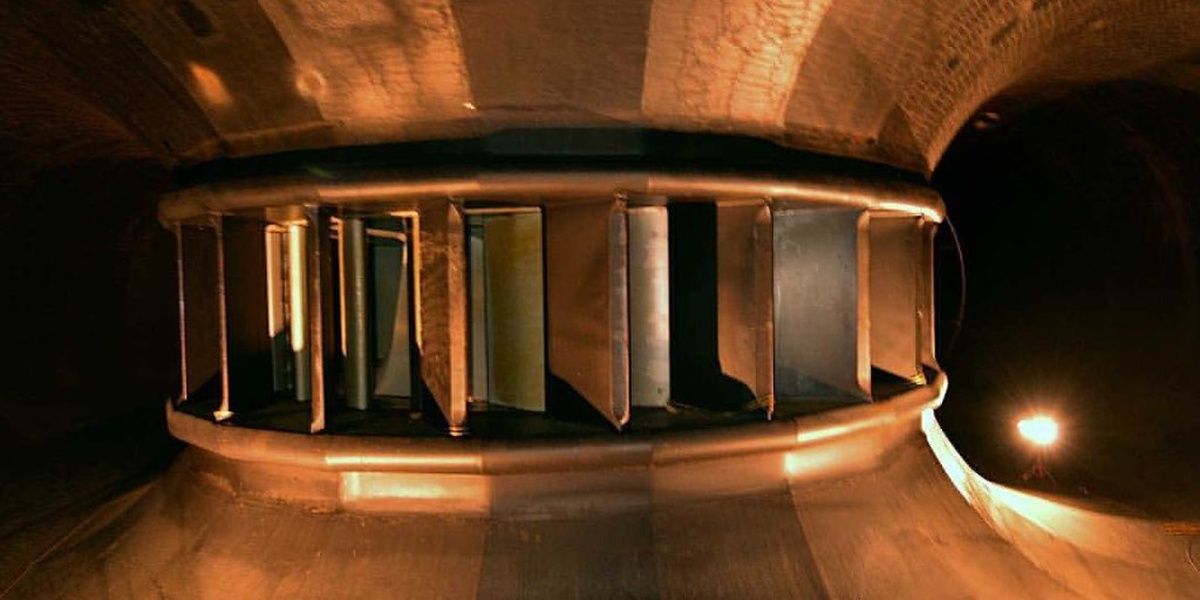
Hydropower potential
Nepal’s steep rivers and large monsoon flows give enormous hydropower potential concentrated in the Koshi, Gandaki and Karnali basins; this theoretical gross figure (~83,000 MW) underpins energy export and domestic development plans (GON, NEA).
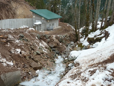
Installed hydropower capacity
Installed hydropower (~2,500 MW) comes from large and small plants across Nepal’s rivers, supplying most electricity domestically and driving rural development; capacity is growing as projects commission (NEA, GON).
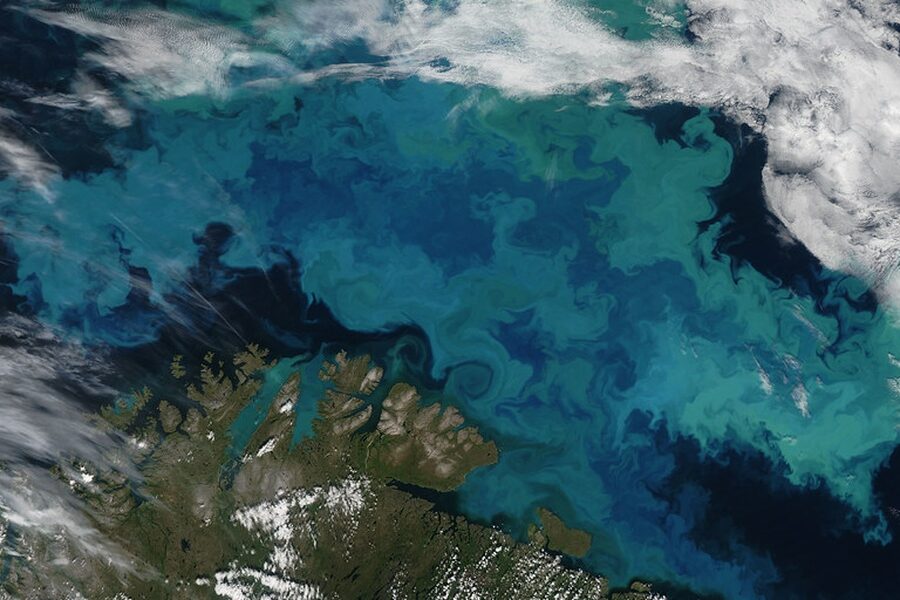
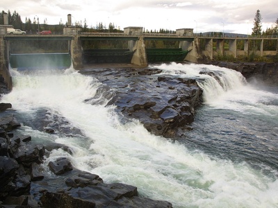
Surface freshwater resources
Nepal’s rivers drain Himalayan glaciers and monsoon rains, producing roughly 200 billion cubic meters of renewable freshwater annually, vital for irrigation, hydropower and ecosystems (GON, ICIMOD).
Groundwater resources
Groundwater in the Terai and valleys supports irrigation and drinking water; estimated annual recharge is several billion cubic meters, critical for agriculture but vulnerable to overuse and contamination (GON, FAO).
Glaciers
Nepal’s glaciers store freshwater across high Himalayan ranges, feeding rivers and seasonal flows; about 3,250 glaciers cover some 5,323 km2, crucial for downstream water security and climate impacts (ICIMOD, GON).

Arable land (cropland resource)
Approximately 3.6 million hectares of arable land—mainly in the fertile Terai plains and inner valleys—produce staples like rice and wheat and sustain most livelihoods (FAO, GON).
Forest area
About 5.8 million hectares of forest span Nepal’s elevation gradients, providing timber, fuelwood, biodiversity habitat and carbon sequestration; forests are central to rural economies and conservation (FAO, GON).
Timber (commercial species group)
Commercial timber from Sal in the Terai and conifers and oaks in the hills supplies construction and industry; Sal forests alone cover roughly a million hectares, historic timber value for local economies (GON, FAO).

Bamboo
Bamboo grows widely in Terai and hill forests, used for construction, handicrafts and erosion control; it covers large forest tracts and supports livelihoods through small industries and local use (FAO, GON).

Non-timber forest products (NTFPs) overall
NTFPs—including fuelwood, fodder, fruits, rattan, wild mushrooms and medicinal plants—support rural incomes and trade; annual NTFP value is roughly estimated around USD 150 million (GON, FAO).
Yarsagumba (Ophiocordyceps sinensis)
Yarsagumba is a wild caterpillar fungus harvested in alpine meadows, generating large seasonal income for mountain communities; annual harvest value fluctuates but can reach hundreds of millions USD (GON, FAO).
Medicinal and aromatic plants (MAPs)
Wild MAPs—including species used in herbal medicines and essential oils—are collected across hills and mountains, contributing to export earnings, local healthcare and biodiversity conservation (GON, FAO).
Protected areas network
Nepal’s system of national parks, reserves and conservation areas covers about 34,000 km2 or ~23% of the country, protecting wildlife, watersheds and tourism assets (GON, IUCN).
Wildlife/ecotourism resources
Iconic wildlife like Bengal tigers and one-horned rhinos draw tourism and conservation investment; protected areas and corridors underpin biodiversity-based livelihoods and international conservation (IUCN, GON).
Rangelands and pastures
Upland rangelands and alpine pastures are essential for pastoralism and livestock fodder in mountain districts, supporting transhumant communities and local meat/dairy economies (GON, FAO).
Wetlands and Ramsar sites
Nepal’s wetlands—including Ramsar sites like Koshi Tappu (~175 km2)—support waterbirds, fisheries and flood buffering, important for biodiversity and local fisheries (GON, Ramsar).
Limestone (cement raw material)
Extensive limestone deposits supply Nepal’s cement industry and construction materials; proven reserves exceed hundreds of millions of tonnes, underpinning domestic construction and reduced import dependence (GON, USGS).
Marble
Commercial marble deposits occur in several mountainous districts and are quarried for domestic use and export; marble supports building materials sector and local employment (GON, USGS).

Coal
Nepal has limited coal deposits used locally for energy and industry; estimated reserves are in the low millions of tonnes, insufficient for large-scale coal-based development (GON, USGS).
Gypsum
Gypsum deposits occur in central and eastern Nepal and are used in cement and plaster; commercial reserves support local industry and construction supply chains (GON, USGS).
Talc and soapstone
Talc and soapstone are quarried for ceramics, carving and industrial uses; these soft-rock deposits support local artisans and small-scale industry (GON, USGS).
Mica
Mica occurs in parts of western Nepal and historically supported small-scale mining for electronics and cosmetics raw materials; reserves are limited but commercially used (GON, USGS).
Silica sand and kaolin
Silica sand and kaolin occur in Terai riverbeds and terraces, supplying local glass, ceramics and brick industries and supporting construction materials supply chains (GON, USGS).
Iron ore occurrences
Iron-bearing rocks and small-scale ore occurrences exist in several hill districts; deposits have local industrial potential but are not yet major national resources (GON, USGS).
Copper (known deposits)
Nepal hosts copper occurrences being explored for mining potential; known deposits are of local economic interest but large-scale reserves remain under assessment (USGS, GON).
Lead-zinc occurrences
Lead-zinc mineralization appears in various hilly zones with artisanal to small-scale mining history; reserves are limited but contribute to local mineral economies (GON, USGS).
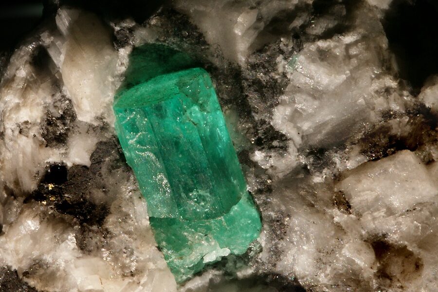
Gemstones (garnet, aquamarine, ruby)
Nepal’s rugged geology yields small gemstone deposits—garnet, aquamarine, occasional ruby—supporting local artisan mining and niche export markets (GON, USGS).
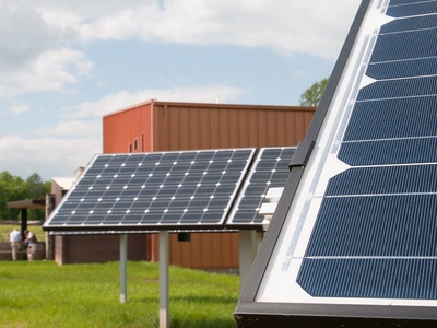
Solar energy potential
Solar radiation across Nepal, especially the Terai, offers high potential for distributed solar power and off-grid energy solutions; average insolation ranges around 3.5–6.0 kWh/m2/day (GON, AEPC).
Wind energy potential
Wind potential is concentrated on exposed ridgelines and high valleys; studies estimate a few thousand megawatts of technical potential suitable for hybrid energy projects (AEPC, GON).