The northern Korean Peninsula shows clear signs of past tectonic upheaval, with volcanic peaks and calderas that shape local topography and history. Mount Paektu (Baekdu/Changbai) is the region’s best-known volcanic feature, cited in geological studies and cultural records on both sides of the border.
There are 1 Volcanoes in North Korea, ranging from Paektu (Baekdu/Changbai) to Paektu (Baekdu/Changbai). For each entry, data are organized as Coordinates (lat, long),Elevation (m),Last eruption (year or age); you’ll find below.
Is Mount Paektu (Baekdu/Changbai) considered active?
Mount Paektu is regarded as a potentially active stratovolcano: its major Millennium eruption around 946 AD is well documented, and the area shows ongoing geothermal signs and occasional minor activity, so scientists monitor it as capable of future eruptions.
How reliable are the coordinates, elevations and eruption dates for these volcanoes?
Data quality varies: major features like Paektu have well-established coordinates and geological records, but information on smaller or remote vents is often limited by restricted field access and depends on satellite imagery and historical reports, so some entries should be treated as approximate.
Volcanoes in North Korea
| Name | Coordinates (lat, long) | Elevation (m) | Last eruption (year or age) |
|---|---|---|---|
| Paektu (Baekdu/Changbai) | 42.01,128.06 | 2,744 | 946 AD |
Images and Descriptions

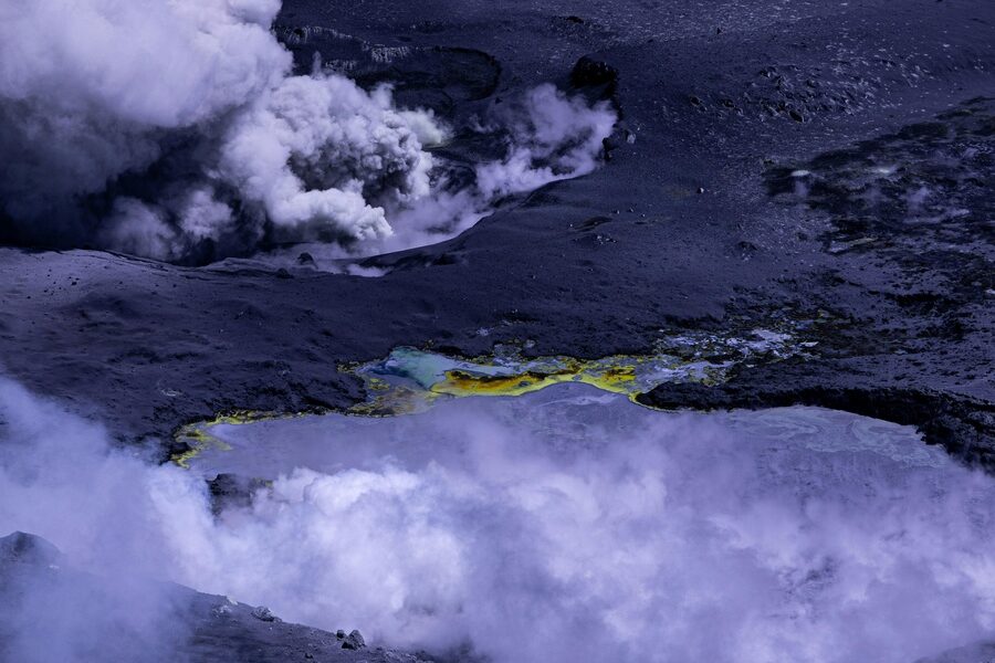
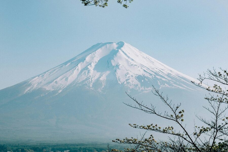
Paektu (Baekdu/Changbai)
Stratovolcano on the DPRK–China border; summit crater lake (Heaven Lake) straddles the boundary. Elevation 2,744 m. Site of a massive 946 AD eruption. Active in the Holocene; transboundary status noted; culturally and geologically significant.