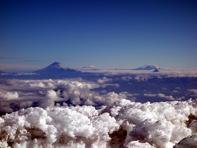
Ecuador’s landscape is shaped by a dramatic chain of volcanic peaks, from the high Andes down to remote islands in the Pacific. Whether you’re planning field research, a trek, or just curious about geology, a concise list helps make sense of the variety and activity across the country.
There are 20 Volcanoes in Ecuador, ranging from Alcedo to Wolf. Each entry below is organized with the columns Location,Elevation (m),Last eruption so you can quickly compare where they are, how tall they stand, and when they last erupted. Scroll down — you’ll find below the complete list and details for every volcano.
How current is the eruption and elevation data in the list?
The data compiles the most recent publicly available records from national and international monitoring bodies; eruption dates reflect documented events, which can be updated as new observations arrive. Treat the table as a snapshot and check local agencies (like Ecuador’s geological service) for the latest activity if you need real-time information.
Which of these volcanoes are easiest for visitors to reach?
Mainland Andean volcanoes near Quito and other populated areas usually have road access, marked trails, and local guides, while Galápagos volcanoes (including those like Alcedo and Wolf) are remote, require permits and boat travel, and often need specialized logistics — plan accordingly.
Volcanoes in Ecuador
| Name | Location | Elevation (m) | Last eruption |
|---|---|---|---|
| Cotopaxi | Cotopaxi Province,Latacunga | 5,897 | 2015 |
| Chimborazo | Chimborazo Province,Riobamba | 6,263 | Unknown |
| Cayambe | Pichincha Province,Cayambe | 5,790 | Holocene |
| Antisana | Napo Province,Papallacta | 5,704 | Holocene |
| Altar | Azuay/Chimborazo Province,near Cuenca | 5,319 | Unknown |
| IlinizaSur | Pichincha Province,near Latacunga | 5,248 | Unknown |
| IlinizaNorte | Pichincha Province,near Latacunga | 5,126 | Unknown |
| Carihuairazo | Tungurahua Province,near Ambato | 5,018 | Unknown |
| Sangay | Morona-Santiago Province,near Macas | 5,230 | Historic |
| Tungurahua | Tungurahua Province,Baños | 5,023 | 2016 |
| Reventador | Napo Province,near Reventador town | 3,562 | Historic |
| GuaguaPichincha | Pichincha Province,Quito outskirts | 4,794 | 1999 |
| Quilotoa | Cotopaxi Province,near Latacunga | 3,914 | Holocene |
| Cotacachi | Imbabura Province,Cotacachi town | 4,944 | Unknown |
| Wolf | Isabela Island,Galápagos | 1,707 | 2015 |
| Fernandina | Fernandina Island,Galápagos | 1,494 | 2018 |
| CerroAzul | Isabela Island,Galápagos | 1,710 | 2008 |
| SierraNegra | Isabela Island,Puerto Villamil | 1,124 | 2018 |
| Alcedo | Isabela Island,central Isabela | 1,123 | Holocene |
| Darwin | Darwin Island,Galápagos | 1,420 | Holocene |
Images and Descriptions
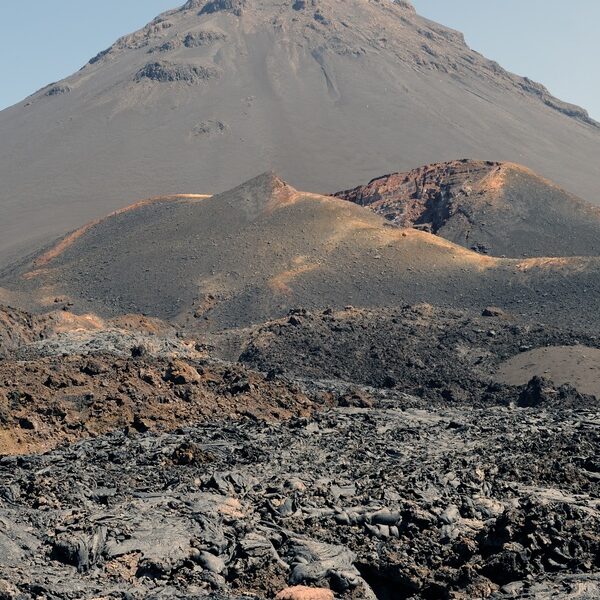
Cotopaxi
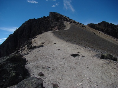
Active stratovolcano in Cotopaxi Province near Latacunga; one of the world’s highest active volcanoes. Frequent eruptions and ash emissions; last significant activity in 2015. Popular with mountaineers but glaciated slopes and sudden eruptions make climbs demanding and regulated.
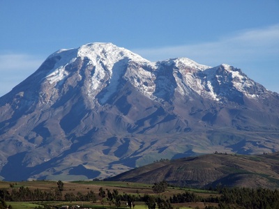
Chimborazo
Massive dormant stratovolcano in Chimborazo Province near Riobamba; Ecuador’s highest peak. No confirmed historical eruptions and volcanism is largely ancient, so activity is uncertain. Iconic for its summit and high-altitude climbs; accessible routes require technical experience.
Cayambe
Glaciated stratovolcano in Pichincha Province near Cayambe town; highest point on the equator. Limited historic activity, with Holocene eruptions recorded. Popular for technical climbs on ice and rock; remote access and variable weather require experienced guides.
Antisana
Large eroded stratovolcano in the Antisana region near Papallacta; one of Ecuador’s high Andean peaks. Evidence of Holocene activity exists but no recent historical eruptions. Remote, glaciated summit visits are possible with permits and experienced mountaineers.

Altar
Collapsed stratovolcano south of Chimborazo near Cuenca with a breached crater and complex summit. No reliable historical eruptions; considered older and eroded. Scenic but rugged terrain; access is controlled and climbs require local knowledge and planning.

IlinizaSur
Twin volcanic peaks near Latacunga; Iliniza Sur is a heavily eroded stratovolcano with steep flanks. No recorded historic eruptions; popular with climbers for alpine routes. Access through nearby towns; technical gear advised for summit attempts.
IlinizaNorte
Lower, jagged companion to Iliniza Sur near Latacunga; often climbed as a technical glacier-free summit. Lacks documented historical eruptions and is considered dormant. Well-established routes and guide services make it accessible to experienced climbers.
Carihuairazo
Isolated stratovolcano near Ambato and Chimborazo; heavily eroded with multiple summits. No confirmed historic eruptions and mostly older volcanic deposits. Climbs are less frequented than nearby peaks but offer challenging routes and scenic views.
Sangay
One of Ecuador’s most active volcanoes in the Amazonian foothills; steep stratovolcano with persistent eruptions and ash emissions in historical times. Inaccessible and within protected areas; approaches are restricted and hazardous for casual visitors.
Tungurahua
Active stratovolcano overlooking Baños in Tungurahua Province; known for violent eruptions since 1999. Frequent ash plumes and explosions have affected nearby towns. Popular viewpoint but climbing is risky during unrest; local authorities regulate access.
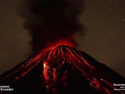
Reventador
Forest-covered stratovolcano in Napo Province with persistent activity, frequent lava flows and explosions. Dense vegetation and remoteness make access difficult, limiting visits to scientific teams and experienced guides with permits.
GuaguaPichincha
Active volcanic summit just west of Quito; last major eruptions in 1999 produced ash and lahars. Easily visible from the city; shorter climbs possible but routes are closed during unrest due to ash, gas hazards and falling debris.
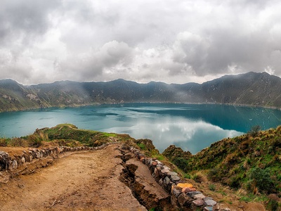
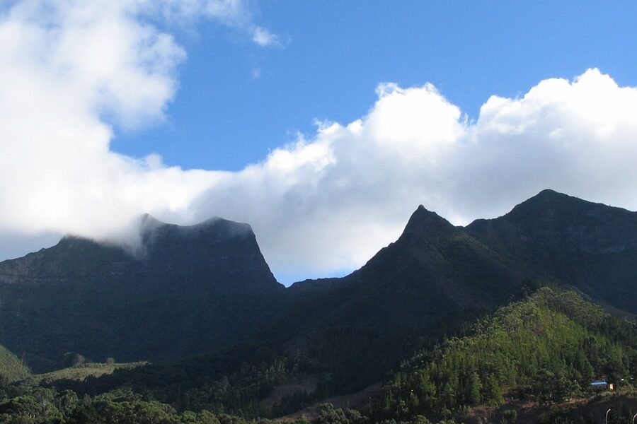
Quilotoa
Explosive caldera west of Latacunga with a scenic crater lake formed by a late Holocene eruption. No recent historical eruptions. Popular for day hikes, spectacular viewpoints and local communities that support tourism and guided treks.
Cotacachi
Extinct to dormant stratovolcano in Imbabura Province near Cotacachi town; part of the northern volcanic chain. No recent activity documented. Gentle flanks and scenic landscapes make it popular for hikes and cultural visits rather than technical climbs.
Wolf
Highest peak in the Galápagos on Isabela Island; basaltic shield/stratovolcano with recent eruptions, including 2015. Remote and ecologically sensitive; access requires national park permits. Climbs are challenging and usually undertaken by experienced visitors or researchers.
Fernandina
One of the most active Galápagos volcanoes on Fernandina Island; basaltic shield with frequent flank and summit eruptions. Recent activity has been recorded in the 21st century. Visits are strictly regulated due to fragile ecosystems and eruptive hazards.
CerroAzul
Large shield volcano on Isabela Island with extensive lava flows and frequent activity; significant eruptions in recent decades. Rugged terrain and remoteness restrict access; scientific expeditions and occasional tourist visits are tightly controlled by park authorities.
SierraNegra
Broad shield volcano on Isabela Island with a large caldera and frequent eruptions, most recently in 2018. Popular day hikes to the caldera rim depart from Puerto Villamil with park permits and guided tours; vistas are dramatic but trails can be rough.
Alcedo
Central Isabela shield volcano notable for giant tortoise populations and Holocene lava flows. Recent eruptions are scarce. Interior location is remote and access is limited; visits are mainly scientific and regulated to protect wildlife and habitat.
Darwin
Small shield volcano on remote Darwin Island with Holocene activity but rare historical eruptions. Extremely remote and protected; the island is primarily visited by researchers and divers, with landings and climbs typically restricted by park regulations.