Ancient Greek geographers more than two millennia ago divided the known world into Europe, Asia and Africa—an idea that still shapes how many people think about continents today. That simple division made maps and stories easier to teach, but it also seeded a lot of lasting assumptions. Misconceptions about continents matter for classrooms, travel writing, diplomacy and science — they shape who is counted, how resources are allocated, and even which conservation policies get funded. There are seven continents in the most commonly taught model, and 195 UN member states use varying regional definitions in statistics and treaties. This piece clears up eight common myths about continents with facts, examples and practical implications, so readers can spot sloppy claims and think critically about maps and borders. Now, let’s start with how maps and naming skew what people believe about size and boundaries.
Geography and Size Myths
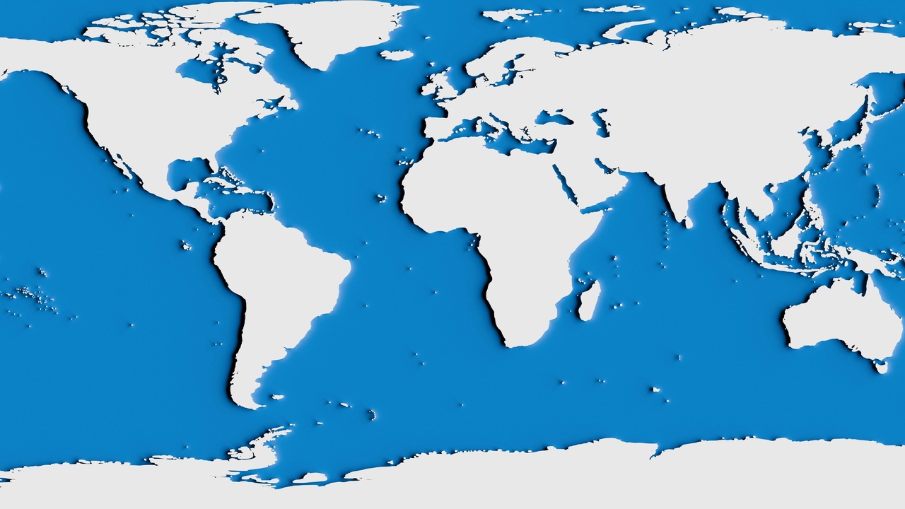
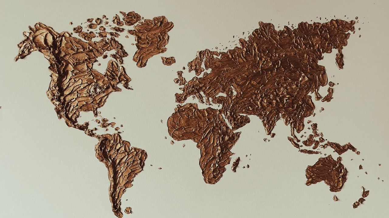
Map projections, school charts and shorthand labels create some of the most persistent continent misconceptions. A rectangular Mercator projection inflates areas near the poles, making Greenland look enormous next to Africa; in reality Africa is about 30.37 million km² while Greenland is roughly 2.16 million km² — Africa is roughly 14 times larger. Education often collapses political and geographic concepts into tidy categories, which confuses country and continent distinctions. And many of the lines people assume are natural — mountain chains, straits — are conventions rather than sharp physical divisions. Below are three related myths that come from those distortions and naming habits.
1. Continents are the same as countries
People often assume a continent equals a country, but the two are different kinds of units. Continents are large landmasses defined by geography, geology or convention; countries are political entities with borders and governments. Counting countries (there are 195 UN member states) uses legal recognition and diplomacy; counting continents uses cultural and cartographic rules.
That overlap causes confusion: Australia is both a country and a continent, whereas Greenland is the world’s largest island, not a continent. Comparing sizes helps — Africa at ~30.37 million km² towers over Greenland’s ~2.16 million km² — yet casual usage still mixes up the terms in travel guides and news stories, leading to misleading headlines and classroom errors.
2. Europe and Asia are clearly separate continents
Many people think Europe and Asia are neatly separated by a jagged physical wall. In fact they form one continuous landmass, Eurasia, and the boundaries are largely historical conventions. Features like the Ural Mountains, the Caucasus and the Bosporus were chosen by cartographers and states to mark a divide.
Combine Europe and Asia and you have the planet’s largest single landmass; Asia alone contains about 4.7 billion people, underscoring how scale blurs cultural and geographic lines. Turkey and Russia physically straddle the conventional divide — Istanbul sits on both continents — which shows the arbitrariness of many textbook borders.
3. Antarctica is uninhabited year-round
Antarctica is often pictured as empty white desert, but it hosts seasonal human populations tied to science and logistics. Roughly 1,000 people remain during the Antarctic winter and about 4,000–5,000 live at research stations in summer.
The Antarctic Treaty (1959) coordinates peaceful scientific activity; examples of staffed bases include McMurdo Station (U.S.) and the Amundsen-Scott South Pole Station. Those temporary communities support biology, climate monitoring and astronomy, and they require year-round supply chains and environmental management.
Geology and Formation Myths
Continents are dynamic features shaped by deep-time processes. Plate tectonics explains how whole continents rift, collide and slide past one another; Pangaea existed roughly 200 million years ago before the major landmasses drifted toward their modern positions. Beneath that apparent stability, plates move at measurable rates — millimeters to centimeters per year — and crust type, thickness and buoyancy influence surface geography and long-term evolution.
4. Continents don’t move anymore
That idea is false: tectonic plates keep moving at measurable speeds. Most plates slide at a few millimeters to several centimeters per year; some plate boundaries record rates up to about 10 cm/year.
Deep-time events illustrate the point: Pangaea began breaking up ~200 million years ago, and India’s collision with Asia began around 50 million years ago, creating the Himalayas, which continue to rise. Active motion means earthquake risk, mountain building and shifting coastlines remain relevant today.
5. Continents float on water
People sometimes picture continents bobbing on an ocean, but the real picture involves isostasy and the lithosphere-asthenosphere system. Continental crust is thicker and less dense (average ~35 km, up to ~70 km under big mountain belts) while oceanic crust is thinner, about 7–10 km, and denser.
Buoyancy and crustal rigidity produce vertical adjustments — mountain “roots” beneath ranges and post-glacial rebound where ice sheets once depressed the crust. Scandinavia and parts of Canada are still rising after the last Ice Age, evidence of isostatic recovery rather than literal floating.
Biodiversity and Human History Myths
Continents have long been treated as biologically and culturally separate units, but land connections, past climates and people have mixed life and languages. The Last Glacial Maximum (~26,000–19,000 years ago) exposed land bridges like Beringia that enabled human and animal movements. Human introductions, continental drift and regional extinctions mean strict endemism is rare, and continent-scale cultural labels obscure vast internal diversity.
6. Each continent hosts entirely unique, isolated life
Endemism exists — Australia’s marsupials are a famous example — but absolute isolation is a myth. Geological links and land bridges allowed exchanges, and people have moved species widely.
During the Last Glacial Maximum, the Bering land bridge (around ~20,000 years ago) connected Asia and North America. In recent centuries humans introduced rabbits and foxes to Australia (19th century), dramatically altering ecosystems. Conservation and biosecurity policies now grapple with those legacies.
7. Human cultures on a continent are homogeneous
Large-scale labels like “Asian culture” or “African people” erase enormous variation. Africa alone has 54 countries and more than 2,000 distinct languages; Nigeria by itself lists over 500 languages. Those numbers show how misleading continent-wide generalizations can be.
Legal systems, cuisines, religious practices and social norms vary widely within continents. Oversimplified continental stereotypes mislead policy, tourism expectations and media coverage, so region-specific knowledge matters for sensible decisions.
Naming and Conceptual Myths
“Continent” is a human-made category that has shifted with history, culture and pedagogy. Different countries teach different models — seven continents are common, some lists combine Europe and Asia into Eurasia, and a few contexts use five continental groupings for sporting or diplomatic reasons. Those choices reflect language and politics as much as physical geography, so expecting a single universal list is unrealistic. These myths about continents persist because naming makes complex geography easier to memorize, but it also hides ambiguity and change.
8. Continent boundaries are fixed and universally agreed
Continental boundaries depend on convention rather than a single global standard. The most common seven-continent model coexists with six-continent options that combine Europe and Asia, and international organizations sometimes use regional groupings tailored to statistics or diplomacy.
The ancient Greeks set many naming precedents about 2,500 years ago, and countries like Turkey and Russia are transcontinental in everyday practice. Those differing models affect textbooks, atlases and data sets — which is why educators and analysts should specify the model they use.
Summary
- Question simple assumptions about borders and size — map projections and conventions often mislead.
- Continents change: plate motions (millimeters to centimeters per year), Pangaea (~200 million years ago) and ongoing uplift show geology matters.
- Some surprising facts: Antarctica hosts ~1,000 people in winter and ~4,000–5,000 in summer; Africa is ~30.37 million km² versus Greenland ~2.16 million km².
- Avoid continent-wide generalizations about culture and biology — Africa has 54 countries and 2,000+ languages; human and species movements (e.g., Bering land bridge ~20,000 years ago) complicate neat categories.
- Compare projections and models: check National Geographic, UNESCO and reputable atlases when you need authoritative maps or definitions.