From coastal cliffs to deep boreholes and the planet’s interior, geophysics gives us the tools to see what’s hidden beneath the surface. Different measurements reveal different scales and properties, helping with everything from groundwater studies to earthquake analysis and resource exploration.
There are 17 Branches of Geophysics, ranging from Borehole geophysics to Seismology. For each branch, data are organized by Primary focus, Key methods/instruments, and Typical data and units, which you’ll find below.
What practical differences should I know between Borehole geophysics and Seismology?
Borehole geophysics works at very local scales inside wells and gives high-resolution measurements (e.g., resistivity, sonic logs) useful for lithology, porosity, and fluid studies; Seismology uses wave propagation across regions or the globe with seismometers and reflection/refraction surveys, providing deeper but lower-resolution imaging—choose based on required depth, resolution, and site access.
How do I use the table below to pick the right branch for a project?
Match your objective to the Primary focus, check Key methods/instruments for feasibility at your site, and confirm the Typical data and units fit your processing and interpretation workflow; then weigh logistics, budget, and regulatory constraints or consult a specialist if needed.
Branches of Geophysics
| Name | Primary focus | Key methods/instruments | Typical data and units |
|---|---|---|---|
| Seismology | Study of Earth’s seismic waves and earthquake processes | Seismic networks,broadband seismometers,accelerometers,array analysis | Wave arrival times (s),ground velocity/acceleration (m/s,m/s²),seismic velocity (km/s),magnitude |
| Reflection seismology | Imaging subsurface structure using reflected seismic waves | Controlled sources,geophone arrays,vibroseis,seismic processing | Two-way travel time (s),reflection amplitude,seismic velocity (km/s),depth (m) |
| Geodesy | Measuring Earth’s shape, gravity field, and surface motions | GPS/GNSS,VLBI,satellite laser ranging,InSAR,gravimetry | Positions (m),velocities (mm/yr),gravity (mGal),surface deformation (mm) |
| Gravimetry | Measuring gravity variations to infer subsurface density structure | Absolute/relative gravimeters,airborne/space gravimetry,gradiometers | Gravity anomaly (mGal),gravity gradient (Eötvös),Bouguer anomaly (mGal) |
| Geomagnetism | Studying Earth’s magnetic field and its spatial/temporal changes | Magnetometers,observatories,satellite magnetics,magnetic surveys | Magnetic field strength (nT),inclination/declination (°),magnetic anomalies (nT) |
| Paleomagnetism | Reconstructing past magnetic field recorded in rocks and sediments | Rock magnetometers,thermal/AF demagnetization,laboratory paleomagnetic techniques | Remanent magnetization (A/m),declination/inclination (°),paleointensity (µT) |
| Electromagnetics | Imaging subsurface electrical conductivity with EM fields | Magnetotellurics,controlled-source EM,airborne EM,ground EM receivers | Impedance/resistivity (ohm·m),apparent resistivity (ohm·m),impedance tensor (Ω) |
| Electrical methods | Mapping resistivity and chargeability near surface and boreholes | DC resistivity,induced polarization (IP),electrode arrays,borehole logging | Resistivity (ohm·m),chargeability (mV/V),apparent resistivity (ohm·m) |
| Near-surface geophysics | Characterizing shallow subsurface for environmental and engineering uses | GPR,shallow seismic,resistivity,EM,magnetics,borehole logging | Depth (m),resistivity (ohm·m),GPR time (ns),seismic velocity (m/s) |
| Exploration geophysics | Locating and characterizing natural resources using geophysical data | Seismic reflection,gravity,magnetics,EM,airborne and borehole surveys | Seismic time/km,gravity (mGal),magnetics (nT),resistivity (ohm·m) |
| Marine geophysics | Studying seafloor and sub-seafloor structure and processes | Multibeam sonar,seismic reflection/refraction,sub-bottom profilers,magnetics,gravimetry | Bathymetry (m),seismic time (s),acoustic backscatter,magnetic anomalies (nT) |
| Planetary geophysics | Applying geophysical methods to planets, moons, and small bodies | Seismometers,radar,gravimetry,magnetometers,orbital remote sensing | Seismic waves (s),gravity (mGal),magnetic field (nT),radar delay (s) |
| Hydrogeophysics | Characterizing groundwater distribution and flow using geophysics | Electrical resistivity,GPR,seismic,EM,tracer-geophysics,borehole logging | Resistivity (ohm·m),hydraulic conductivity (m/s),water content (vol%),head (m) |
| Cryospheric geophysics | Studying ice sheets, glaciers, and permafrost with physical measurements | Ice-penetrating radar,seismic,GPS,thermal sensors,borehole thermistors | Ice thickness (m),radar travel time (ns),temperature (°C),velocity (m/yr) |
| Geothermal geophysics | Imaging subsurface heat, permeability and reservoirs for geothermal energy | Heat-flow surveys,MT,seismic,gravity,resistivity,temperature logging | Heat flow (mW/m²),temperature (°C),resistivity (ohm·m),permeability (m²) |
| Borehole geophysics | In-situ measurement of subsurface properties inside wells | Logging tools:gamma,resistivity,acoustic,density,magnetic,ultrasonic | Porosity (%),density (g/cm³),resistivity (ohm·m),sonic velocity (km/s) |
| Computational geophysics | Numerical modeling and inversion of geophysical data using physics | Finite-difference/element modeling,inversion algorithms,HPC,machine learning | Modeled fields (various units: km/s,nT,ohm·m),misfit (RMS) |
Images and Descriptions
Seismology
Seismology studies how elastic waves travel through Earth to image interior structure, locate earthquakes and probe tectonics. Networks and arrays record waveforms and arrival times for tomography, source physics, and seismic-hazard assessment.
Reflection seismology
Reflection seismology maps layered subsurface using controlled seismic sources. It’s central to hydrocarbon and reservoir exploration, engineering site characterization, and stratigraphic studies by producing seismic sections that reveal faults, folds, and lithology contrasts.

Geodesy
Geodesy quantifies Earth’s size, gravity and slow surface motions using space-geodetic techniques. It underpins plate-motion studies, sea-level monitoring, crustal deformation, and precise positioning for mapping and navigation.
Gravimetry
Gravimetry maps tiny gravity variations caused by density differences in the crust and mantle. Applications include mineral and oil exploration, crustal structure studies, glacier mass change, and satellite missions tracking mass redistribution.
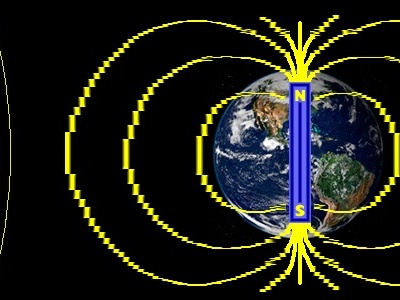
Geomagnetism
Geomagnetism examines the present-day magnetic field from the core and external sources. It supports navigation, space-weather monitoring, tectonic studies, and magnetic anomaly mapping for exploration.
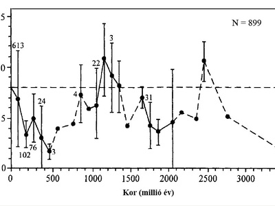
Paleomagnetism
Paleomagnetism reads the ancient magnetic signals locked in rocks to reconstruct plate motions, polar wander, and geomagnetic reversals. Lab measurements help date rocks and test tectonic reconstructions and dynamo history.
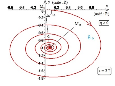
Electromagnetics
Electromagnetics uses natural or controlled EM fields to map conductivity contrasts related to fluids, salts, temperature, and mineralization. Methods range from deep MT to shallow controlled-source and airborne surveys for exploration and environmental work.

Electrical methods
Electrical methods measure how the ground resists electrical current and stores charge to detect groundwater, contamination, clays and mineralization. DC resistivity and IP are staples of environmental and exploration surveys, often calibrated with borehole data.
Near-surface geophysics
Near-surface geophysics applies multiple physics-based tools to map shallow features for contamination mapping, archaeology, geotechnical surveys and groundwater studies, emphasizing high-resolution, noninvasive imaging.
Exploration geophysics
Exploration geophysics integrates diverse geophysical methods to find minerals, hydrocarbons and groundwater. It uses regional reconnaissance and detailed surveys to reduce drilling risk and estimate resource size and geometry.
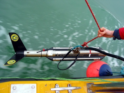
Marine geophysics
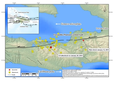
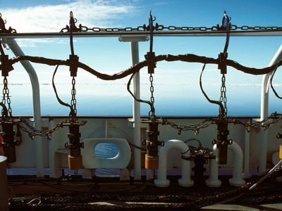
Marine geophysics maps seafloor topography, sediment layers, faults and submarine processes using shipborne and submersible instruments. It’s key for plate tectonics, tsunami and slope stability studies, and offshore resource exploration.
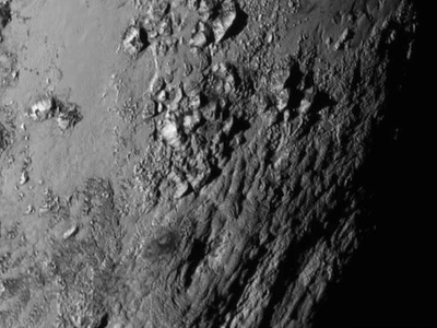
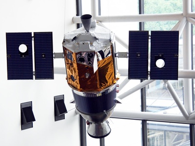
Planetary geophysics
Planetary geophysics adapts Earth’s tools to probe interiors, tectonics and volcanism on the Moon, Mars and icy moons. Lander and orbital data reveal planetary structure, thermal state and evolutionary history.
Hydrogeophysics
Hydrogeophysics combines geophysical measurements with hydrologic models to map aquifers, saturation and flow paths. Techniques infer porosity, permeability and contaminant transport for water-resource management and remediation.
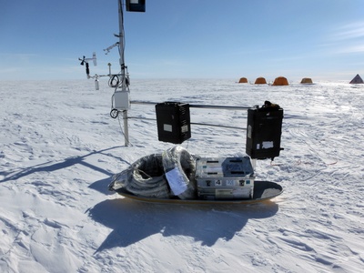
Cryospheric geophysics
Cryospheric geophysics measures ice thickness, flow and thermal structure to study glacier dynamics, ice-sheet mass balance and permafrost changes. Radar, seismic and GPS surveys track response to climate forcing.
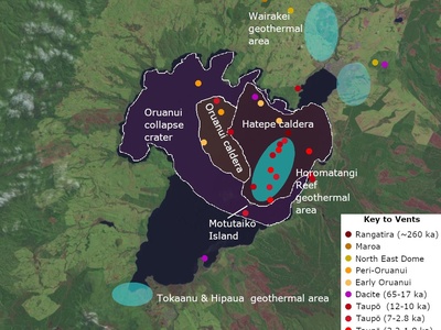
Geothermal geophysics
Geothermal geophysics maps subsurface temperature and fluid pathways to locate geothermal reservoirs. It uses heat-flow measurements, MT and seismic data to assess resource potential and guide drilling and development.
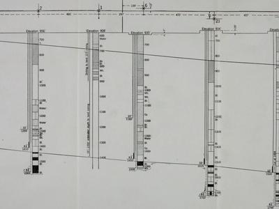
Borehole geophysics
Borehole geophysics acquires high-resolution physical measurements in wells to quantify porosity, density, fluid content and acoustic velocity. Logs calibrate surface surveys and are essential for reservoir evaluation and engineering.
Computational geophysics
Computational geophysics develops forward models and inversion techniques that translate measurements into images and physical parameters. It supports tomography, uncertainty quantification and large-scale simulation using high-performance computing.