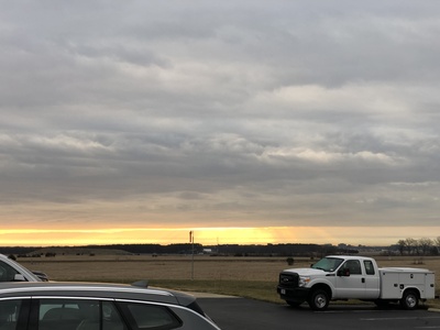
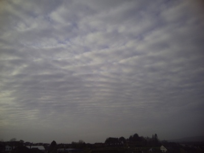
On many afternoons, a band of clouds sits between the lower stratus and the high cirrus, telling a subtle story about moisture and atmospheric layers. Whether you’re scanning the sky from a park bench or watching from a small aircraft, those mid-level formations are often the first clue that the weather is shifting.
There are 10 Examples of Mid-level Clouds, ranging from Altocumulus castellanus to Altostratus translucidus. For each entry you’ll find below data organized with Genus,Altitude (km),Visual ID so you can compare form, typical height, and how to spot them in the field — you’ll find below.
How can I tell mid-level clouds apart from low or high clouds?
Mid-level clouds typically appear between about 2 and 7 km altitude (varies with latitude) and include clumped, layered, or banded textures like altocumulus and altostratus. Use relative size and sharpness: high cirrus look fibrous and very thin, low stratus are thicker and closer to the ground; mid-level types often have moderate opacity and sharper edges than high clouds when viewed against the sun.
What do mid-level clouds usually indicate about upcoming weather?
They often signal approaching frontal systems or elevated moist layers; altostratus can foreshadow steady precipitation if thickening, while altocumulus castellanus may indicate mid-tropospheric instability and possible showers or thunderstorms later. Observing changes in coverage and thickness gives the best short-term clues.
Examples of Mid-Level Clouds
| Name | Genus | Altitude (km) | Visual ID |
|---|---|---|---|
| Altostratus opacus | Altostratus | 2-6 km | Thick grey sheet, sun usually hidden |
| Altostratus translucidus | Altostratus | 2-6 km | Thin veil, sun visible as bright disc |
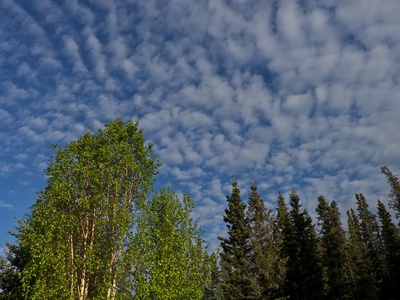
| Altocumulus stratiformis | Altocumulus | 2-6 km | Widespread patches or sheets of small rolls |
| Altocumulus castellanus | Altocumulus | 2-6 km | Towering turreted tops like small castles |
| Altocumulus floccus | Altocumulus | 2-6 km | Small, woolly tufts with ragged bases |
| Altocumulus lenticularis | Altocumulus | 2-7 km | Smooth, lens-shaped or stacked discs |
| Altocumulus undulatus | Altocumulus | 2-6 km | Regular wavy bands or ripples |
| Altocumulus radiatus | Altocumulus | 2-6 km | Parallel rows converging toward horizon |
| Altocumulus perlucidus | Altocumulus | 2-6 km | Patchy elements with small transparent gaps |
| Altocumulus translucidus | Altocumulus | 2-6 km | Thin elements allowing sunlight through |
Images and Descriptions
Altostratus opacus
A uniform, featureless mid-level layer that often precedes warm fronts; forms as large-scale moist air lifts and spreads. Can produce steady light rain or snow and signals prolonged overcast and increasing precipitation chances.
Altostratus translucidus
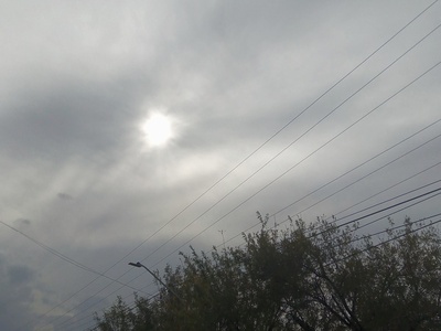
A thinner variant of altostratus allowing the Sun or Moon to show as a bright disc. Forms from gradual widespread lifting ahead of fronts; rarely gives measurable precipitation but indicates increasing mid-level moisture and incoming frontal cloud.
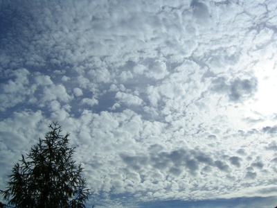
Altocumulus stratiformis
Sheet-like patches of small, rounded cloud elements formed by shallow mid-level convection or lifted humid layers. Often seen on fair days but thickening may signal approaching disturbances; generally little precipitation to ground.
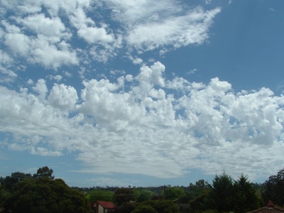
Altocumulus castellanus
Distinct turreted, castle-like tops indicating mid-level instability and local rising air. Common before afternoon storms; can be a precursor to cumulonimbus and show increasing thunderstorm potential when vertical growth continues.
Altocumulus floccus
Loose, tufted cloudlets with frayed bases resulting from localized convection in the mid-levels. Often produce virga and signal mid-level instability; may precede more organized convective activity if growth occurs.
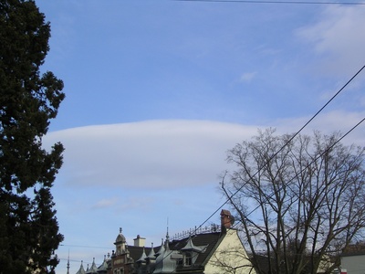
Altocumulus lenticularis
Stationary lens-shaped clouds formed by mountain-wave lift in stable air. Indicate strong winds aloft and wave activity; often dramatic but produce little precipitation at the surface and persist downwind of terrain.

Altocumulus undulatus
Wavy, ripple-like bands created by wind shear or atmospheric waves in a stable mid-layer. Suggest layered winds and oscillations aloft; usually harmless but can signal changing wind patterns and moisture distribution.

Altocumulus radiatus
Rows of cloudlets aligned in parallel bands that appear to converge with perspective. Formed by organized wind flow and layering; typically no precipitation but can indicate coherent wind patterns at mid-levels.
Altocumulus perlucidus
Patchy collections of rounded cloud elements spaced so blue sky is visible between them. Indicates partial drying or breaks in mid-level moisture; commonly seen during transitional weather and often accompanies fair conditions.

Altocumulus translucidus
Thin altocumulus whose elements transmit sunlight or moonlight, appearing translucent. Forms in shallow moist layers at mid-levels; rarely produces ground-level precipitation and signals modest mid-atmospheric moisture without strong vertical depth.