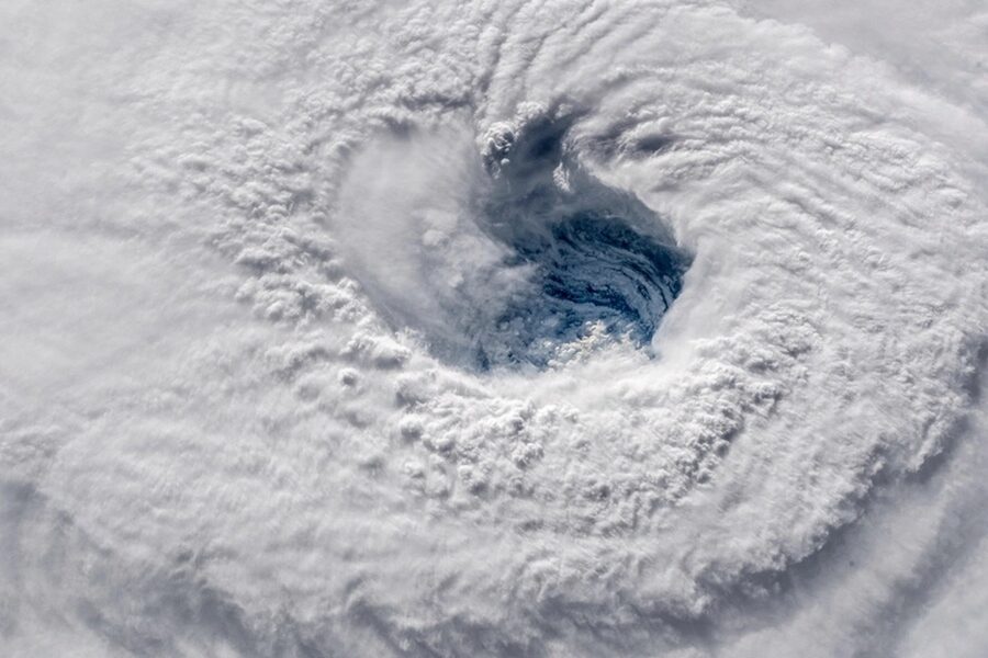
From coastal communities to mountain towns, weather drives daily decisions — from travel plans to building codes — and knowing the kinds of severe events that can occur helps people stay safer. This list gives a clear snapshot of common and uncommon phenomena so you can spot what matters where you live or travel.
There are 28 Storms, ranging from Blizzard to Waterspout. For each entry, the data are organized as Category, Peak wind (km/h), Typical region & season — you’ll find below.
How should I interpret the “Peak wind (km/h)” numbers?
Peak wind values indicate typical maximum winds associated with that event but can vary widely by intensity and location; treat them as a comparative guide rather than exact predictions, and always check local watches and warnings for real-time measurements.
Can this list help me prepare for local weather risks?
Yes — by showing which event types occur in particular regions and seasons, plus their typical peak winds and categories, the list helps you prioritize preparedness actions (timelines for warnings, sheltering needs, and structural concerns) relevant to your area.
Storms
| Name | Category | Peak wind (km/h) | Typical region & season |
|---|---|---|---|
| Tropical cyclone | tropical | 315 | Tropical oceans, warm season |
| Hurricane (Atlantic)/Typhoon (Pacific) | tropical | 280 | Atlantic/Caribbean; NW Pacific, warm season |
| Tropical storm | tropical | 120 | Tropics, pre/post peak hurricane season |
| Subtropical cyclone | tropical | 160 | Subtropical oceans, transitional seasons |
| Extratropical cyclone (mid-latitude cyclone) | precipitation-driven | 160 | Mid-latitudes, all seasons (peaks fall/winter) |
| Nor’easter | winter | 150 | East coast North America, late fall–spring |
| Blizzard | winter | 110 | Mid- to high-latitudes, winter months |
| Lake-effect snowstorm | winter | 100 | Great Lakes region, late fall–winter |
| Ice storm | winter | 120 | Cold temperate regions, winter |
| Thunderstorm | convective | 120 | Worldwide, warm months |
| Supercell thunderstorm | convective | 200 | Mid-latitudes, spring–summer |
| Squall line | convective | 140 | Mid-latitudes, warm season |
| Derecho | convective | 160 | Mid-latitudes, warm season |
| Tornado | convective | 500 | Worldwide (US Plains peak), spring–summer |
| Waterspout | convective | 200 | Tropical/subtropical waters, warm months |
| Microburst | convective | 240 | Mid-latitudes, warm months |
| Hailstorm | convective | 120 | Mid- to low-latitudes, warm season |
| Squall | convective | 140 | Mid-latitudes tropics, various seasons |
| Dust storm | wind/sand | 110 | Arid regions, dry season |
| Haboob | wind/sand | 110 | Deserts (Sahara, Middle East, US Southwest), dry season |
| Sandstorm | wind/sand | 120 | Arid/semi-arid regions, dry season |
| European windstorm | wind/sand | 180 | Europe, autumn–winter |
| Extratropical nor’easter hybrid (superstorm) | precipitation-driven | 165 | Coastlines, late fall–spring |
| Cyclone (Southern Hemisphere) | tropical | 250 | Southwest Pacific/Indian Ocean, summer |
| Tropical depression | tropical | 60 | Tropics, within cyclone season |
| Coastal storm surge event | precipitation-driven | 150 | Coastal regions during cyclones/high tides |
| Rainband flooding event | precipitation-driven | 120 | Tropical/subtropical regions, monsoon or cyclone seasons |
| Cold-air outbreak squall | winter | 130 | High latitudes, winter |
Images and Descriptions
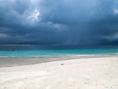
Tropical cyclone
Large organized low-pressure systems over warm seas driven by ocean heat and rotation; produce extreme winds, storm surge and heavy rain. Notable example: Hurricane Katrina. Evacuate storm surge zones and follow official evacuation orders for safety.
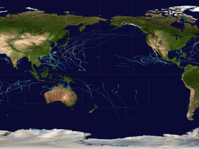
Hurricane (Atlantic)/Typhoon (Pacific)
Regional name for strong tropical cyclones; cause catastrophic coastal wind damage, flooding, and surge. Notable examples: Hurricane Katrina, Typhoon Haiyan. Heed evacuation orders, move inland and to higher ground for storm surge risk.
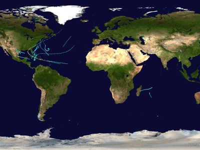
Tropical storm
Weaker tropical cyclones with sustained winds below hurricane strength; still bring heavy rain, flooding and gust damage. Representative: Tropical Storm Allison (2001). Stay aware of flood alerts; avoid driving through flooded roads.
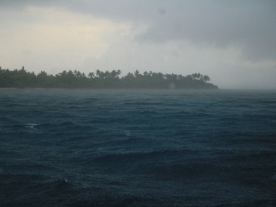
Subtropical cyclone
Hybrid storms with both tropical and extratropical characteristics, often forming over cooler waters; can produce strong winds and coastal flooding. Example: Subtropical Storm Andrea (2013). Coastal residents should secure loose items and heed local warnings.
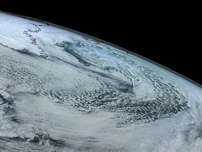
Extratropical cyclone (mid-latitude cyclone)
Large low-pressure systems driven by temperature contrasts; produce frontal rain, snow, and strong winds across continents. Notable: European windstorms. Prepare for travel disruption and secure outdoor objects; follow forecasts.
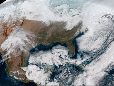
Nor’easter
Powerful coastal storms that bring heavy snow, wind, coastal flooding and beach erosion. Famous example: The Blizzard of 1993. Stock essentials, avoid travel during warnings, and prepare for power outages.
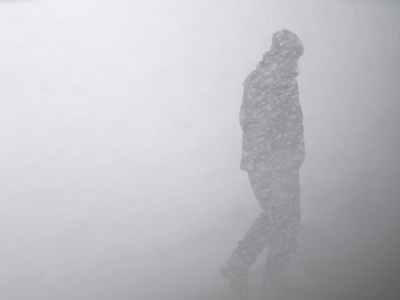
Blizzard
Severe winter storms with heavy snow and sustained strong winds reducing visibility; cause transport, power and infrastructure disruption. Example: Great Blizzard of 1978. Stay indoors, maintain heating sources, and have emergency supplies.

Lake-effect snowstorm
Localized heavy snow bands formed when cold air moves over warm lakes, causing intense snowfall rates and whiteouts. Prepare for rapid road closures and prolonged shoveling; monitor local lake-effect advisories.
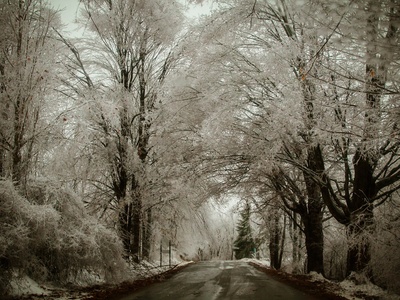
Ice storm
Storms dominated by freezing rain that coats surfaces with ice, bringing down power lines and trees and causing hazardous travel. Example: North American ice storms. Avoid travel, have alternative heating, and limit tree-clearing near power lines.
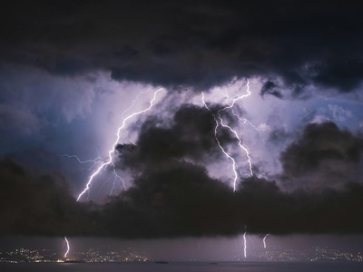
Thunderstorm
Convective storms driven by instability produce lightning, heavy rain, gusts and hail; can occur singly or in clusters. Lightning causes fire and injury. Seek shelter indoors or in a hard-top vehicle during lightning and heavy winds.
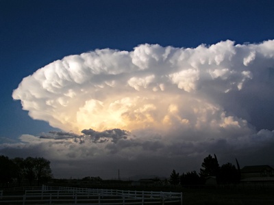
Supercell thunderstorm
Highly organized rotating thunderstorms producing extreme hail, tornadoes and destructive wind gusts. Notable for long-lived severe events. When warned, move to an interior, windowless room or storm shelter immediately.
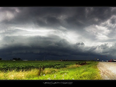
Squall line
A linear band of severe thunderstorms producing straight-line winds, heavy rain and lightning; can cause rapid widespread wind damage. Example: Midwest squall lines. Avoid driving under intense squalls; seek sturdy shelter and fasten outdoor objects.
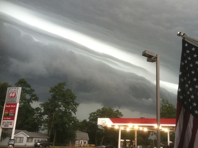
Derecho
Long-lived, straight-line wind storm from fast-moving thunderstorm complexes; can produce hurricane-force winds hundreds of kilometres long. Notable: 2020 Midwest derecho. Seek shelter indoors away from windows; expect widespread power outages.
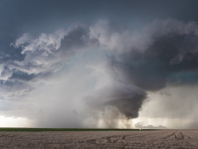
Tornado
Violently rotating columns of air touching ground, spawned by thunderstorms; cause concentrated but extreme wind damage. Notable: Tri-State Tornado (1925). Go to a basement or interior small room; have a helmet and emergency kit.
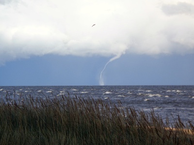
Waterspout
Tornado-like vortex over water; can be tornadic or fair-weather type, causing hazardous winds for boats and coastal areas. Avoid small craft and seek shelter ashore if a waterspout is sighted near land.
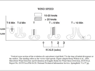
Microburst
Intense localized downdraft from thunderstorms producing damaging straight-line winds on impact; dangerous for aviation and structures. Monitor storm radar and move indoors; expect sudden, short-lived extreme winds.
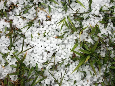
Hailstorm
Storms producing hailstones that damage roofs, vehicles and crops; associated with strong updrafts in thunderstorms. Significant hail can cause injury and property loss. Protect vehicles and avoid being outside; shelter under sturdy cover.
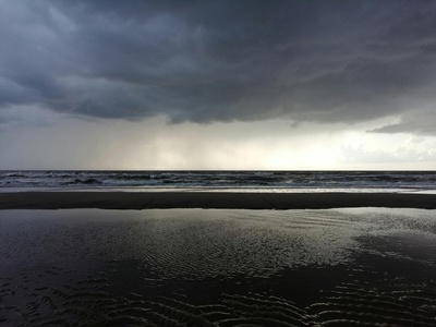
Squall
A sudden powerful gust or increase in wind speed, often within convective storms or fronts; can topple trees and damage light structures. Secure loose outdoor items and avoid standing near trees or power lines during squalls.
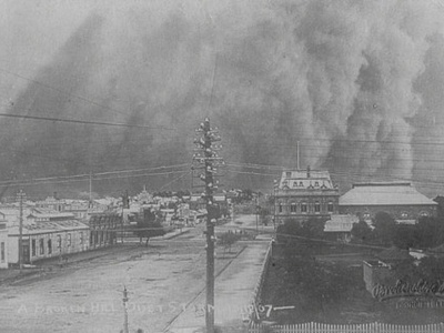
Dust storm
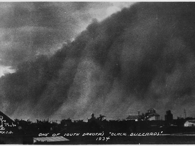
Strong winds lifting large quantities of dust reducing visibility, causing respiratory and transport hazards. Haboobs are intense regional examples. If caught in one, pull off road, turn off lights, set parking brake, and stay inside until cleared.
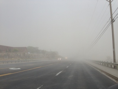
Haboob
A dramatic wall of dust and sand driven by thunderstorm outflows; causes near-zero visibility and abrasive damage. Protect airways with masks/cloth, seek indoor shelter, and avoid driving until conditions improve.
Sandstorm
Strong winds lifting sand with abrasive impacts on infrastructure and health; reduces visibility and can disrupt aviation and shipping. Seal doors and windows, use eye protection and N95 mask if available.

European windstorm
Powerful extratropical cyclones bringing widespread gale to storm-force winds, coastal flooding and infrastructure damage. Examples: Storm Eunice. Secure outdoor items, prepare for power outages and heed local marine and weather warnings.
Extratropical nor’easter hybrid (superstorm)
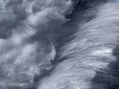
Exceptionally strong cyclones merging tropical and extratropical traits, causing vast coastal damage, flooding and widespread wind impacts. Example: Superstorm Sandy (2012). Follow evacuation orders and plan for extended power and infrastructure outages.
Cyclone (Southern Hemisphere)
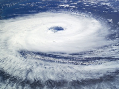
Regional tropical cyclone causing storm surge, heavy rain, and destructive winds in southern hemisphere seasons. Notable: Cyclone Tracy (1974). Move inland from low-lying coasts and prepare emergency supplies.

Tropical depression
Weak tropical cyclone with lower sustained winds but capable of heavy rain and flooding, often a precursor to stronger storms. Even without high winds, watch for flash floods and mudslides; avoid flood-prone areas.
Coastal storm surge event
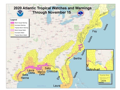
A coastal flooding event driven by storm winds and low pressure pushing ocean water ashore; can inundate low-lying areas with destructive force. Evacuate when surge warnings are issued and move to higher ground immediately.
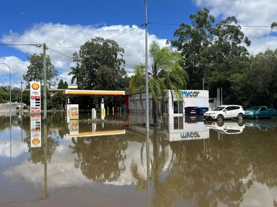
Rainband flooding event
Persistent heavy rain bands from tropical or extratropical systems causing prolonged flooding and landslides. Notable in event-associated floods. Monitor flood watches, avoid floodwaters, and move to higher ground quickly.
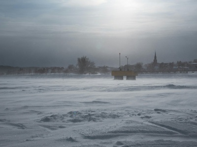
Cold-air outbreak squall
Rapidly forming squalls when cold air moves over warmer surfaces, producing heavy snow or rain and strong winds that reduce visibility and temperature. Secure travel plans and have winter emergency supplies if travel is essential.
